

-
Products -PCBA Manufacturing RF Connectors RF Cable Assemblys Embedded Antennas External Antennas Positioning Chips and Modules
RF Connectors

RF Cable Assemblys
Embedded Antennas
External Antennas
Positioning Chips and Modules


 Language


Language


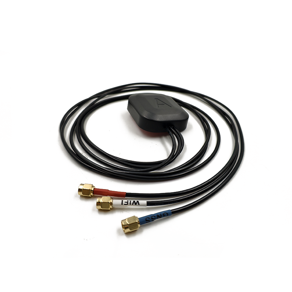
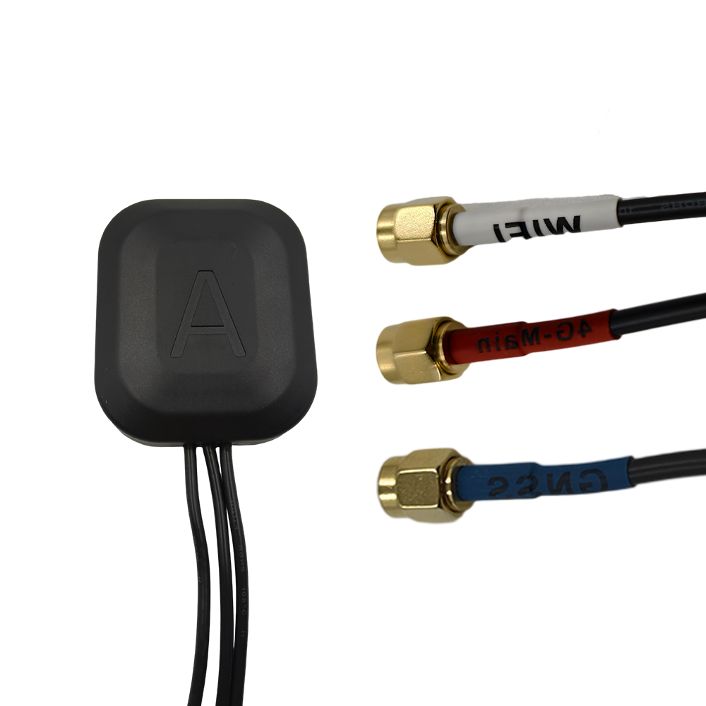
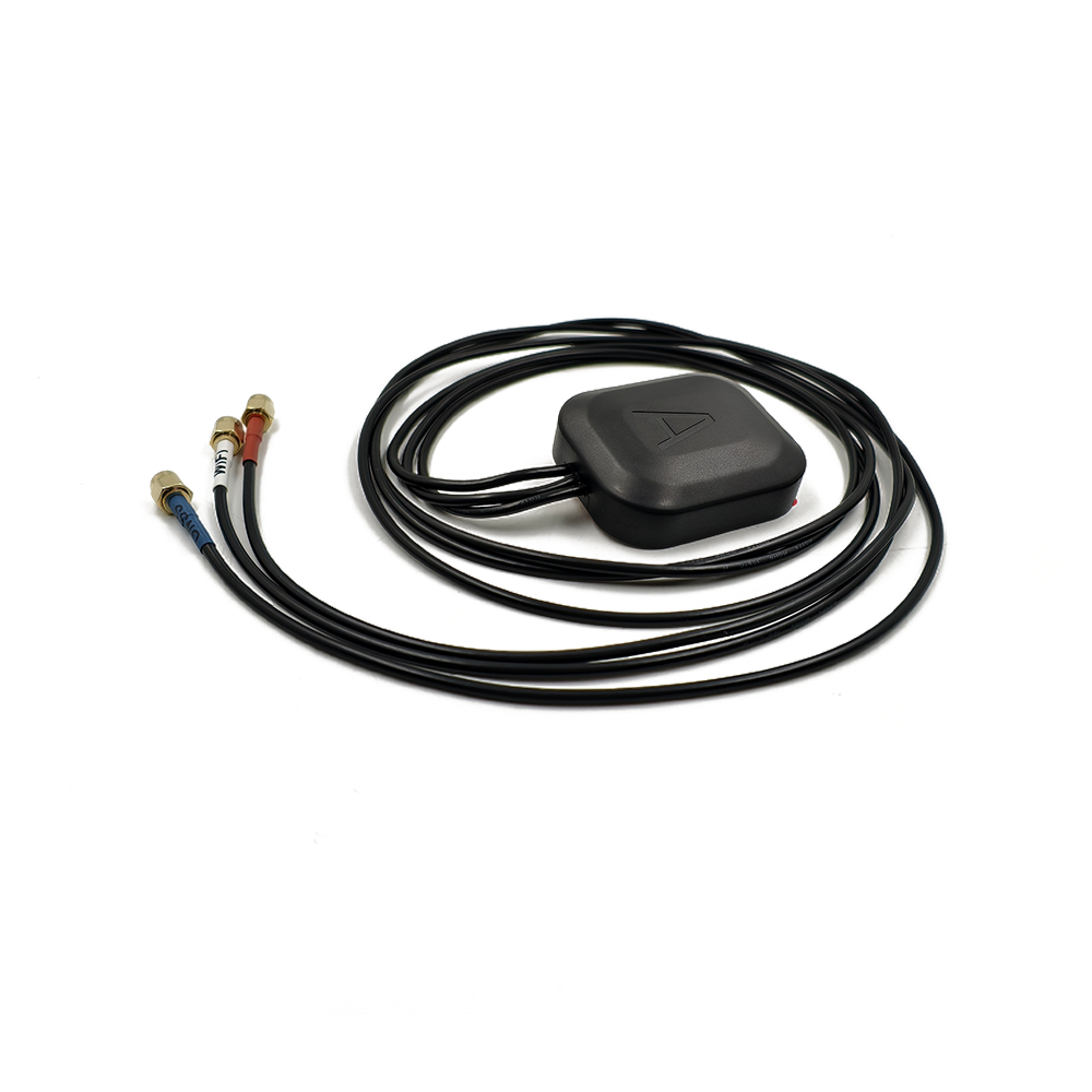
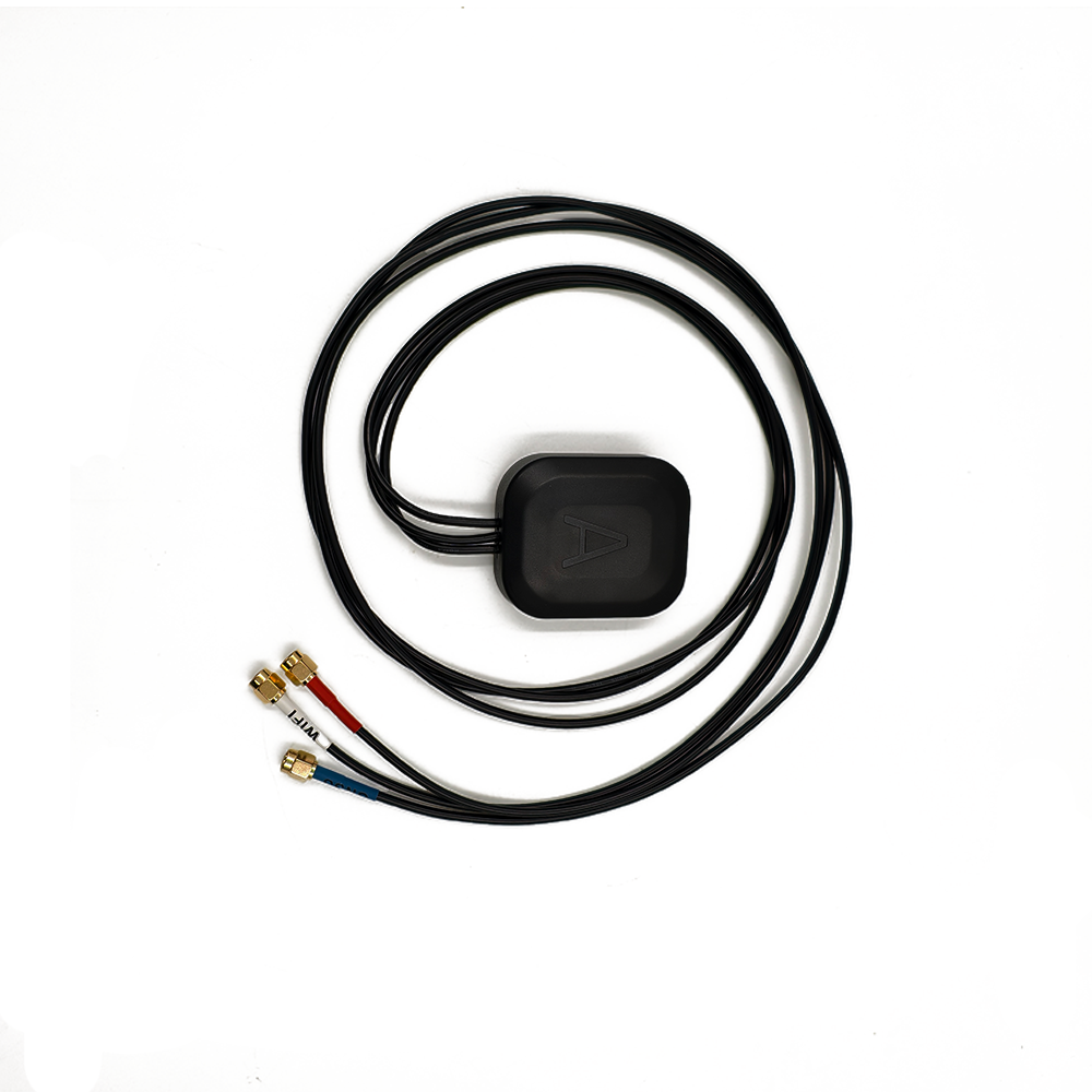

A multi-frequency GNSS antenna is a specialized device designed to receive satellite signals across multiple frequency bands (e.g., L1, L2, L5, B1, B2, E1, E5) from global navigation satellite systems (GNSS), including GPS, GLONASS, BeiDou, Galileo, and others. Unlike traditional single-frequency antennas, which operate on a single band (typically L1), multi-frequency antennas enhance positioning accuracy, reliability, and convergence time by leveraging signals from multiple constellations and frequencies.
1.1 Definition and Core Functionality
A multi-frequency GNSS antenna is a specialized device designed to receive satellite signals across multiple frequency bands (e.g., L1, L2, L5, B1, B2, E1, E5) from global navigation satellite systems (GNSS), including GPS, GLONASS, BeiDou, Galileo, and others. Unlike traditional single-frequency antennas, which operate on a single band (typically L1), multi-frequency antennas enhance positioning accuracy, reliability, and convergence time by leveraging signals from multiple constellations and frequencies.
In surveying applications, these antennas are critical for achieving centimeter- to millimeter-level precision in geodetic measurements, cadastral mapping, structural monitoring, and autonomous navigation. Their ability to mitigate ionospheric delays, multipath errors, and signal obstructions makes them indispensable in challenging environments such as urban canyons, forests, and mountainous regions.
1.2 Historical Evolution
The development of multi-frequency GNSS antennas traces back to the late 1990s, when geodetic surveys demanded higher accuracy than single-frequency GPS could provide. Early dual-frequency antennas (e.g., GPS L1/L2) were introduced to correct ionospheric delays, which are frequency-dependent. However, with the advent of modernized GNSS constellations (e.g., Galileo E5, BeiDou B3), triple-frequency antennas (L1/L2/L5) became standard, enabling faster ambiguity resolution and improved robustness against interference.
Today, leading manufacturers like Trimble, Septentrio, Leica Geosystems, and CHCNAV offer multi-frequency antennas that support five or more frequency bands, ensuring compatibility with all major GNSS systems. These antennas are integral to Real-Time Kinematic (RTK) and Precise Point Positioning (PPP) techniques, which rely on carrier-phase observations for high-precision positioning.
1.3 Market Landscape
The global market for multi-frequency GNSS antennas is driven by:
Infrastructure Development: High-speed railways, bridges, and dams require sub-centimeter accuracy for deformation monitoring.
Autonomous Systems: Self-driving vehicles and drones rely on multi-frequency GNSS for lane-level positioning.
Agriculture: Precision farming demands centimeter-level accuracy for automated machinery guidance.
Scientific Research: Tectonic plate movement studies and atmospheric monitoring utilize multi-frequency GNSS for long-term stability.
Key players include Trimble (ATRx, Zephyr), Septentrio (PolaNt), Leica (AS10, AS15), and CHCNAV (C220 GR2), with prices ranging from
1,500to
10,000, depending on frequency bands and environmental ratings.
2.1 Core Components
A multi-frequency GNSS antenna consists of several critical subsystems:
2.1.1 Antenna Element
Microstrip Patch Antenna: Common in compact designs, optimized for multi-band operation using stacked patches or reactive loading.
Helical Antenna: Used in rugged applications (e.g., UAVs) for omnidirectional coverage.
Phased Array Antenna: Advanced designs employ beamforming to improve signal gain and suppress multipath.
2.1.2 Choke Ring Structure
Purpose: Mitigates multipath interference by reflecting ground-reflected signals away from the antenna element.
Design: Consists of 3–6 concentric metallic rings with precise dimensions tuned to block specific frequencies (e.g., L1: 1575.42 MHz, L2: 1227.60 MHz).
Effectiveness: Reduces multipath errors by 15–20 dB, critical for high-precision surveying.
2.1.3 Low-Noise Amplifier (LNA)
Function: Boosts weak satellite signals (e.g., −160 dBm) before downconversion.
Multi-Band Support: Modern LNAs integrate filters to isolate L1, L2, L5, etc., minimizing inter-frequency interference.
Noise Figure: Typically <2 dB to preserve signal integrity.
2.1.4 Radome and Enclosure
Material: UV-resistant polycarbonate or fiberglass for weatherproofing.
Mounting: Threaded base or magnetic mount for tripods, vehicles, or drones.
Environmental Rating: IP67 or higher for dust/water resistance.
2.2 Material Selection
Metallic Components: Aluminum or stainless steel for choke rings (corrosion resistance).
Dielectric Substrate: High-permittivity materials (e.g., Rogers RT/duroid) for compact multi-band antennas.
LNA Components: GaAs or CMOS transistors for low-power, high-linearity amplification.
2.3 Manufacturing Tolerances
Phase Center Stability (PCS): Must be <1 mm across all frequencies to ensure consistent measurements during rover movement.
Ring Spacing: ±0.1 mm precision to maintain frequency-selective attenuation.
PCV Calibration: Manufacturers provide phase center variation (PCV) models to correct off-axis signal reception errors.
3.1 Signal Reception and Processing
Satellite Signal Reception:
The antenna captures L-band signals (1–2 GHz) from GNSS satellites, which carry navigation data (e.g., ephemeris, clock corrections) and carrier-phase information.
Multipath Suppression:
The choke ring reflects ground-reflected signals away from the antenna element, while advanced designs use Right-Hand Circular Polarization (RHCP) to reject left-handed reflections.
LNA Amplification:
Weak signals are amplified (e.g., 30–40 dB gain) while minimizing noise introduction.
Downconversion and Digitization:
The receiver converts RF signals to baseband for processing (e.g., correlation with satellite code/phase).
3.2 Multi-Frequency Advantages
Ionospheric Delay Correction:
Dual-frequency (L1/L2) measurements allow for ionosphere-free combinations, eliminating first-order delays.
Faster Ambiguity Resolution:
Triple-frequency (L1/L2/L5) observations reduce the time to fix integer ambiguities from minutes to seconds (critical for RTK).
Improved Availability:
Multi-constellation support (GPS+GLONASS+BeiDou+Galileo) ensures more visible satellites, reducing the risk of signal blockage.
3.3 RTK and PPP Integration
RTK (Real-Time Kinematic):
A base station transmits correction data to a rover antenna via radio or cellular links, enabling centimeter-level accuracy in real time.
PPP (Precise Point Positioning):
Uses satellite clock and orbit corrections from ground stations (e.g., IGS) to achieve decimeter- to centimeter-level accuracy without a base station (but with longer convergence times).
4.1 Key Advantages
Sub-Centimeter Accuracy:
Phase center stability and multipath rejection enable millimeter-level precision in static surveys.
All-Weather Performance:
Robust against rain, fog, and dust (IP67+ ratings).
Multi-System Compatibility:
Supports GPS, GLONASS, BeiDou, Galileo, and regional systems (e.g., QZSS, IRNSS).
4.2 Technical Challenges
Cost:
Multi-frequency LNAs and precision-manufactured choke rings increase production costs.
Size and Weight:
Choke ring antennas are bulkier (e.g., 200 mm diameter) than patch antennas, limiting portability.
Signal Obstruction:
Near-field objects (e.g., vehicle roofs) can still cause multipath, requiring careful mounting.
4.3 Operational Limitations
RTK Range:
Corrections are valid only within 10–20 km of the base station due to spatial decorrelation of atmospheric errors.
Latency:
Real-time data transmission delays (e.g., 100–500 ms) may affect high-speed applications (e.g., drone navigation).
5.1 Current Applications
Geodesy and Surveying:
CORS networks and tectonic monitoring rely on multi-frequency antennas for sub-millimeter crustal deformation measurements.
Autonomous Vehicles:
Self-driving trucks and agricultural machinery use RTK-GNSS for lane-level positioning in GPS-challenged environments.
Structural Health Monitoring:
Bridges and dams are equipped with GNSS antennas to detect millimeter-scale movements indicative of structural failure.
5.2 Emerging Trends
Miniaturization:
Advances in MEMS and 3D printing enable compact choke ring designs (e.g., 100 mm diameter) for UAVs and handheld devices.
AI-Enhanced Multipath Mitigation:
Machine learning algorithms analyze signal patterns to dynamically suppress reflections, reducing reliance on physical choke rings.
LEO Satellite Integration:
Companies like SpaceX’s Starlink plan to augment GNSS with LEO signals, potentially reducing RTK convergence time to seconds.
5.3 Market Projections
The global multi-frequency GNSS antenna market is expected to grow at a CAGR of 8.5% from 2025 to 2030, driven by autonomous vehicle adoption and smart city infrastructure projects. Choke ring antennas will dominate high-precision segments, while software-defined radios (SDRs) may replace traditional hardware in cost-sensitive applications.
Conclusion
Multi-frequency GNSS antennas represent the pinnacle of precision positioning technology, combining advanced electromagnetic design with multi-constellation signal processing to deliver centimeter-level accuracy in challenging environments. While their cost and size remain barriers to widespread adoption, ongoing innovations in miniaturization, AI, and LEO satellite integration are expanding their applicability across industries.
As autonomous systems and smart infrastructure projects proliferate, multi-frequency GNSS antennas will remain indispensable for applications where reliability and precision are non-negotiable—solidifying their role as the gold standard in high-stakes surveying and navigation.
Final Thought: The evolution of multi-frequency GNSS antennas underscores a broader trend in positioning technology: the relentless pursuit of accuracy through hardware specialization and algorithmic intelligence. Future advancements will likely blur the lines between physical antenna design and software-defined signal processing, ushering in an era of ubiquitous sub-centimeter positioning.

 86 0755 2819 9597
Lucy Yang | lucy.y@toxutech.com
Nicole Li | nicole@toxutech.com
Dotty Zhao | sales04@toxutech.com
Global Business Director / Sales Team / Global Operations


 En
En Cn
Cn Korean
 Home >


