

-
Products -PCBA Manufacturing RF Connectors RF Cable Assemblys Embedded Antennas External Antennas Positioning Chips and Modules
RF Connectors

RF Cable Assemblys
Embedded Antennas
External Antennas
Positioning Chips and Modules


 Language


Language


The advent of Unmanned Aerial Vehicles (UAVs), or drones, has revolutionized the fields of surveying, mapping, and geospatial data collection. What was once the domain of manned aircraft, expensive satellite imagery, and labor-intensive ground surveys can now be accomplished with unprecedented speed, safety, and flexibility. At the core of this revolution lies a critical technological synergy: photogrammetry and LiDAR. These techniques allow for the creation of highly accurate 2D orthomosaics, 3D models, digital surface models (DSMs), and digital terrain models (DTMs) from overlapping aerial imagery and laser scans. However, the absolute accuracy of these stunning outputs is entirely dependent on precise geolocation. This is where the multi-frequency GNSS antenna becomes the unsung hero, the "precision eye in the sky."
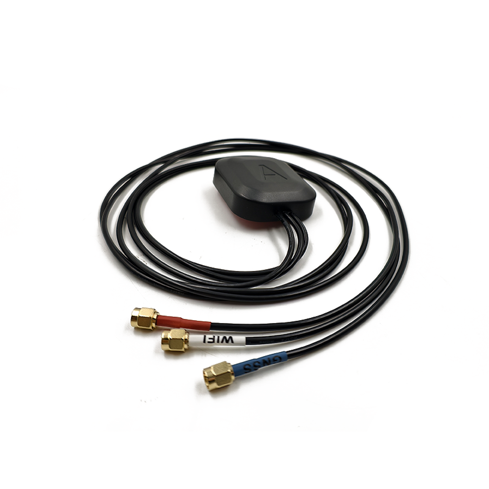
A multi-frequency GNSS antenna for UAV mapping is a highly specialized component designed to be integrated into a drone or mounted on its payload. Its primary function is to receive signals from multiple Global Navigation Satellite Systems (GPS (USA), GLONASS (Russia), Galileo (EU), BeiDou (China)) across multiple frequency bands (e.g., L1, L2, L5) and deliver them to a high-precision GNSS receiver. This receiver's purpose is not merely navigation but providing precise geotags for each captured photograph or LiDAR point, often in conjunction with Real-Time Kinematic (RTK) or Post-Processed Kinematic (PPK) techniques.
The term "multi-frequency" is the key differentiator from standard consumer-grade GPS antennas. Consumer devices typically use a single frequency (L1), which is sufficient for meter-level navigation. Multi-frequency operation is the gateway to centimeter-level accuracy. By receiving signals on two or more frequencies, the system can perform a critical function: calculating and eliminating the ionospheric delay, which is the largest source of error in GNSS measurements. The ionosphere, a layer of the atmosphere filled with charged particles, slows down and bends GNSS signals. The degree of this delay is frequency-dependent. By comparing the signals on two different frequencies (e.g., L1 and L2), the receiver can precisely model and remove this error.
For UAV mapping, the antenna is not a standalone device; it is part of a complex system. The drone typically has two antennas:
The Rover Antenna: Mounted directly on the drone, often directly above the camera or sensor payload to minimize lever arm effects. This antenna captures the raw satellite data for the drone's precise position.
The Base Station Antenna: Set up on a known, precisely surveyed point on the ground. This antenna collects correction data.
Using RTK, the base station sends corrections to the drone in real-time via a radio link. Using PPK (a more robust method for UAVs), the raw data from both the rover and base are recorded and processed after the flight. In both cases, the multi-frequency capability of both antennas is crucial for rapid and reliable resolution of the "integer ambiguity," the process that unlocks centimeter accuracy.
The applications are vast: precision agriculture for crop health monitoring and yield prediction; volumetric calculations in mining and quarrying; infrastructure inspection for railways, roads, and power lines; construction site progress monitoring; topographic mapping; and emergency response for disaster assessment. In every case, the multi-frequency GNSS antenna provides the geospatial foundation that transforms a simple aerial image into a measurable, accurate data product. It is the critical link that elevates drone photography from pretty pictures to professional-grade geospatial intelligence.
The design of a multi-frequency GNSS antenna for UAVs is a delicate balancing act between achieving supreme electromagnetic performance and meeting the stringent demands of aerial deployment: minimal size, light weight, low aerodynamic drag, and resilience to harsh environmental conditions.
The Antenna Element: The Heart of the System
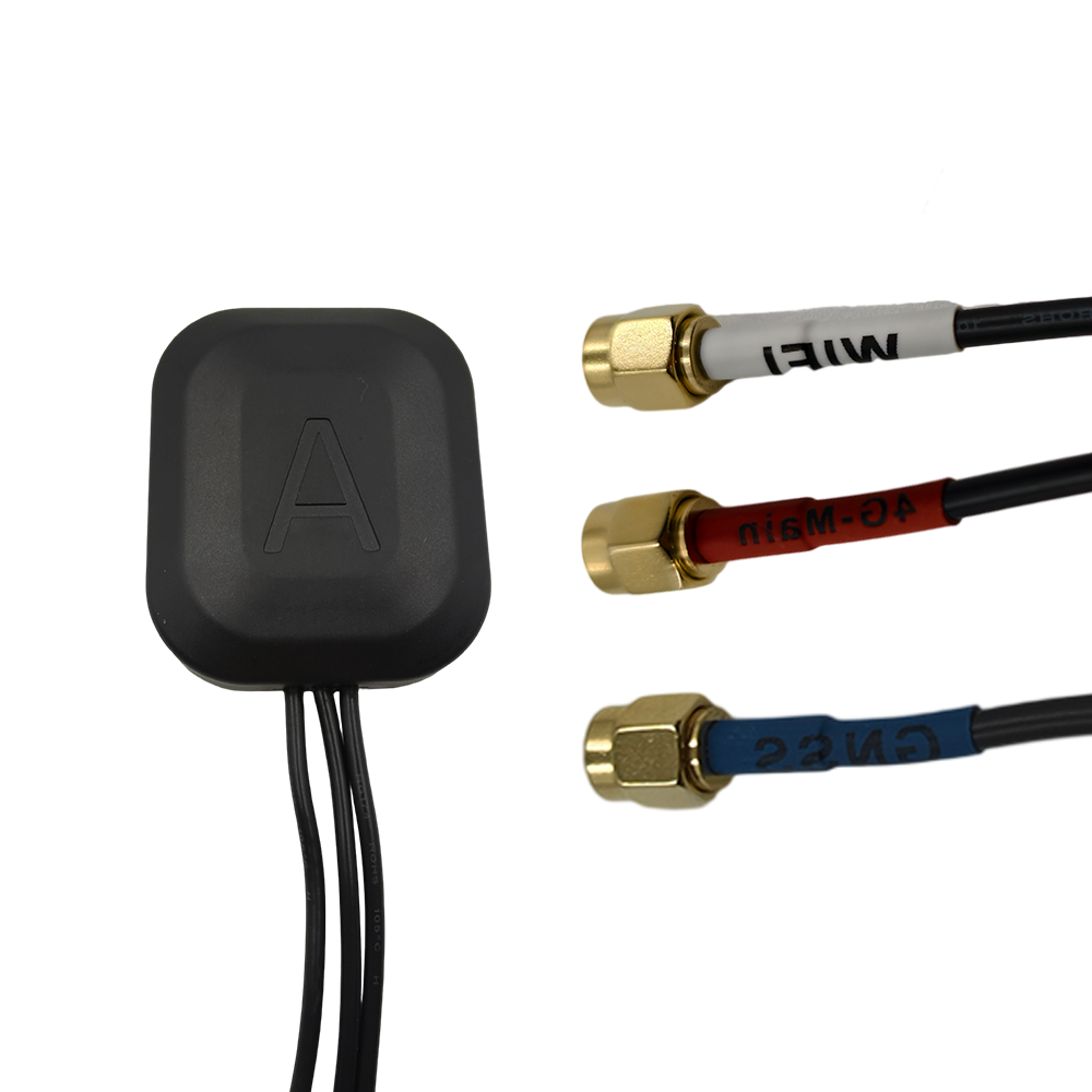
The core of the antenna is the radiating element. For UAV applications, the almost universal choice is a ceramic patch antenna. This is a flat, square or circular conductor printed on a ceramic substrate. Ceramic is chosen for its high dielectric constant, which allows the patch to be made smaller while maintaining resonance at the target GNSS frequencies (1.1-1.6 GHz). The patch is not a simple element; it is a sophisticated multi-resonant structure.
Multi-Band Design: To receive multiple frequencies (e.g., L1, L2, L5), the patch is carefully engineered. This can be achieved through:
Stacked Patches: Using multiple layers of ceramic with patches of different sizes tuned to different frequencies. A larger patch for lower frequencies (L2) is placed beneath a smaller patch for higher frequencies (L1).
Slotted or Notched Patches: Introducing precise cuts or slots into a single patch to excite multiple resonant modes.
Advanced Feed Networks: The method of delivering RF power to the patch (e.g., probe feed, aperture coupling) is optimized to excite all desired frequencies efficiently.
The goal is to achieve good impedance matching (a low VSWR) and consistent radiation patterns across all bands.
The Ground Plane: Shaping the View of the Sky
The antenna element does not operate in isolation; it requires a ground plane. This is a conductive surface, typically a circular metal disk, located beneath the patch. The ground plane is critical for two reasons:
It creates the antenna's directional radiation pattern, focusing gain towards the zenith (the sky above) and providing a null below to reject multipath signals reflected from the ground.
It acts as an electrical barrier, isolating the sensitive antenna from the noisy electronics of the drone itself (flight controllers, video transmitters, motors).
For UAVs, the ground plane is integrated into the antenna assembly itself, as the drone's body is often made of non-conductive materials like carbon fiber or plastic, which are also electromagnetically "noisy."
Low-Noise Amplifier (LNA): Boosting the Whisper
GNSS signals are incredibly weak after traveling over 20,000 km from space. The integrated LNA is therefore non-negotiable. It must provide high gain (typically 28-40 dB) to overcome cable losses and deliver a strong signal to the receiver. Crucially, it must do this while adding an absolute minimum of internal electronic noise, characterized by a very low Noise Figure (often < 2 dB). The LNA is powered via the coaxial cable from the receiver (phantom power). To protect this sensitive component from voltage spikes or static discharge, surge protection circuits are often integrated.
Physical Construction: Light, Tough, and Aerodynamic
Radome: The entire assembly is protected by a outer shell or radome. For UAVs, this is molded from a material that is RF-transparent (low dielectric constant and loss tangent), such as high-grade plastic or ceramic-filled composite. The radome must be extremely lightweight and is often designed with a low-profile, aerodynamic shape (like a dome or a puck) to minimize drag during flight, which is critical for flight time and stability.
Size and Weight: Every gram matters in UAV design. Manufacturers use lightweight materials like aluminum for the ground plane and miniaturized surface-mount components for the LNA and filters. A typical UAV mapping antenna might weigh only 15-40 grams.
Mounting: The antenna is designed for secure and precise mounting. Common methods include adhesive pads, magnetic bases (for quick testing), or threaded holes for screw attachment. The mounting must be rigid to prevent movement during flight, as any vibration can introduce noise into the phase measurements.
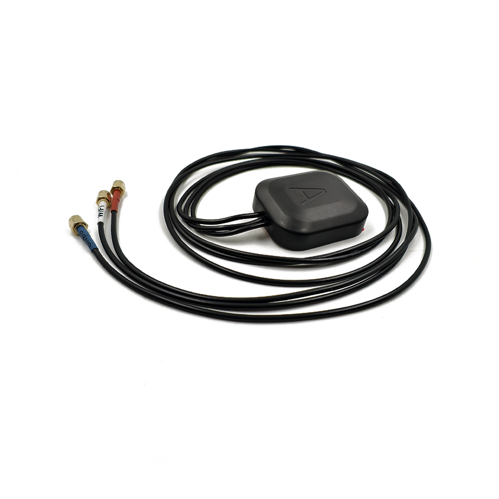
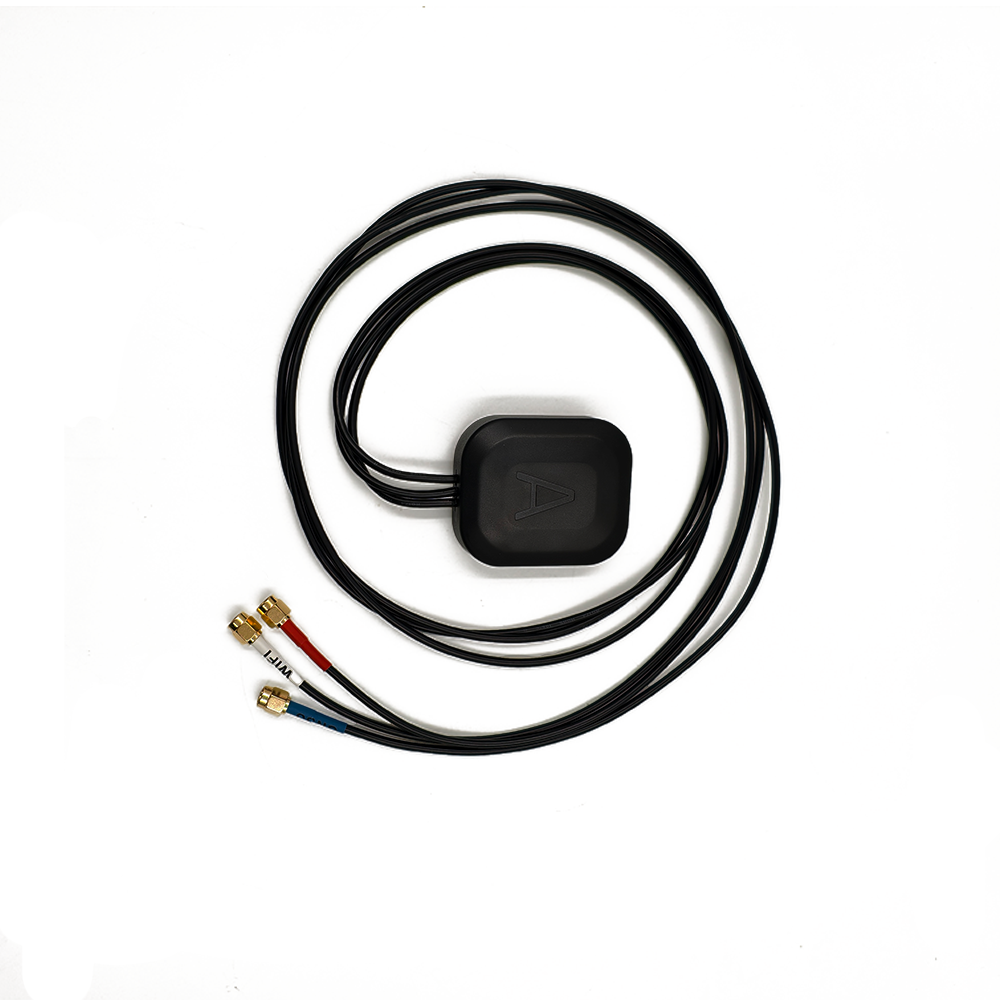
Cable and Connector: The cable is a critical and often overlooked part. A lightweight, thin, and flexible coaxial cable (like RG174) is used to connect the antenna to the receiver. The connector, typically an SMA or MMCX type, must be robust and secure to prevent disconnection due to vibration. MMCX connectors are popular due to their small size and "click" locking mechanism.
Filtering: Surviving the RF Jungle
A drone is a hostile RF environment. Motors, motor controllers (ESCs), video transmitters, and telemetry radios all generate significant electromagnetic interference (EMI). This broadband noise can easily drown out the faint GNSS signals. Therefore, high-quality bandpass filters are integrated between the patch and the LNA. These Surface Acoustic Wave (SAW) or IPD filters are designed to have a very sharp roll-off, allowing the GNSS frequencies to pass through perfectly while aggressively attenuating signals outside this band.
In summary, the construction of a UAV multi-frequency antenna is an exercise in miniaturization and optimization, packing world-class RF performance into a tiny, lightweight, and robust package that can survive the demanding conditions of flight.
The working principle of the multi-frequency GNSS antenna in a UAV mapping context is to act as the optimal collector of raw satellite data, enabling advanced positioning techniques that are fundamentally different from standard navigation.
The Foundation: Code and Carrier Phase
A GNSS receiver calculates its position by measuring the time it takes for a signal to travel from a satellite to itself. It does this using two types of measurements:
Code Phase: Measuring the alignment of the pseudo-random code transmitted by the satellite. This provides a measurement with meter-level accuracy (the "standard" GPS position).
Carrier Phase: Measuring the phase of the underlying carrier wave itself. This measurement is incredibly precise (to a fraction of a millimeter) but has an initial unknown: the number of whole wavelengths between the satellite and receiver, known as the integer ambiguity.
The key to centimeter accuracy is resolving this integer ambiguity to use the ultra-precise carrier phase measurement.
The Critical Role of Multi-Frequency: Ionospheric Correction
The largest error source preventing ambiguity resolution is the ionospheric delay. The ionosphere's density (and thus its delaying effect) changes with time of day, solar activity, and location. A single-frequency receiver must model this delay, leading to residual errors.
A multi-frequency receiver directly measures it. The ionospheric delay is inversely proportional to the square of the frequency (Delay ∝ 1/f²). Therefore, the delay on L1 is different from the delay on L2.
By comparing the measured carrier phases on both L1 and L2, the receiver can precisely calculate the total electron content in the signal path and thus the absolute delay for each frequency.
This allows it to eliminate virtually all of the ionospheric error from the measurements.
This process, known as the ionosphere-free linear combination, is the single most important reason for using multi-frequency GNSS in precision applications. It results in:
Faster and more reliable integer ambiguity resolution.
Much higher accuracy over longer distances from the base station.
Superior performance during periods of high solar activity that disturb the ionosphere.
Integration with RTK/PPK for UAV Mapping
The antenna provides the raw, multi-frequency data to the receiver. The receiver's job is to use this data in one of two workflows:
Real-Time Kinematic (RTK): The UAV (rover) receives correction data from a ground-based station in real-time via a radio link. Using these corrections and its own multi-frequency data, it resolves the integers and computes its own centimeter-accurate position in real-time. This position is then stamped onto each photo as it is taken.
Post-Processed Kinematic (PPK): This is often preferred for UAVs. Both the UAV and the base station simply record their raw, multi-frequency observation data (carrier phase, pseudorange) to a file during the flight. No real-time radio link is needed. After the flight, the data from both is combined in processing software. The software uses the powerful multi-frequency observations to resolve the integers and compute the drone's precise trajectory backward in time. This trajectory is then used to geotag the images.
PPK is often favored because it is more robust. It avoids issues with radio link dropouts, which are common in challenging terrain, and allows for a more rigorous processing approach.
The Antenna's Role in the Chain
The antenna's performance directly impacts every step:
Signal Strength: A high-gain antenna ensures lock is maintained on more satellites, even during banked turns.
Multipath Rejection: A good ground plane and antenna pattern minimize signals reflected from the drone's own body or the ground, which corrupt measurements.
Low Noise: A low-noise figure preserves the signal-to-noise ratio, essential for tracking weak signals and maintaining lock.
Phase Center Stability: The electrical point from which the signal is measured (the phase center) must be stable. Any movement of this point with temperature or signal direction introduces error. High-quality antennas have stable, well-calibrated phase centers.
In essence, the multi-frequency antenna provides the pristine, high-fidelity raw material—the dual-frequency carrier phase observations—that allows the sophisticated RTK/PPK engine to perform its magic, transforming the drone's position from a meter-grade estimate to a centimeter-accurate truth.
Integrating a multi-frequency GNSS antenna into a UAV mapping system brings transformative advantages but also introduces specific complexities and costs that must be managed.
Advantages:
Centimeter-Level Absolute Accuracy: This is the paramount advantage. It moves UAV mapping from relative "pretty pictures" to survey-grade measurable data. This allows for confident calculations of stockpile volumes, cut-and-fill quantities, and precise feature locations.
Elimination of Ground Control Points (GCPs): Traditionally, aerial mapping required numerous GCPs—physical markers on the ground surveyed in with GNSS—to correct the model's accuracy. With direct georeferencing via RTK/PPK, the need for GCPs is drastically reduced or eliminated entirely. This saves enormous time in the field, increases safety (no need to access dangerous areas), and allows mapping of inaccessible sites (e.g., active mines, disaster zones).
Superior Efficiency and Scalability: Without GCPs, field time is slashed. A crew can deploy a base station and launch the drone within minutes. This makes it feasible to map large areas or numerous small sites in a single day, dramatically improving project economics and scalability.
Robust Performance in Challenging Conditions: Multi-frequency capabilities provide resilience. They maintain accuracy over longer baselines (distance from base station) and during periods of ionospheric disturbance, ensuring data quality is consistent throughout the day and across large project sites.
Direct Georeferencing for LiDAR: For LiDAR systems, which capture millions of 3D points per second, RTK/PPK is not an option but a requirement. There is no imagery to "stitch" and correct with GCPs. The precise position and orientation of the laser scanner for every pulse must be known instantly, making the multi-frequency GNSS antenna and an IMU absolutely critical.
Challenges and Considerations:
Cost: A multi-frequency GNSS system (antenna, receiver, and often a separate base station) represents a significant additional investment on top of the drone and camera/LiDAR payload. This can multiply the cost of a mapping-ready UAV platform.
System Complexity: Integration is non-trivial. It involves mounting the antenna precisely, measuring its offset from the camera sensor (the lever arm), calibrating that offset, and managing the data flow between the receiver and the flight controller/camera. This requires specialized knowledge.
Weight and Power Penalty: The antenna, receiver, and cabling add weight and consume power, both of which are precious commodities on a UAV, directly reducing flight time.
Dependence on GNSS Coverage: The system requires a clear view of the sky to maintain a sufficient number of satellite locks. Performance degrades or fails entirely near tall buildings, under dense canopy cover, or in deep trenches—precisely where some mapping missions are needed.
Calibration Requirements: The precise 3D offset between the antenna's phase center and the camera's sensor must be measured and input into the system. Any error in this measurement introduces a systematic error into every geotag.
Data Management and Processing: RTK/PPK introduces an additional data layer. Raw observation files from the rover and base must be managed, stored, and processed. This requires additional software and processing time, adding a step to the workflow compared to traditional GCP-based methods.
In summary, the advantages of achieving survey-grade accuracy without ground control are overwhelming for professional applications. However, the path to achieving this requires a conscious acceptance of higher costs, increased system complexity, and a more technically demanding workflow.
Multi-frequency GNSS antennas have unlocked a vast array of professional applications for UAVs, moving them far beyond hobbyist photography into the realm of essential geospatial tools.
Applications:
Surveying and Topographic Mapping: Creating high-accuracy contour maps, DTMs, and DSMs for engineering design, land development, and environmental planning.
Volumetric Measurements: The "killer app" for many industries. Precisely calculating stockpile volumes in mining, aggregates, and agriculture (e.g., silage, manure piles) for inventory management and operational planning.
Precision Agriculture: Using multispectral and hyperspectral cameras to create NDVI and other health maps, precisely geolocated to enable variable rate application of water, fertilizers, and pesticides.
Infrastructure Inspection: Monitoring progress on large construction sites (as-built vs. as-designed), inspecting railways, roads, and bridges for deformation, and planning utility corridors. The accurate geolocation allows issues to be precisely mapped and tracked over time.
Corridor Mapping: Efficiently mapping long, linear features like pipelines, power lines, and highways.
Disaster Response and Management: Rapidly and safely mapping disaster zones (earthquakes, floods, landslides) to assess damage, plan response efforts, and calculate volumes of debris.
Future Trends:
Tighter Integration and Miniaturization: Antennas and receivers will become smaller, lighter, and more power-efficient. We will see more "all-in-one" payloads where the GNSS antenna, IMU, and processing unit are seamlessly integrated with the camera or LiDAR sensor, simplifying setup and calibration.
On-the-Fly Ambiguity Resolution (OTF-AR) and PPP-RTK: Advancements in processing will enable faster and more reliable integer resolution without the need for initial static initialization. The emergence of PPP-RTK correction services will allow for centimeter accuracy without a local base station, using corrections from a global network delivered via cellular internet.
AI-Enhanced Processing: Artificial intelligence will be used to improve ambiguity resolution in challenging signal environments, filter multipath, and even assist in the automatic calibration of system parameters like lever arm offsets.
Multi-Sensor Deep Fusion: GNSS will not operate in isolation. Deep fusion algorithms will tightly couple GNSS, IMU, camera-based visual odometry, and even LiDAR SLAM to provide continuous, precise positioning even during complete GNSS outages (e.g., tunnels, indoors).
Resilience and Cybersecurity: As drones become more autonomous, antennas and receivers will need built-in resilience to jamming and spoofing (malicious fake GNSS signals), which are significant threats to drone operations.
L-Band Correction Services: Wider adoption of satellite-delivered L-band correction services (e.g., SPARK, Atlas) will provide a reliable correction source in areas without cellular coverage, further reducing the dependency on a local base station.
Conclusion
The multi-frequency GNSS antenna is far more than a simple component on a mapping drone; it is the technological linchpin that has enabled the transition from qualitative aerial imagery to quantitative geospatial data. It provides the fundamental metric of truth—absolute position—that elevates photogrammetry and LiDAR from creating visual models to generating precise, measurable, and trustworthy spatial information.
By enabling direct georeferencing through RTK and PPK techniques, it has fundamentally rewired the UAV mapping workflow, eliminating the bottleneck and safety concern of ground control points and unlocking new levels of efficiency and scalability. Its multi-frequency capability is not a luxury but a necessity, providing the robustness and reliability required for professional-grade results across diverse conditions and large project areas.
While it introduces complexity and cost, the return on investment is measured in the unparalleled accuracy, operational efficiency, and new applications it enables. From monitoring the volume of a mine to tracking the progress of a billion-dollar construction project, the data it helps generate drives critical business and engineering decisions.
As UAV technology continues to evolve towards greater autonomy and deeper integration into our digital world, the role of the multi-frequency GNSS antenna will only become more critical. It will remain the indispensable foundation, the precise eye in the sky, ensuring that our digital models of the world are not just visually impressive but are metrically faithful to reality.

 86 0755 2819 9597
Lucy Yang | lucy.y@toxutech.com
Nicole Li | nicole@toxutech.com
Dotty Zhao | sales04@toxutech.com
Global Business Director / Sales Team / Global Operations


 En
En Cn
Cn Korean
 Home >


