

-
Products -PCBA Manufacturing RF Connectors RF Cable Assemblys Embedded Antennas External Antennas Positioning Chips and Modules
RF Connectors

RF Cable Assemblys
Embedded Antennas
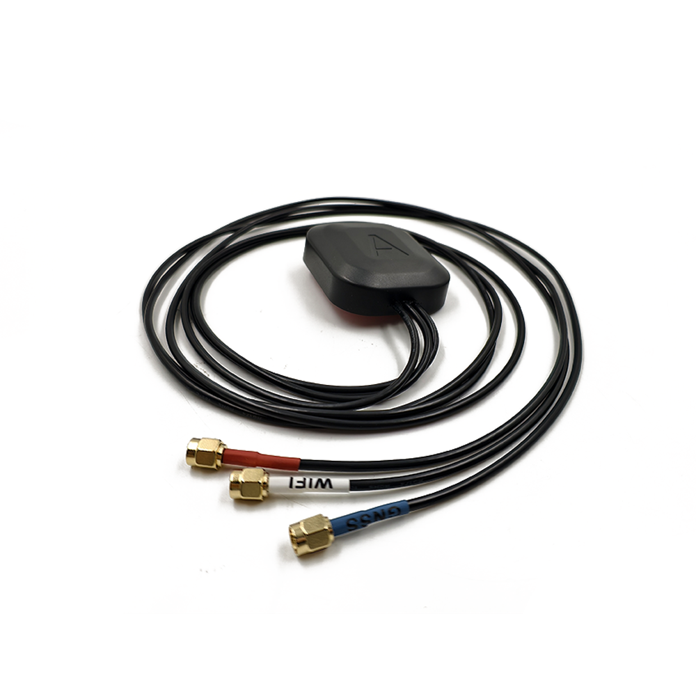
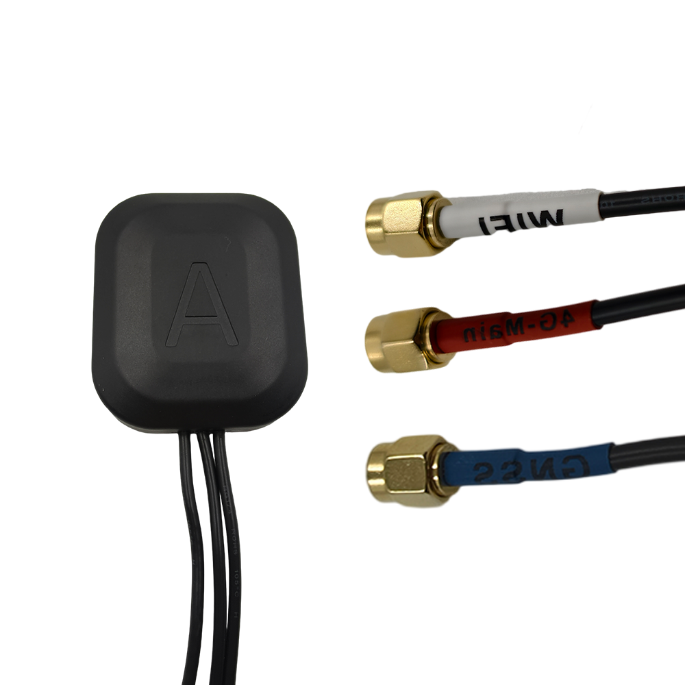
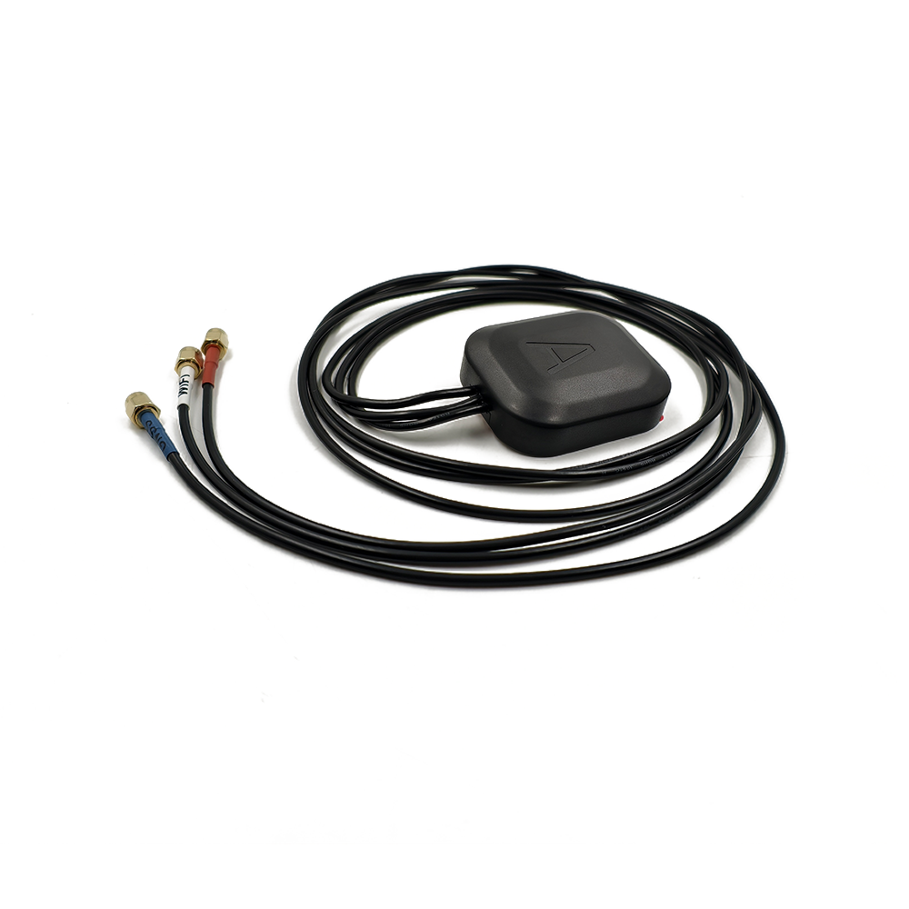
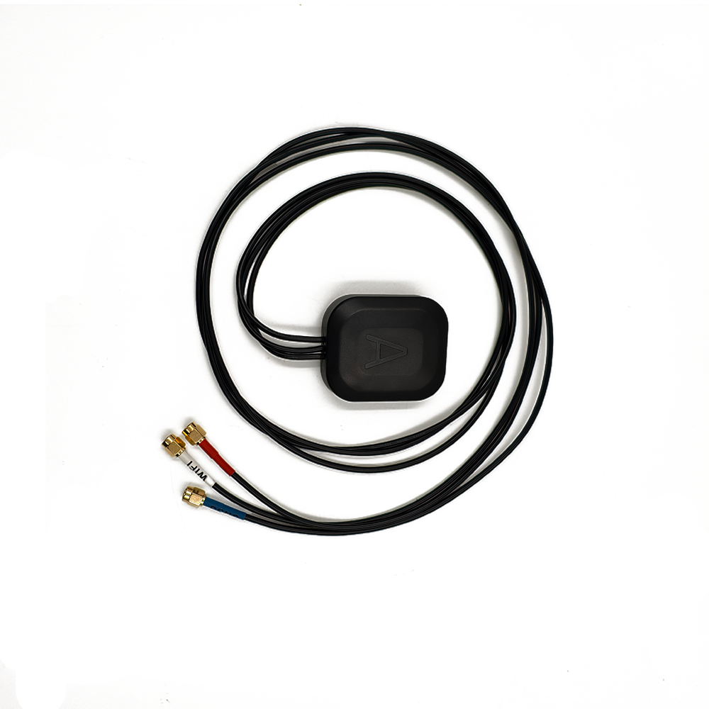
External Antennas
Positioning Chips and Modules


 Language


Language


A multi-band GNSS antenna for Unmanned Aerial Vehicles (UAVs) is a specialized receiver designed to capture satellite signals across multiple frequency bands (e.g., GPS L1/L2/L5, GLONASS L1/L2, Galileo E1/E5, BeiDou B1/B2) from global navigation satellite systems (GNSS). Unlike single-band antennas, which rely on one frequency (typically L1), multi-band antennas enhance positioning accuracy, reliability, and resilience against environmental interferences—critical for UAV navigation in dynamic and challenging environments.
1.1 Definition and Core Functionality
A multi-band GNSS antenna for Unmanned Aerial Vehicles (UAVs) is a specialized receiver designed to capture satellite signals across multiple frequency bands (e.g., GPS L1/L2/L5, GLONASS L1/L2, Galileo E1/E5, BeiDou B1/B2) from global navigation satellite systems (GNSS). Unlike single-band antennas, which rely on one frequency (typically L1), multi-band antennas enhance positioning accuracy, reliability, and resilience against environmental interferences—critical for UAV navigation in dynamic and challenging environments.
In UAV applications, these antennas enable centimeter-level precision for tasks such as aerial mapping, infrastructure inspection, agriculture, and autonomous flight. Their ability to mitigate ionospheric delays, multipath errors, and signal obstructions ensures stable performance even in urban canyons, forests, or areas with partial satellite visibility.
1.2 Market Drivers and UAV-Specific Needs
The UAV industry’s rapid growth—projected to reach $58.4 billion by 2026 (CAGR 16.9%)—is fueled by demand for high-precision navigation in:
Commercial Mapping: Drone-based LiDAR and photogrammetry require sub-5 cm accuracy.
Agriculture: Precision farming relies on GNSS-guided drones for crop monitoring and variable-rate spraying.
Infrastructure Inspection: Drones inspect bridges, power lines, and pipelines with millimeter-level positional awareness.
Autonomous Delivery: Last-mile drones need robust GNSS to navigate GPS-denied zones.
Multi-band antennas address these needs by supporting Real-Time Kinematic (RTK) and Precise Point Positioning (PPP) techniques, which leverage carrier-phase observations for high-precision fixes.
1.3 Key Players and Product Trends
Leading manufacturers of UAV-grade multi-band GNSS antennas include:
Trimble: Zephyr 3 (L1/L2/L5) for survey-grade drones.
u-blox: ANN-MB1 series (L1/L2/E5/B1) for compact UAVs.
Tallysman: TW3882 (L1/L2/L5) with anti-multipath choke rings.
Septentrio: PolaNt x5 (L1/L2/L5/E1/E5) for industrial drones.
Recent trends focus on miniaturization (e.g., <50 mm diameter), low power consumption (<1 W), and integration with IMUs for tight GNSS/INS coupling.
2.1 Core Components
A UAV multi-band GNSS antenna comprises:
2.1.1 Antenna Element
Microstrip Patch Antenna: Dominates UAV designs due to its compact size (20–50 mm) and multi-band capability via stacked patches or reactive loading.
Helical Antenna: Used in rugged UAVs for omnidirectional coverage but less common due to larger size.
Phased Array Antenna: Emerging in high-end drones for beamforming and adaptive nulling of multipath signals.
2.1.2 Choke Ring Structure
Purpose: Suppress ground-reflected multipath signals by reflecting them away from the antenna element.
Design: 3–4 concentric metallic rings with precise spacing (e.g., λ/4 at L1 frequency) to attenuate low-angle reflections.
Trade-off: Adds weight (~50–100 g) but improves accuracy by 15–30% in urban environments.
2.1.3 Low-Noise Amplifier (LNA)
Function: Amplifies weak satellite signals (−160 dBm) before downconversion.
Multi-Band Support: Modern LNAs integrate band-pass filters to isolate L1, L2, L5, etc., minimizing inter-frequency interference.
Noise Figure: Typically <2 dB to preserve signal-to-noise ratio (SNR).
2.1.4 Radome and Mounting
Material: Lightweight polycarbonate or carbon fiber for minimal aerodynamic drag.
Mounting: Magnetic or screw-based for quick attachment to UAV frames.
Environmental Rating: IP67 or higher for dust/water resistance.
2.2 Material Selection
Metallic Parts: Aluminum 6061-T6 for choke rings (lightweight and corrosion-resistant).
Dielectric Substrate: Rogers RT/duroid 5880 (εr = 2.2) for compact multi-band patch antennas.
LNA Components: GaAs pHEMT transistors for low-noise, high-linearity amplification.
2.3 Manufacturing Tolerances
Phase Center Stability (PCS): Must be <2 mm across all frequencies to avoid positional errors during UAV maneuvers.
Choke Ring Precision: Ring spacing tolerances of ±0.05 mm to maintain frequency-selective attenuation.
PCV Calibration: Manufacturers provide phase center variation (PCV) models to correct off-axis signal reception errors.
3.1 Signal Reception and Processing
Satellite Signal Capture:
The antenna receives L-band signals (1–2 GHz) from GNSS satellites, carrying navigation data (ephemeris, clock corrections) and carrier-phase information.
Multipath Suppression:
The choke ring reflects ground-reflected signals away, while RHCP (Right-Hand Circular Polarization) rejects left-handed reflections from buildings or trees.
LNA Amplification:
Weak signals are amplified (30–40 dB gain) while minimizing noise introduction.
Downconversion and Digitization:
The receiver converts RF signals to baseband for processing (e.g., correlation with satellite code/phase).
3.2 Multi-Band Advantages
Ionospheric Delay Correction:
Dual-frequency (L1/L2) measurements enable ionosphere-free combinations, eliminating first-order delays that cause ~5 m errors in single-frequency systems.
Faster Ambiguity Resolution:
Triple-frequency (L1/L2/L5) observations reduce RTK initialization time from minutes to seconds, critical for UAVs in motion.
Improved Availability:
Multi-constellation support (GPS+GLONASS+BeiDou+Galileo) ensures more visible satellites, reducing the risk of signal blockage during agile maneuvers.
3.3 RTK and PPP Integration
RTK (Real-Time Kinematic):
A ground base station transmits correction data to the UAV via radio or cellular links, enabling centimeter-level accuracy in real time.
PPP (Precise Point Positioning):
Uses satellite clock and orbit corrections from ground stations (e.g., IGS) to achieve decimeter- to centimeter-level accuracy without a base station (but with longer convergence times).
4.1 Key Advantages
Sub-Centimeter Accuracy:
Phase center stability and multipath rejection enable millimeter-level precision in static surveys and centimeter-level in dynamic flight.
All-Weather Performance:
Robust against rain, fog, and dust (IP67+ ratings).
Multi-System Compatibility:
Supports GPS, GLONASS, BeiDou, Galileo, and regional systems (e.g., QZSS, IRNSS).
4.2 Technical Challenges
Size and Weight:
Choke ring antennas add bulk (~100–200 g), limiting payload capacity for small UAVs.
Power Consumption:
Multi-band LNAs and receivers consume 2–5 W, draining UAV batteries faster.
Signal Obstruction:
UAV propellers or landing gear can cause near-field multipath, requiring careful antenna placement.
4.3 Operational Limitations
RTK Range:
Corrections are valid only within 10–20 km of the base station due to spatial decorrelation of atmospheric errors.
Latency:
Real-time data transmission delays (100–500 ms) may affect high-speed UAVs (>50 m/s).
5.1 Current Applications
Aerial Mapping:
Drones equipped with multi-band GNSS and LiDAR create high-resolution 3D models for urban planning and mining.
Precision Agriculture:
GNSS-guided drones apply fertilizers with ±2 cm accuracy, reducing waste and boosting yields.
Infrastructure Inspection:
Drones inspect pipelines and wind turbines using RTK-GNSS for millimeter-scale crack detection.
5.2 Emerging Trends
Miniaturization:
Advances in MEMS and 3D printing enable choke ring antennas under 50 mm diameter for nano-drones.
AI-Enhanced Multipath Mitigation:
Machine learning algorithms analyze signal patterns to dynamically suppress reflections, reducing reliance on physical choke rings.
LEO Satellite Integration:
Companies like SpaceX’s Starlink plan to augment GNSS with LEO signals, potentially reducing RTK convergence time to <1 second.
5.3 Market Projections
The UAV GNSS antenna market is expected to grow at a CAGR of 12.3% from 2025 to 2030, driven by autonomous delivery and smart city projects. Multi-band antennas will dominate high-precision segments, while software-defined radios (SDRs) may replace traditional hardware in cost-sensitive applications.
Conclusion
Multi-band GNSS antennas are transforming UAV navigation by delivering unprecedented accuracy and reliability in dynamic environments. Their ability to mitigate ionospheric delays, multipath errors, and signal obstructions makes them indispensable for applications ranging from precision agriculture to infrastructure inspection.
While challenges like size, weight, and power consumption persist, ongoing innovations in miniaturization, AI, and LEO satellite integration are expanding their applicability across UAV segments. As autonomous systems become mainstream, multi-band GNSS antennas will remain the cornerstone of safe, efficient, and high-precision drone operations—ushering in a new era of aerial robotics.
Final Thought: The future of UAV navigation lies in hybrid positioning systems that combine multi-band GNSS with vision-based sensors, 5G, and LEO satellites. This convergence will enable ubiquitous centimeter-level positioning, even in the most challenging environments.

 86 0755 2819 9597
Lucy Yang | lucy.y@toxutech.com
Nicole Li | nicole@toxutech.com
Dotty Zhao | sales04@toxutech.com
Global Business Director / Sales Team / Global Operations


 En
En Cn
Cn Korean
 Home >


