

-
Products -PCBA Manufacturing RF Connectors RF Cable Assemblys Embedded Antennas External Antennas Positioning Chips and Modules
RF Connectors

RF Cable Assemblys
Embedded Antennas
External Antennas
Positioning Chips and Modules


 Language


Language


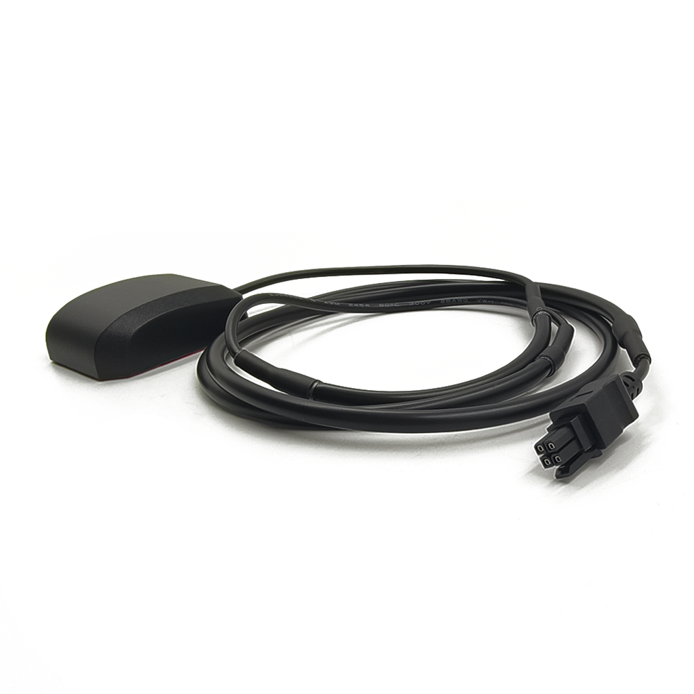
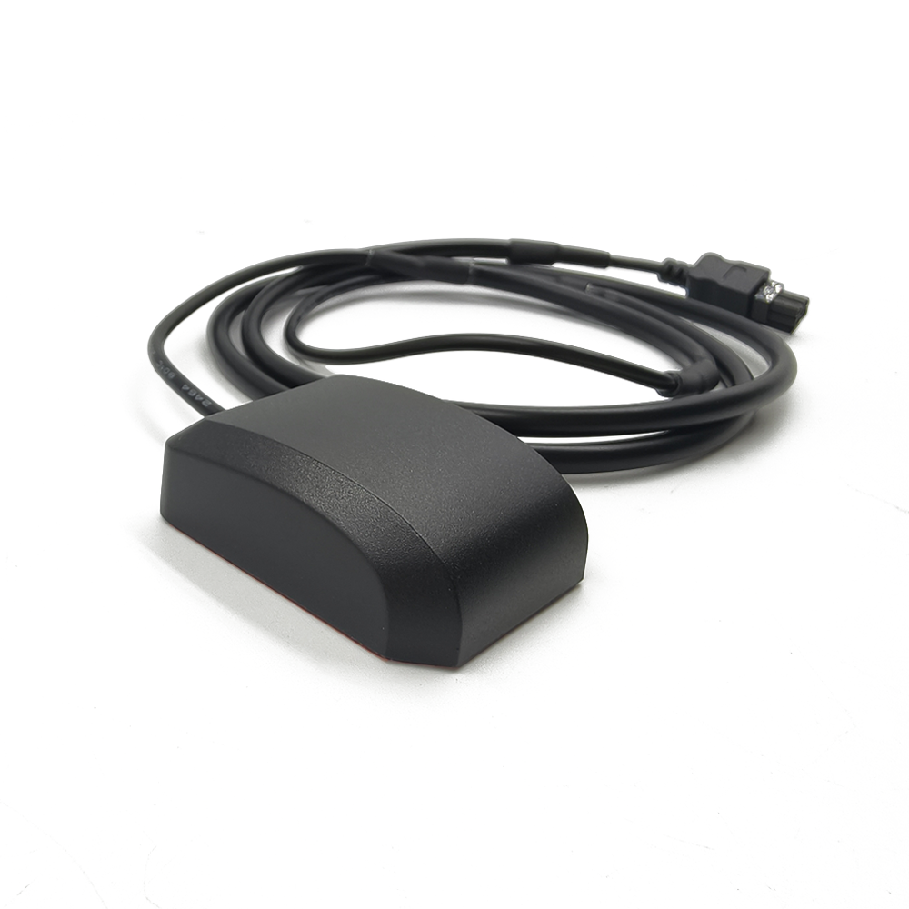
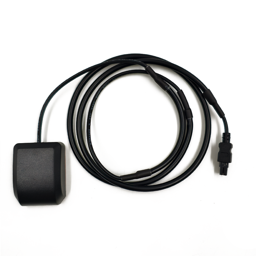

A high-accuracy GNSS RTK external antenna is a specialized radio-frequency (RF) component designed to receive signals from multiple global navigation satellite systems (GNSS)—including GPS, GLONASS, Galileo, BeiDou, and QZSS—while leveraging Real-Time Kinematic (RTK) technology to achieve centimeter-level positioning accuracy. Unlike standard GNSS antennas, which typically provide meter-level accuracy, RTK antennas integrate advanced signal processing, dual- or multi-frequency reception, and correction data from terrestrial base stations to eliminate atmospheric delays, ionospheric errors, and multipath interference.
1.1 Definition and Core Functionality
A high-accuracy GNSS RTK external antenna is a specialized radio-frequency (RF) component designed to receive signals from multiple global navigation satellite systems (GNSS)—including GPS, GLONASS, Galileo, BeiDou, and QZSS—while leveraging Real-Time Kinematic (RTK) technology to achieve centimeter-level positioning accuracy. Unlike standard GNSS antennas, which typically provide meter-level accuracy, RTK antennas integrate advanced signal processing, dual- or multi-frequency reception, and correction data from terrestrial base stations to eliminate atmospheric delays, ionospheric errors, and multipath interference.
These antennas are externally mounted on vehicles, drones, surveying equipment, or agricultural machinery to maximize sky visibility and minimize signal obstruction. Their robust design ensures reliability in harsh environments, including extreme temperatures, vibrations, and electromagnetic interference (EMI).
1.2 Market Drivers and Industry Trends
The global high-accuracy GNSS RTK antenna market is projected to grow at a CAGR of 12.8% from 2025 to 2030, driven by:
Autonomous Vehicle Deployment: Self-driving cars and trucks require RTK-grade positioning for lane-level navigation and collision avoidance.
Precision Agriculture: Farmers use RTK-enabled tractors and drones for optimal seed placement, fertilization, and crop monitoring, reducing waste and boosting yields.
Surveying and Construction: RTK antennas enable real-time 3D mapping of infrastructure projects with sub-5 cm accuracy.
Marine and Aerial Navigation: Drones and unmanned surface vessels (USVs) rely on RTK for stable operation in coastal and offshore environments.
Key trends include:
Multi-Constellation Support: Combining GPS L1/L2/L5 with Galileo E1/E5 and BeiDou B1/B2 for improved satellite availability.
Miniaturization: Compact antennas (<100 mm diameter) for integration into drones and small robots.
AI-Powered Multipath Mitigation: Machine learning algorithms dynamically suppress reflections from buildings or terrain.
PPP-RTK Hybridization: Merging Precise Point Positioning (PPP) with RTK for global coverage without local base stations.
1.3 Key Players and Product Landscape
Leading manufacturers of high-accuracy GNSS RTK external antennas include:
Trimble: BX992 (L1/L2/L5, 1 cm accuracy, IP67-rated).
u-blox: ZED-F9P (multi-band, RTK/PPP support, <10 cm accuracy in dynamic mode).
Tallysman: TW3882 (L1/L2/L5, helical design for compact integration).
Harxon: HX-CSX771A (choke-ring antenna, anti-jamming, 1 cm accuracy).
Taoglas: MA.810 (magnetic-mount, L1/L5, 48 mW power consumption).
These products typically offer:
Frequency Bands: GPS L1 (1575.42 MHz), L2 (1227.60 MHz), L5 (1176.45 MHz); Galileo E1/E5; BeiDou B1/B2.
Accuracy: 1–2 cm horizontal, 2–3 cm vertical (static); 5–10 cm (dynamic).
Environmental Ratings: IP67/IP69K (dust/water resistance), MIL-STD-810G (shock/vibration).
2.1 Core Components
A high-accuracy GNSS RTK external antenna consists of the following key elements:
2.1.1 Antenna Element
Microstrip Patch Antenna: Common in low-cost designs, but limited to single-band operation.
Helical Antenna: Compact and circularly polarized, ideal for drones and small robots.
Choke-Ring Antenna: Features concentric rings to suppress ground-reflected multipath signals, used in survey-grade applications.
Quadrifilar Helix (QFH): Optimized for low-angle satellite signals in marine environments.
2.1.2 Ground Plane
A metal reflector beneath the antenna element enhances radiation efficiency and reduces backlobe interference.
Size Matters: A ground plane diameter of ≥150 mm is recommended for optimal L1/L2 performance.
2.1.3 Low-Noise Amplifier (LNA)
Function: Amplifies weak satellite signals (−160 dBm) before downconversion.
Key Specs:
Noise Figure (NF): <1.5 dB to minimize signal degradation.
Gain: 28–32 dB to overcome cable losses.
Multi-Band Support: Separate LNAs for L1, L2, and L5 to prevent inter-frequency interference.
2.1.4 Filtering and Matching Network
Band-Pass Filters: Isolate GNSS frequencies (e.g., 1575.42 MHz ± 2 MHz for GPS L1).
Impedance Matching: Ensures 50 Ω matching to minimize signal reflection.
2.1.5 Radome and Enclosure
Material: UV-resistant ABS plastic or fiberglass for durability.
Mounting Options:
Magnetic Base: For temporary deployment on vehicles.
Threaded Stud: For permanent installation on surveying tripods.
Aero Mount: For drones and aircraft.
2.2 Material Selection and Manufacturing
Dielectric Substrate: Rogers RT/duroid 5880 (εr = 2.2) for high-frequency patch antennas.
Conductive Layers: Silver-plated copper for low-loss RF paths.
LNA Components: GaAs pHEMT transistors for low-noise, high-linearity amplification.
Manufacturing Tolerances:
Phase Center Stability (PCS): <1 mm across all frequencies to avoid positional errors during vehicle maneuvers.
Antenna Efficiency: >85% for reliable signal reception in urban canyons.
2.3 Integration Challenges
Thermal Management: LNAs generate heat; thermal vias or heat sinks are required in high-temperature environments.
EMI/EMC Compliance: Must coexist with 4G/5G, Wi-Fi, and CAN bus signals without interference.
Mechanical Stress: Vibration-resistant designs for construction and agricultural machinery.
3.1 Signal Reception and Processing
Satellite Signal Capture:
The antenna receives L-band signals (1–2 GHz) from GNSS satellites, carrying navigation data (ephemeris, clock corrections) and carrier-phase information.
Multipath Mitigation:
Right-Hand Circular Polarization (RHCP) rejects left-handed reflections from buildings or vehicles.
Choke-ring antennas suppress ground-reflected signals by >20 dB.
LNA Amplification:
Weak signals are amplified (30–40 dB gain) while minimizing noise introduction.
Downconversion and Digitization:
The receiver converts RF signals to baseband for processing (e.g., correlation with satellite code/phase).
3.2 RTK Correction Mechanism
RTK achieves centimeter-level accuracy by:
Base Station Setup:
A fixed base station with known coordinates receives GNSS signals and calculates differential corrections (ionospheric delays, clock errors, etc.).
Rover Unit Operation:
The vehicle-mounted RTK antenna receives both satellite signals and corrections from the base station via radio (RTCM 3.x) or cellular (NTRIP) links.
Carrier-Phase Differencing:
The rover compares the phase of the satellite carrier wave with the base station’s reference phase to resolve integer ambiguities (whole-cycle differences).
Real-Time Positioning:
The receiver computes 3D coordinates with 1–2 cm accuracy every 1–2 seconds.
3.3 Multi-Constellation and Multi-Frequency Operation
Dual-Frequency (L1/L2): Corrects ionospheric delays, reducing positional errors from ~5 m (single-frequency) to <0.5 m.
Triple-Frequency (L1/L2/L5): Enables RTK-PPP hybridization for global centimeter-level accuracy without local base stations.
Multi-Constellation (GPS+Galileo+BeiDou): Increases the number of visible satellites, improving availability in urban canyons.
4.1 Key Advantages
Centimeter-Level Accuracy:
Essential for autonomous navigation, precision agriculture, and surveying.
Real-Time Corrections:
Unlike PPP, which requires 20–30 minutes of convergence, RTK provides instantaneous accuracy.
Robustness in Challenging Environments:
Choke-ring antennas and AI-based multipath filters ensure reliability in urban canyons and forests.
Scalability:
A single base station can support multiple rovers over a 10–20 km radius.
4.2 Technical Challenges
Initial Ambiguity Resolution:
RTK requires 10–60 seconds to resolve integer ambiguities, delaying high-accuracy positioning at startup.
Baseline Distance Limitations:
Accuracy degrades beyond 20 km from the base station due to residual atmospheric errors.
Signal Obstruction:
Tunnels, parking garages, and dense foliage can cause GNSS outages, requiring fallback to inertial navigation systems (INS).
4.3 Operational Limitations
Cost: High-end RTK antennas cost
500–
2,000, limiting adoption in budget-constrained applications.
Power Consumption: LNAs and RTK modules draw 2–5 W, which is prohibitive for battery-powered drones.
Regulatory Compliance: Radio-based RTK corrections require licensing in some regions (e.g., FCC Part 90 in the U.S.).
5.1 Current Applications
Autonomous Vehicles:
RTK antennas enable lane-level positioning for self-driving trucks and passenger cars.
Precision Agriculture:
John Deere’s AutoTrac system uses RTK for sub-inch accuracy in seeding and harvesting.
Surveying and Construction:
Trimble’s R12i rover provides 3D point clouds with 1 cm accuracy for infrastructure monitoring.
Marine Navigation:
UAVs equipped with RTK antennas conduct bathymetric surveys in coastal zones.
5.2 Emerging Trends
PPP-RTK Hybridization:
Combining PPP’s global coverage with RTK’s real-time accuracy via LEO satellites (e.g., SpaceX’s Starlink).
AI-Powered Multipath Mitigation:
Neural networks analyze signal patterns to dynamically suppress reflections in real time.
Solid-State Antennas:
MEMS-based tunable antennas adapt to multiple frequency bands without mechanical components.
5G Integration:
Joint GNSS/5G antennas support V2X communication for smart traffic management.
5.3 Market Projections
The high-accuracy GNSS RTK antenna market is expected to reach $4.2 billion by 2030, driven by:
Autonomous trucking: $1.7 billion (40% share).
Precision agriculture: $1.1 billion (26% share).
Surveying/construction: $0.8 billion (19% share).
Conclusion
High-accuracy GNSS RTK external antennas are transforming industries by enabling centimeter-level positioning in real time. Their ability to integrate multi-constellation, multi-frequency, and AI-driven correction technologies makes them indispensable for autonomous vehicles, precision agriculture, and surveying.
While challenges like baseline distance limitations and signal obstruction persist, ongoing innovations in PPP-RTK hybridization, solid-state tuning, and 5G integration are expanding their applicability across diverse sectors. As the automotive industry transitions toward full autonomy and smart cities demand high-precision infrastructure monitoring, RTK antennas will remain at the forefront of safe, efficient, and intelligent mobility systems—ushering in a new era of geospatial accuracy.
Final Thought: The future of RTK antennas lies in hybrid positioning systems that combine GNSS with inertial sensors, 5G, and computer vision. These solutions will deliver ubiquitous, centimeter-level positioning even in the most challenging environments, from dense urban cores to remote offshore zones.

 86 0755 2819 9597
Lucy Yang | lucy.y@toxutech.com
Nicole Li | nicole@toxutech.com
Dotty Zhao | sales04@toxutech.com
Global Business Director / Sales Team / Global Operations


 En
En Cn
Cn Korean
 Home >


