

-
Products -PCBA Manufacturing RF Connectors RF Cable Assemblys Embedded Antennas External Antennas Positioning Chips and Modules
RF Connectors

RF Cable Assemblys
Embedded Antennas
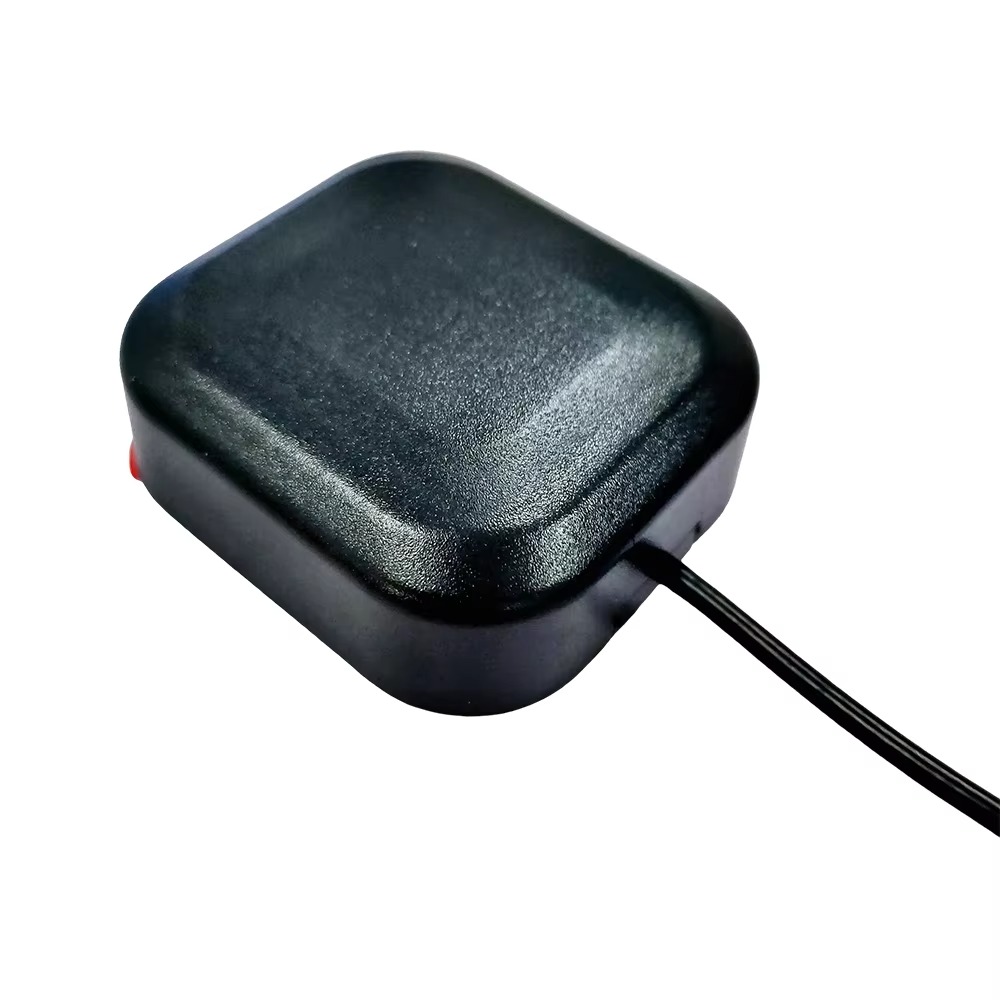
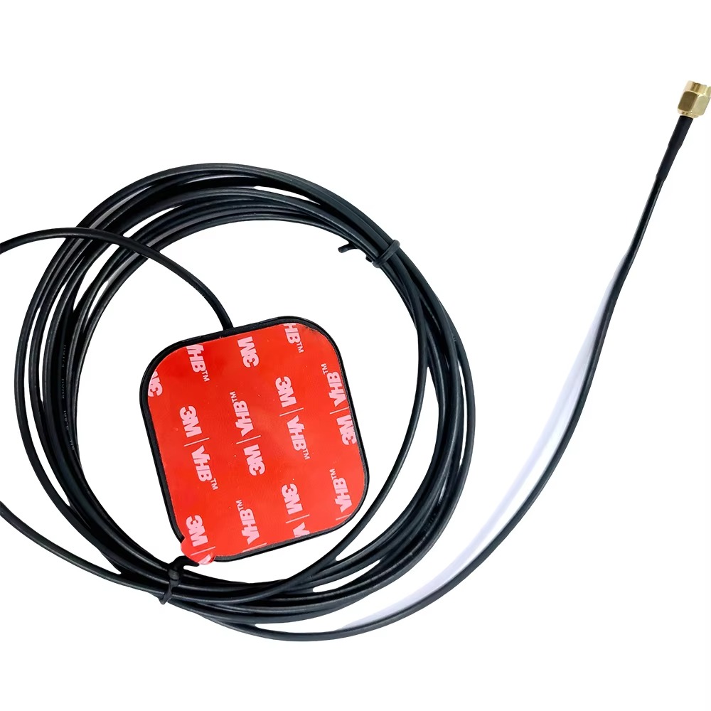
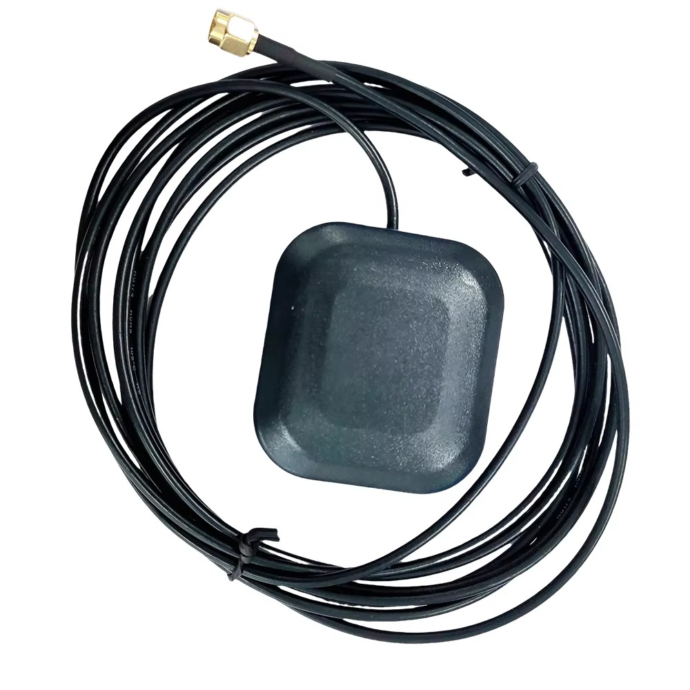
External Antennas
Positioning Chips and Modules


 Language


Language


In the realm of modern surveying, precision is the cornerstone of every successful project—whether it’s mapping vast construction sites, delineating property boundaries, or monitoring geological shifts. Traditional single-band GPS antennas, while revolutionary in their time, often fall short of the sub-centimeter accuracy demanded by today’s high-stakes applications. This is where the dual band RTK (Real-Time Kinematic) GPS antenna emerges as a transformative technology, redefining the standards of precision in surveying equipment.
To understand its significance, it’s first critical to break down the key components of its name. “Dual band” refers to the antenna’s ability to receive signals from two distinct frequency bands used by GPS satellites: the L1 band (centered at 1575.42 MHz) and the L2 band (centered at 1227.60 MHz). Unlike single-band antennas, which rely solely on L1 signals, dual band antennas leverage both frequencies to mitigate common sources of signal error—such as ionospheric delay, a major culprit in positioning inaccuracies. Ionospheric delay occurs when GPS signals pass through the Earth’s ionosphere, where charged particles bend and slow the signal; L1 and L2 signals are affected differently by this phenomenon, allowing dual band systems to calculate and correct for the delay in real time.
“RTK” technology further elevates precision by enabling real-time data processing. Unlike post-processing methods, which require surveyors to collect data in the field and analyze it later, RTK uses a network of fixed reference stations and a rover (equipped with the dual band antenna) to transmit corrected positioning data instantaneously. The reference station, positioned at a known location, continuously calculates the difference between its actual coordinates and the coordinates derived from GPS signals. This correction data is then sent to the rover, which applies the corrections to its own GPS readings—resulting in accuracy levels of 1–2 cm horizontally and 2–5 cm vertically, a game-changer for applications where even minor errors can lead to costly rework or safety hazards.
Dual band RTK GPS antennas are not just upgrades to existing technology; they are enablers of new possibilities in surveying. They have become indispensable in industries ranging from civil engineering (e.g., road and bridge construction) to agriculture (precision farming) and environmental science (landslide monitoring). By combining the reliability of dual band signal reception with the speed of RTK processing, these antennas address the core challenges of traditional surveying—namely, time inefficiency and accuracy limitations.
As surveying equipment continues to evolve, driven by advancements in satellite technology (e.g., the rollout of GPS III and Galileo) and signal processing algorithms, the role of dual band RTK GPS antennas will only grow. They serve as the critical link between satellites and surveyors, translating raw satellite data into actionable, precise positioning information that powers some of the world’s most important infrastructure and environmental projects. In short, the dual band RTK GPS antenna is not just a component of surveying equipment—it is the backbone of modern, precision-driven surveying.
The performance of a dual band RTK GPS antenna—its ability to receive clear, stable signals, resist interference, and deliver sub-centimeter accuracy—depends entirely on its design and construction. Every component, from the radiating elements to the housing, is engineered with a singular goal: to optimize signal reception while withstanding the harsh conditions of field surveying. This section delves into the key design considerations and construction details that define high-quality dual band RTK GPS antennas.
Core Design Considerations
1. Frequency Band Optimization
The primary design challenge is ensuring the antenna efficiently receives both L1 (1575.42 MHz) and L2 (1227.60 MHz) bands. Unlike single-band antennas, which can be tuned to a single frequency, dual band antennas require a broadband design that minimizes signal loss across both bands. Engineers achieve this using either:
Dual-element designs: Two separate radiating elements (one for L1, one for L2) integrated into a single antenna structure, each tuned to its respective frequency. This approach ensures maximum sensitivity for each band but requires careful placement to avoid mutual interference.
Wideband elements: A single radiating element designed to cover both frequencies. This simplifies the antenna’s structure but demands precise material selection (e.g., high-dielectric constant substrates) to maintain efficiency across the L1-L2 frequency range.
In both cases, the antenna’s impedance (typically 50 ohms, matching the standard for GPS equipment) is calibrated to ensure optimal power transfer between the antenna and the receiver, reducing signal reflection and loss.
2. Polarization
GPS satellite signals are transmitted in right-hand circular polarization (RHCP). To maximize signal capture, dual band RTK GPS antennas are designed with RHCP polarization—critical because a mismatched polarization (e.g., linear polarization) would result in significant signal attenuation (up to 30 dB or more). The radiating elements are shaped (often as helices or microstrip patches) to generate RHCP, ensuring alignment with the satellite signals and minimizing interference from linearly polarized noise (e.g., from power lines or buildings).
3. Radiation Pattern
Surveying antennas require a hemispherical radiation pattern (also called a “dome” pattern) with uniform coverage across the sky. This ensures the antenna can receive signals from satellites at low elevations (e.g., near the horizon) as well as high elevations, which is essential in urban canyons or forested areas where satellite visibility is limited. Engineers use simulation tools (e.g., CST Microwave Studio) to model the radiation pattern and adjust the antenna’s shape—for example, adding ground planes or parasitic elements—to eliminate “nulls” (areas of weak signal) and ensure consistent sensitivity across all azimuths and elevations.
Construction Details
1. Radiating Elements
The radiating element is the heart of the antenna, responsible for converting electrical signals from the receiver into electromagnetic waves (for transmission, though GPS antennas are primarily receive-only) and vice versa. For dual band RTK antennas, the most common designs are:
Microstrip patches: Thin, flat elements printed on a dielectric substrate (e.g., FR4 or Rogers material). They are lightweight, low-cost, and easy to integrate into compact designs—ideal for portable surveying rovers. However, they require a ground plane (a conductive layer beneath the substrate) to enhance efficiency and reduce backlobes (unwanted signal reception from the ground).
Helical antennas: Coiled elements that offer high gain (signal amplification) and wide bandwidth. They are particularly effective in areas with weak satellite signals but are bulkier than microstrip patches, making them better suited for fixed reference stations than portable rovers.
2. Housing and Environmental Protection
Surveying equipment operates in extreme conditions—rain, snow, high winds, and temperature fluctuations (from -40°C to 60°C). As such, dual band RTK GPS antennas are encased in weatherproof housings made from durable materials like UV-stabilized ABS plastic or aluminum. The housing is sealed to IP67 or IP68 standards (protection against dust and water immersion), preventing moisture or debris from damaging internal components.
Additionally, the housing is designed to minimize signal attenuation. Materials with low dielectric loss (e.g., PTFE) are used for the top cover (the part through which signals pass), ensuring that L1 and L2 signals are not absorbed or scattered. Some antennas also include a radome—a thin, transparent layer that provides extra protection without interfering with signal reception.
3. Mounting and Integration
Dual band RTK GPS antennas are designed for easy integration with surveying equipment, such as rovers, total stations, or drones. Common mounting options include:
Threaded mounts: 5/8-inch threads (a standard in surveying) for attaching to tripods or rover poles.
Magnetic mounts: For temporary installation on vehicles or metal surfaces (though magnetic materials can interfere with signal reception, so these are used sparingly).
Pole mounts: Lightweight brackets for attaching to telescopic poles, allowing surveyors to adjust the antenna’s height for optimal satellite visibility.
Internally, the antenna includes a low-noise amplifier (LNA) to boost weak satellite signals before they are sent to the receiver. The LNA is designed to have low noise figure (typically <1.5 dB) to avoid adding unwanted noise to the signal—a critical factor in maintaining RTK accuracy. A coaxial cable (e.g., RG-58 or RG-174) connects the antenna to the receiver, with shielding to prevent electromagnetic interference (EMI) from nearby electronics (e.g., radios or power tools).
In summary, the design and construction of a dual band RTK GPS antenna are a balance of technical precision and practical durability. Every choice—from the type of radiating element to the housing material—is intended to ensure reliable, accurate signal reception in the toughest field conditions, making it an essential component of modern surveying equipment.
To appreciate the precision of a dual band RTK GPS antenna, it’s essential to understand the underlying principles that govern its operation. Unlike basic GPS antennas, which simply receive satellite signals, dual band RTK systems combine advanced signal processing, real-time data correction, and dual frequency reception to deliver sub-centimeter accuracy. This section breaks down the working principles into four key stages: signal reception, error correction, RTK data processing, and positioning calculation.
Stage 1: Satellite Signal Reception
The process begins with the dual band RTK GPS antenna capturing signals from at least four GPS satellites (the minimum required for 3D positioning). Unlike single-band antennas, which only receive L1 signals, dual band antennas simultaneously receive L1 and L2 signals—a critical distinction that enables superior error correction.
GPS satellites transmit two types of data via these signals:
Ephemeris data: Detailed information about the satellite’s orbit, clock corrections, and health status. This data is updated every 2 hours and allows the receiver to calculate the satellite’s precise position at any given time.
Pseudorange data: A measure of the “apparent” distance between the satellite and the antenna, calculated by multiplying the time it takes for the signal to travel from the satellite to the antenna by the speed of light. However, this pseudorange is not the true distance—it is distorted by several sources of error (e.g., ionospheric delay, atmospheric refraction).
The antenna’s radiating elements (e.g., microstrip patches or helices) are tuned to L1 and L2 frequencies, ensuring efficient signal capture. The low-noise amplifier (LNA) integrated into the antenna then boosts the weak satellite signals (which are often as low as -130 dBm, equivalent to a whisper from miles away) to a level that the receiver can process, while minimizing the addition of unwanted noise.
Stage 2: Dual Band Error Correction
The primary advantage of dual band reception is its ability to correct for ionospheric delay—one of the largest sources of GPS positioning error. The ionosphere, a layer of charged particles in the Earth’s upper atmosphere (50–600 km), bends and slows GPS signals. The amount of delay depends on the signal’s frequency: L1 signals are delayed more than L2 signals.
Dual band RTK systems leverage this frequency-dependent delay to calculate and eliminate ionospheric errors. Here’s how:
The receiver measures the pseudorange for both L1 and L2 signals from the same satellite.
It calculates the ionospheric delay difference between the two signals (since L1 is delayed more, the difference is predictable based on the ionosphere’s properties).
Using this difference, the receiver estimates the total ionospheric delay affecting the L1 signal (the primary signal used for positioning) and subtracts it from the pseudorange.
This correction is far more accurate than the approximate ionospheric models used by single-band systems (e.g., the Klobuchar model), which can introduce errors of up to 10 meters in poor ionospheric conditions. By eliminating ionospheric delay, dual band antennas reduce a major source of inaccuracy, laying the groundwork for RTK precision.
In addition to ionospheric correction, dual band systems also mitigate tropospheric delay (caused by water vapor and temperature variations in the lower atmosphere) using mathematical models, and multipath interference (signals reflected off buildings or terrain) through signal processing techniques (e.g., narrow correlators or adaptive filtering).
Stage 3: RTK Data Processing (Reference Station + Rover)
RTK technology relies on a two-part system: a fixed reference station and a rover (equipped with the dual band antenna). The reference station is positioned at a known location (with coordinates surveyed to sub-centimeter accuracy in advance), while the rover is the mobile unit used for field surveying.
The RTK process unfolds as follows:
Reference Station Data Collection: The reference station’s GPS receiver (also equipped with a dual band antenna) continuously receives L1 and L2 signals from satellites. It calculates its own “GPS-derived” position using these signals and compares it to its known, true position.
Correction Data Generation: The difference between the GPS-derived position and the true position is called the error vector—it includes all residual errors (e.g., remaining ionospheric delay, satellite clock errors, or receiver noise) affecting the GPS signals at that location. The reference station converts this error vector into correction data (often formatted as RTCM 3.x, a standard for RTK corrections) and transmits it to the rover via a communication link (e.g., UHF radio, cellular network, or Bluetooth).
Rover Data Processing: The rover’s receiver receives both the satellite signals (via its dual band antenna) and the correction data from the reference station. It applies the correction data to its own GPS-derived position, adjusting for the same errors that affected the reference station.
This real-time correction is what sets RTK apart from post-processing methods. Because the correction data is applied instantaneously, the rover can display precise positioning information to the surveyor in real time—eliminating the need to wait for post-field analysis and allowing for immediate adjustments if errors are detected.
Stage 4: Positioning Calculation
Once the rover has corrected its pseudorange data using both dual band error correction and RTK reference data, it calculates its precise 3D position (latitude, longitude, and elevation) using a process called trilateration.
Trilateration works by determining the intersection of spheres (or circles, for 2D positioning) centered on each satellite. Each satellite’s position is known from the ephemeris data, and the true distance from the rover to the satellite is the corrected pseudorange. By calculating the intersection of distances from at least four satellites, the receiver can determine the rover’s exact location.
In dual band RTK systems, this calculation is refined further using carrier phase measurements. Unlike pseudorange measurements (which use the timing of the satellite’s code signals), carrier phase measurements track the phase of the L1 and L2 carrier waves (the “carrier” that carries the code and ephemeris data). Carrier phase measurements are far more precise (to within a few millimeters) than pseudorange measurements, but they require resolving the “integer ambiguity” (the number of full carrier wave cycles between the satellite and the rover).
Dual band systems simplify integer ambiguity resolution by using both L1 and L2 carrier phases. The frequency difference between L1 and L2 allows the receiver to narrow down the possible values of the ambiguity, reducing the time needed to resolve it and improving reliability—even in areas with limited satellite visibility (e.g., urban canyons).
In conclusion, the working principles of a dual band RTK GPS antenna are a synergy of dual frequency signal reception, advanced error correction, real-time data transmission, and precise carrier phase processing. Together, these principles enable the sub-centimeter accuracy that has made dual band RTK antennas indispensable in modern surveying.
Dual band RTK GPS antennas have revolutionized surveying by delivering unprecedented precision, but like any technology, they come with both distinct advantages and inherent challenges. Understanding these pros and cons is critical for surveyors, equipment manufacturers, and project managers to make informed decisions about when and how to use this technology. This section explores the key advantages and challenges of dual band RTK GPS antennas in detail.
Advantages of Dual Band RTK GPS Antennas
1. Unmatched Precision
The most significant advantage of dual band RTK GPS antennas is their ability to deliver sub-centimeter horizontal accuracy (1–2 cm) and sub-decimeter vertical accuracy (2–5 cm). This level of precision is far beyond what single-band GPS or even non-RTK dual band systems can achieve. The combination of dual frequency reception (for ionospheric correction) and RTK real-time correction (for residual errors) eliminates the largest sources of positioning inaccuracy, making these antennas ideal for applications where precision is non-negotiable—such as:
Civil engineering: Aligning bridge segments, installing tunnel liners, or grading roadways.
Land surveying: Delineating property boundaries with legal precision or creating topographic maps with detailed elevation data.
Precision agriculture: Guiding farm machinery to plant seeds or apply fertilizers with centimeter-level accuracy, reducing waste and improving yields.
This precision not only improves the quality of surveying results but also reduces the need for rework—saving time and money on projects.
2. Improved Reliability in Challenging Environments
Single-band GPS antennas often struggle in environments with poor satellite visibility or high interference, leading to dropped signals or reduced accuracy. Dual band RTK GPS antennas, however, are far more resilient:
Ionospheric resilience: By correcting for ionospheric delay using L1 and L2 signals, dual band antennas maintain accuracy even during ionospheric storms (caused by solar activity), which can disrupt single-band signals and introduce errors of up to 10 meters.
Multipath mitigation: While no antenna is immune to multipath interference (signals reflected offbuildings, trees, or water), dual band systems mitigate this issue more effectively. The combination of L1/L2 signal analysis and advanced signal processing algorithms (e.g., adaptive filtering and narrow correlators) allows the receiver to distinguish between direct satellite signals and reflected ones, reducing multipath-induced errors by up to 50% compared to single-band antennas.
Urban and forested area performance: In urban canyons (where tall buildings block satellite signals) or dense forests (where foliage scatters signals), dual band RTK antennas maintain better connectivity. Their ability to receive signals from low-elevation satellites (thanks to a optimized hemispherical radiation pattern) and correct for residual errors via RTK means they can deliver accurate positioning even when only 3–4 satellites are visible—something single-band systems often fail to do.
3. Time and Cost Efficiency
Traditional surveying methods (e.g., using total stations) require surveyors to set up multiple control points and measure distances manually, which is time-consuming and labor-intensive. Dual band RTK GPS antennas streamline this process in two key ways:
Real-time results: RTK technology eliminates the need for post-field data processing. Surveyors can view precise positioning data instantly on the rover’s display, allowing them to verify measurements on-site and adjust their workflow immediately. This reduces project timelines by 30–50% in many cases—critical for tight construction schedules.
Reduced labor needs: Unlike total stations, which often require two people to operate (one to align the instrument, one to hold the prism), dual band RTK rovers can be operated by a single surveyor. This cuts down on labor costs and makes surveying more efficient in remote or hard-to-access areas.
4. Compatibility with Multi-Constellation Systems
Modern dual band RTK GPS antennas are not limited to GPS satellites—they also support other global navigation satellite systems (GNSS), such as Galileo (Europe), GLONASS (Russia), and BeiDou (China). This multi-constellation compatibility increases the number of available satellites (often doubling or tripling the count compared to GPS-only systems), which:
Improves signal availability in challenging environments (e.g., urban canyons or polar regions).
Reduces the risk of signal outages, ensuring continuous surveying operations.
Enhances positioning accuracy by leveraging data from multiple satellite networks, further minimizing errors.
Challenges of Dual Band RTK GPS Antennas
1. Higher Cost
The most significant barrier to adopting dual band RTK GPS antennas is their cost. Compared to single-band GPS antennas (which can cost as little as $100), dual band RTK systems are significantly more expensive:
A high-quality dual band RTK antenna alone can cost \(500–\)2,000.
When paired with a compatible receiver, rover, and reference station, the total system cost can range from \(5,000 to \)20,000—prohibitive for small surveying firms or individual contractors.
Maintenance costs are also higher: the antenna’s precision components (e.g., low-noise amplifiers and broadband radiating elements) are more fragile and expensive to repair or replace if damaged in the field.
2. Dependence on Reference Station Infrastructure
RTK technology relies on a network of fixed reference stations to generate correction data. In areas with limited or no reference station coverage (e.g., remote rural regions, deserts, or developing countries), dual band RTK antennas cannot deliver their full precision. Surveyors in these areas face two options:
Build their own reference station, which requires additional equipment (e.g., a fixed receiver, power supply, and communication module) and ongoing maintenance—adding to the cost and complexity.
Use a commercial RTK network (e.g., Trimble VRS or Topcon HiPerNet), which requires a subscription fee (often \(100–\)300 per month) and reliable cellular or satellite connectivity.
3. Sensitivity to Electromagnetic Interference (EMI)
While dual band RTK GPS antennas are designed to resist interference, they are still sensitive to strong electromagnetic fields from nearby equipment, such as:
Radio transmitters (e.g., walkie-talkies or cellular towers).
Power tools (e.g., drills or welders) used on construction sites.
High-voltage power lines.
EMI can distort L1 and L2 signals, leading to positioning errors or signal dropouts. To mitigate this, surveyors must:
Keep the antenna at least 10–15 meters away from EMI sources—a challenge in crowded construction sites.
Use shielded coaxial cables and ground the antenna properly, adding extra steps to the setup process.
4. Limited Performance in Extreme Weather
While dual band RTK GPS antennas are built to withstand harsh conditions (IP67/IP68 ratings), extreme weather can still degrade their performance:
Heavy rain or snow can absorb or scatter satellite signals, reducing signal strength and increasing noise.
Thick fog or dust storms can block low-elevation satellite signals, limiting the number of available satellites.
Extreme temperatures (above 60°C or below -40°C) can damage internal components (e.g., LNAs or capacitors), leading to permanent failure if not protected.
5. Complexity of Operation
Dual band RTK GPS systems are more complex to operate than single-band GPS antennas. Surveyors need specialized training to:
Set up and calibrate reference stations.
Configure communication links (e.g., cellular or radio) between the reference station and rover.
Resolve integer ambiguities (critical for carrier phase measurements) and troubleshoot signal issues.
This learning curve can be a barrier for new surveyors or those accustomed to simpler equipment. Firms may need to invest in training programs, adding to the overall cost of adoption.
Dual band RTK GPS antennas have transcended traditional surveying boundaries, finding applications in diverse industries where precision and real-time data are critical. As satellite technology and signal processing algorithms advance, their role will expand even further—opening new possibilities for efficiency and innovation. This section explores the key applications of dual band RTK GPS antennas today and the future trends shaping their evolution.
Key Applications
1. Civil Engineering and Construction
Civil engineering is one of the largest adopters of dual band RTK GPS antennas, where precision directly impacts project safety and cost. Key uses include:
Site layout: Surveyors use dual band RTK rovers to mark exact locations for foundations, columns, and utility lines—ensuring alignment with architectural plans to within 1–2 cm. This eliminates the need for manual measuring tapes and reduces the risk of misalignment (which can cost tens of thousands of dollars to correct).
Earthwork monitoring: During road or dam construction, dual band RTK systems track the elevation of soil and rock excavations in real time. This allows contractors to verify that the site is graded to the correct slope and depth, preventing over-excavation (which wastes time and materials) or under-excavation (which compromises structural integrity).
Structural deformation monitoring: For bridges, tunnels, and high-rise buildings, dual band RTK antennas are used to detect tiny shifts (as small as 1 mm) in the structure over time. This helps engineers identify potential safety risks (e.g., settlement or cracking) early, before they escalate into major failures.
2. Land Surveying and Mapping
Land surveying relies on dual band RTK GPS antennas to deliver legally defensible positioning data. Applications include:
Property boundary surveying: When delineating property lines (a process that requires absolute precision to avoid legal disputes), dual band RTK systems provide sub-centimeter accuracy. Surveyors can map boundaries quickly, even in remote areas, without setting up multiple control points.
Topographic mapping: Creating detailed topographic maps (used for urban planning, environmental impact assessments, or mining) requires capturing elevation data across large areas. Dual band RTK rovers collect this data efficiently, allowing surveyors to map 10–20 acres per day (compared to 2–3 acres with traditional total stations).
Cadastral surveying: Governments use dual band RTK systems to update land records (cadastres) with accurate coordinates. This ensures that land ownership data is reliable, reducing disputes and streamlining property transactions.
3. Precision Agriculture
The rise of precision agriculture has made dual band RTK GPS antennas a staple on modern farms. Their ability to deliver centimeter-level accuracy enables:
Guided farming machinery: Tractors, harvesters, and planters equipped with dual band RTK antennas follow pre-programmed paths with minimal human intervention. This reduces overlap (when machinery covers the same area twice, wasting seeds or fertilizer) and skips (when areas are missed), improving crop yields by 5–10%.
Variable rate application (VRA): Using data from soil sensors and dual band RTK positioning, farmers apply fertilizers, pesticides, and water only where needed. For example, a field with low nitrogen levels can receive more fertilizer, while a wet area can receive less irrigation. This reduces input costs by 15–20% and minimizes environmental impact.
Yield mapping: During harvest, dual band RTK systems track the location of each load of crops and record yield data. This allows farmers to identify high-performing areas of the field and adjust their practices (e.g., soil amendments) to improve overall productivity.
4. Environmental Science and Monitoring
Dual band RTK GPS antennas play a critical role in studying and protecting the environment. Key applications include:
Landslide and flood monitoring: In areas prone to natural disasters, dual band RTK systems are installed on hillsides or riverbanks to track ground movement. By measuring tiny shifts (as small as 0.5 mm per day), scientists can predict landslides or floods days in advance, giving communities time to evacuate.
Glacier and ice sheet monitoring: In polar regions, dual band RTK antennas mounted on drones or snowmobiles measure the thickness and movement of glaciers. This data helps scientists understand climate change by tracking how glaciers are melting or advancing over time.
Wetland mapping: Wetlands are ecologically sensitive areas that require protection from development. Dual band RTK systems map wetlands with high precision, helping governments and conservation groups identify critical habitats and enforce environmental regulations.
5. Mining and Resource Exploration
Mining operations depend on dual band RTK GPS antennas to maximize efficiency and safety:
Mine site layout: Surveyors use dual band RTK rovers to mark the location of mine shafts, haul roads, and stockpiles. This ensures that the mine is designed to minimize waste and maximize access to mineral resources.
Haul truck navigation: Large haul trucks equipped with dual band RTK antennas follow optimized routes through the mine, reducing fuel consumption and wear on vehicles. Real-time positioning also helps avoid collisions between trucks and other equipment.
Resource estimation: By mapping the location and quantity of minerals extracted from different parts of the mine, dual band RTK systems help geologists estimate remaining resources. This allows mining companies to plan future operations more effectively.
Future Trends
1. Integration with 5G and IoT
The rollout of 5G networks will revolutionize dual band RTK GPS systems by improving the speed and reliability of data transmission between reference stations and rovers. 5G’s low latency (as little as 1 ms) and high bandwidth will allow:
Real-time collaboration: Multiple rovers can share correction data simultaneously, enabling teams of surveyors to work on the same project across large areas (e.g., a 100-acre construction site) without signal delays.
IoT integration: Dual band RTK antennas will be paired with IoT sensors (e.g., temperature, humidity, or vibration sensors) to collect comprehensive data. For example, a bridge monitoring system could combine RTK positioning data with vibration data to detect structural issues more accurately.
2. Miniaturization and Portability
Advancements in materials science and microelectronics will lead to smaller, lighter dual band RTK GPS antennas. Future antennas may be:
Drone-compatible: Tiny, lightweight antennas (weighing less than 50 grams) will be integrated into small drones, allowing for aerial surveying of hard-to-access areas (e.g., mountain slopes or disaster zones) with sub-centimeter accuracy.
Wearable: Surveyors may use wearable antennas (e.g., attached to hard hats or vests) for hands-free operation, improving mobility and reducing fatigue during long field days.
3. AI-Powered Signal Processing
Artificial intelligence (AI) and machine learning (ML) will enhance the performance of dual band RTK GPS antennas by:
Predictive error correction: AI algorithms will analyze historical data (e.g., ionospheric activity, weather patterns) to predict and correct errors before they affect positioning. For example, an AI system could anticipate an ionospheric storm and adjust correction parameters in real time.
Autonomous troubleshooting: ML models will detect signal issues (e.g., multipath interference or EMI) and automatically adjust the antenna’s settings (e.g., changing the radiation pattern or boosting the LNA gain) to resolve the problem—reducing the need for human intervention.
4. Multi-Constellation and Multi-Frequency Expansion
While current dual band RTK antennas support L1/L2 frequencies, future systems will expand to include additional frequencies (e.g., L5 for GPS, E5a/E5b for Galileo) and more satellite constellations (e.g., NavIC from India). This will:
Improve signal availability: More frequencies and constellations mean more satellites are available, even in extreme environments (e.g., dense urban areas or polar regions).
Enhance accuracy: Additional frequencies will allow for more precise error correction, potentially reducing horizontal accuracy to less than 1 cm.
5. Sustainability and Energy Efficiency
As the world focuses on sustainability, future dual band RTK GPS antennas will be designed to be more energy-efficient:
Solar-powered reference stations: Reference stations will use solar panels to generate power, reducing reliance on grid electricity and making them suitable for remote areas.
Low-power components: New LNAs and signal processors will consume less energy, extending the battery life of rovers (from 8 hours to 12+ hours) and reducing the need for frequent recharging.
Conclusion
The dual band RTK GPS antenna has emerged as a transformative technology in the field of surveying, bridging the gap between traditional precision limitations and the demands of modern, high-stakes applications. From civil engineering to precision agriculture, its ability to deliver sub-centimeter accuracy in real time has redefined what is possible—streamlining workflows, reducing costs, and enabling innovations that were once out of reach.
As outlined in this series, the success of dual band RTK GPS antennas stems from a synergy of advanced design, robust construction, and sophisticated working principles. Their broadband radiating elements, weatherproof housings, and RHCP polarization ensure reliable signal reception in harsh conditions, while dual frequency error correction and RTK real-time processing eliminate the largest sources of positioning inaccuracy. These technical strengths translate directly to practical advantages: unmatched precision, improved reliability in challenging environments, and significant time and cost savings for surveyors and project managers.
Of course, the technology is not without its challenges. Higher costs, dependence on reference station infrastructure, and sensitivity to EMI and extreme weather require careful planning and investment. However, these barriers are being addressed by ongoing advancements—from 5G integration and AI-powered signal processing to miniaturization and multi-constellation support. As these trends unfold, dual band RTK GPS antennas will become more accessible, efficient, and versatile, expanding their reach into new industries and applications.
Looking ahead, the role of dual band RTK GPS antennas in shaping the future of surveying cannot be overstated. As global infrastructure grows more complex, environmental monitoring becomes more critical, and precision agriculture scales to feed a growing population, the demand for accurate, real-time positioning data will only increase. Dual band RTK GPS antennas will be at the forefront of this demand, serving as the backbone of modern surveying and enabling solutions to some of the world’s most pressing challenges—from building resilient cities to mitigating the impacts of climate change.
In short, the dual band RTK GPS antenna is more than just a piece of equipment—it is a catalyst for progress. It empowers surveyors to work faster, more accurately, and more sustainably, and it paves the way for a future where precision is not just a goal, but a standard. For anyone involved in surveying or related fields, understanding and leveraging this technology is no longer an option—it is a necessity to stay competitive and drive innovation in the years to come.

 86 0755 2819 9597
Lucy Yang | lucy.y@toxutech.com
Nicole Li | nicole@toxutech.com
Dotty Zhao | sales04@toxutech.com
Global Business Director / Sales Team / Global Operations


 En
En Cn
Cn Korean
 Home >


