

-
Products -PCBA Manufacturing RF Connectors RF Cable Assemblys Embedded Antennas External Antennas Positioning Chips and Modules
RF Connectors

RF Cable Assemblys
Embedded Antennas
External Antennas
Positioning Chips and Modules


 Language


Language


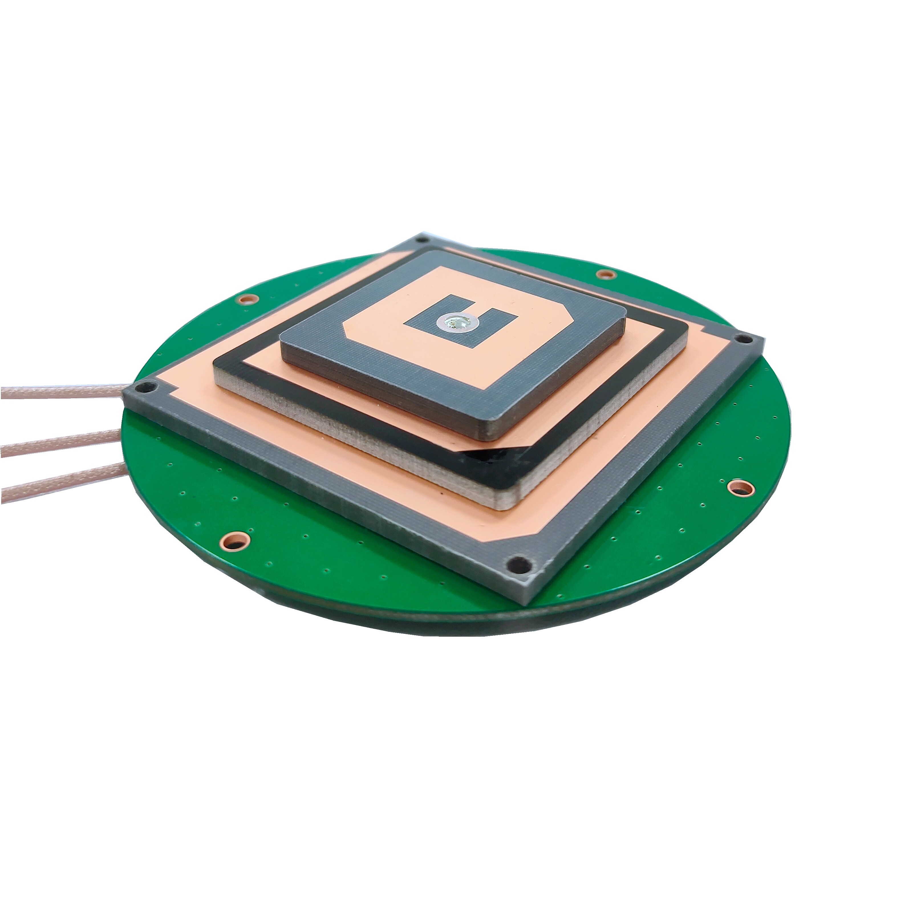
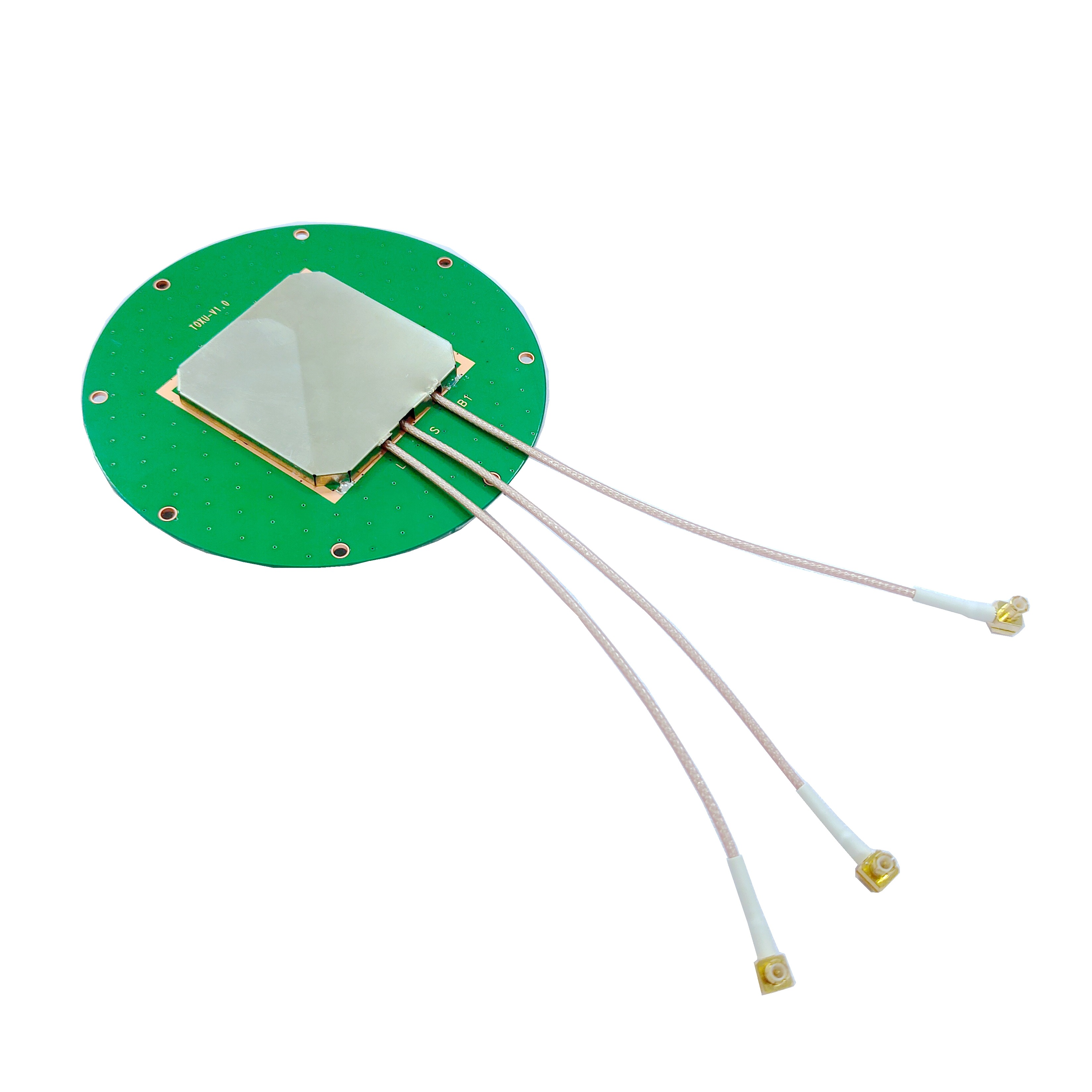
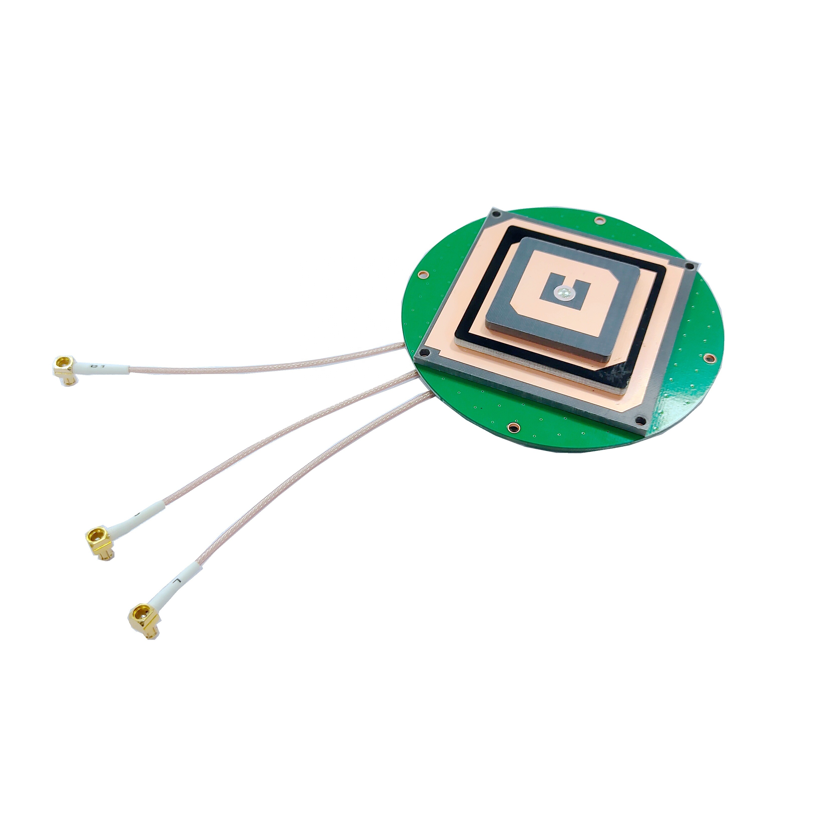
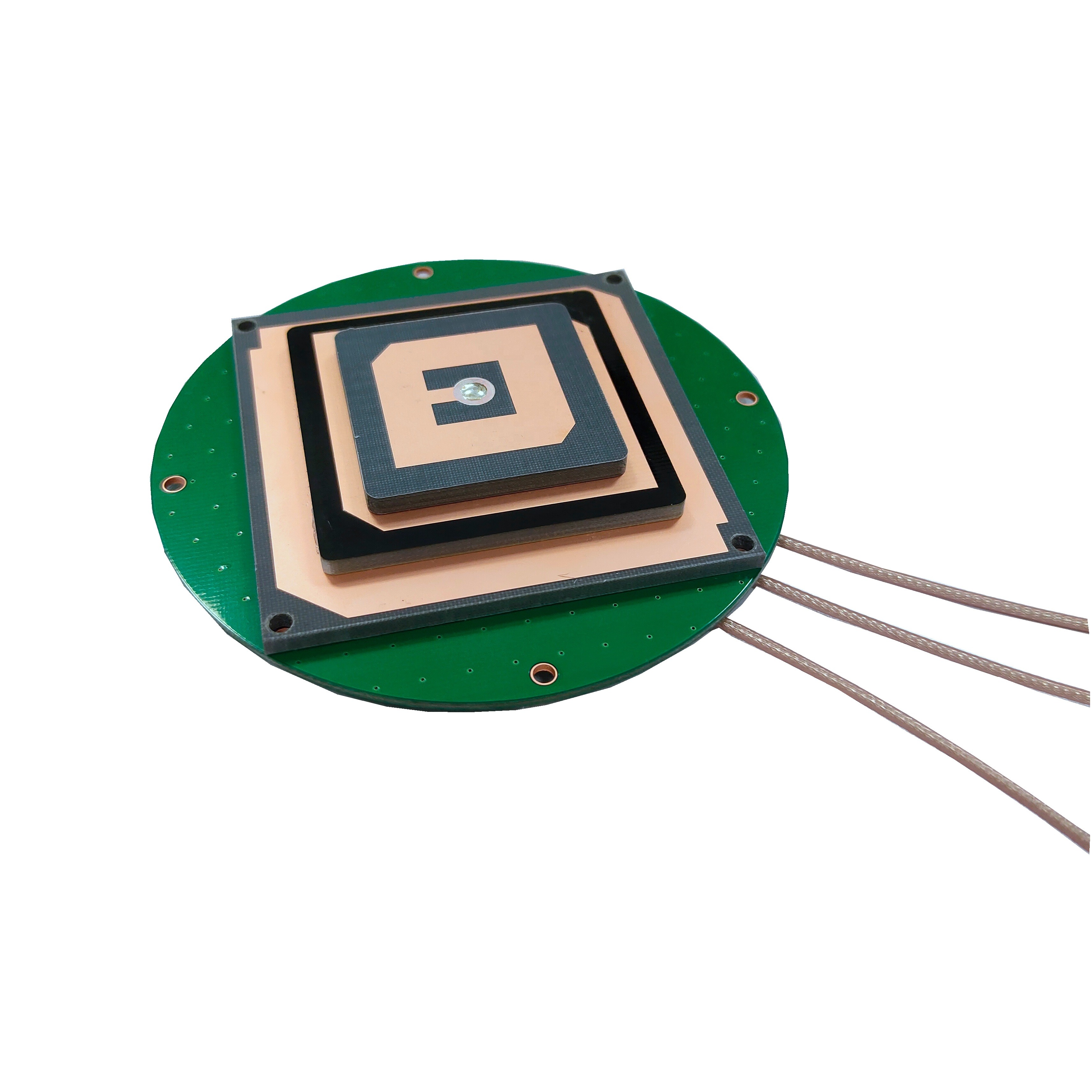

An RTK GNSS embedded module is a compact electronic device that integrates RTK technology with GNSS receivers into a single, ready - to - use component. It is designed to be embedded into larger systems or devices, providing them with high - precision positioning capabilities. Unlike standard GNSS modules, which typically offer meter - level accuracy, RTK - enabled modules can achieve accuracy levels of 1 - 2 centimeters horizontally and 2 - 5 centimeters vertically under optimal conditions.
The core of an RTK GNSS embedded module lies in its ability to process both satellite signals and correction data in real - time. It receives signals from multiple GNSS constellations, such as GPS, GLONASS, Galileo, and BeiDou, and combines them with correction data from a nearby base station. This combination allows the module to eliminate most of the errors that affect standard GNSS positioning, resulting in highly accurate location information.
Working Principles of RTK Technology
Basic GNSS Positioning Limitations
Standard GNSS positioning relies on measuring the distance from the receiver to multiple satellites. However, this method is subject to several sources of error, including atmospheric delays (ionospheric and tropospheric), satellite clock errors, orbital errors, and multipath interference (signals reflecting off surfaces before reaching the receiver). These errors can accumulate, leading to positioning inaccuracies ranging from a few meters to tens of meters.
RTK Correction Mechanism
RTK technology addresses these limitations by using a base station and a rover (the RTK GNSS embedded module in the device). The base station is a fixed - position receiver with a known, precisely surveyed location. It continuously tracks satellite signals and calculates the errors in its own position based on its known coordinates. This error data, known as RTK corrections, is then transmitted to the rover (the embedded module) in real - time, typically via a radio link, cellular network, or satellite communication.
The rover module receives both the satellite signals and the correction data. It uses the correction data to adjust its own position calculations, effectively canceling out the common errors that affect both the base station and the rover. This process allows the rover to achieve centimeter - level positioning accuracy. The key to RTK's effectiveness is the real - time nature of the corrections, ensuring that the rover's position is updated continuously as conditions change.
Key Components of RTK GNSS Embedded Modules
GNSS Receiver
At the heart of the RTK GNSS embedded module is a high - performance GNSS receiver. This receiver is capable of tracking signals from multiple satellite constellations simultaneously, which increases the number of available satellites and improves positioning reliability, especially in challenging environments such as urban canyons or dense foliage. The receiver processes the raw satellite data, including pseudorange and carrier phase measurements, which are essential for RTK calculations.
RTK Processor
The RTK processor is the brain of the module. It runs advanced algorithms to process the raw satellite data and the incoming correction data from the base station. The processor calculates the difference between the measured and expected positions (based on the base station's known location) and applies the necessary corrections to the rover's position. This requires high - speed processing capabilities to handle the large volume of data in real - time.
To receive correction data, the RTK GNSS embedded module is equipped with various communication interfaces. These can include radio transceivers (for short - range communication with the base station), cellular modems (for wide - area coverage via mobile networks), or Bluetooth/Wi - Fi modules (for connecting to nearby devices that relay correction data). The choice of interface depends on the application's range requirements and the availability of communication infrastructure.
Power Management Unit
Given that RTK GNSS embedded modules are often used in battery - powered devices such as drones and portable surveying equipment, efficient power management is crucial. The power management unit ensures that the module operates within acceptable power limits, optimizing energy consumption without compromising performance. This may include features such as low - power modes when the module is not in active use.
Memory and Storage
The module also includes memory and storage components to store configuration data, satellite ephemeris (orbital information), and correction data buffers. This allows the module to continue operating temporarily if the correction data link is interrupted, using stored data to maintain accuracy for a short period.
Advantages of RTK GNSS Embedded Modules
The most significant advantage of RTK GNSS embedded modules is their ability to provide centimeter - level positioning accuracy. This level of precision is unparalleled by standard GNSS modules and opens up a wide range of applications that require exact location data. For example, in precision agriculture, farmers can use RTK - enabled equipment to apply fertilizers or pesticides with pinpoint accuracy, reducing waste and improving crop yields.
Real - Time Performance
RTK technology operates in real - time, providing continuous, updated position data with low latency. This is critical for applications such as autonomous vehicles, where split - second decisions based on accurate location information can mean the difference between safety and disaster. Drones, too, rely on real - time precise positioning to navigate complex environments and perform tasks such as inspection or mapping with high accuracy.
Multi - Constellation Support
Modern RTK GNSS embedded modules support multiple satellite constellations, including GPS, GLONASS, Galileo, and BeiDou. This multi - constellation capability increases the number of visible satellites, enhancing positioning reliability and availability. In areas where one constellation may have poor coverage, the module can switch to others, ensuring that accurate positioning is maintained.
Compact Size and Easy Integration
As embedded modules, they are designed to be small and lightweight, making them easy to integrate into a wide range of devices. Their compact form factor allows them to fit into drones, handheld surveying tools, agricultural machinery, and even small consumer electronics. Manufacturers of these devices can incorporate RTK functionality without significantly increasing the size or weight of their products.
Cost - Effectiveness
While RTK technology was once prohibitively expensive, advancements in technology and mass production have made RTK GNSS embedded modules increasingly cost - effective. This has made high - precision positioning accessible to a broader range of industries and applications, from large - scale agriculture to small - scale drone operations.
Applications of RTK GNSS Embedded Modules
Precision Agriculture
In precision agriculture, RTK GNSS embedded modules are used to guide tractors, harvesters, and other farm equipment with centimeter - level accuracy. This allows farmers to perform tasks such as planting, fertilizing, and harvesting in precise rows, reducing overlap and waste. For example, a tractor equipped with an RTK module can follow a pre - programmed path with minimal deviation, ensuring that seeds are planted at the correct spacing and depth. This not only improves crop yields but also reduces the use of fertilizers and pesticides, making farming more sustainable.
Surveying and Mapping
Surveying and mapping have long relied on precise positioning, and RTK GNSS embedded modules have transformed this field. Surveyors can now use handheld or backpack - mounted devices with RTK modules to collect data quickly and accurately, eliminating the need for traditional, time - consuming surveying methods. These modules enable the creation of detailed topographic maps, boundary surveys, and construction site layouts with centimeter - level precision, reducing errors and improving efficiency.
Autonomous Vehicles
Autonomous vehicles, including self - driving cars, trucks, and buses, require highly accurate and real - time positioning to navigate safely. RTK GNSS embedded modules provide the necessary precision to keep these vehicles within their lanes, avoid obstacles, and follow planned routes. When combined with other sensors such as lidar, radar, and cameras, RTK - enabled positioning ensures that autonomous vehicles can operate reliably in complex environments, from busy urban streets to highways.
Drones and Unmanned Aerial Vehicles (UAVs)
Drones and UAVs use RTK GNSS embedded modules for a variety of applications, including aerial photography, mapping, inspection, and delivery. With centimeter - level accuracy, drones can follow precise flight paths, hover in place, and capture images or data at specific locations. For example, in infrastructure inspection, a drone equipped with an RTK module can inspect power lines or bridges with high precision, identifying defects that would be missed by less accurate positioning systems. In delivery, drones can use RTK to land precisely at a target location, even in windy conditions.
In the construction industry, RTK GNSS embedded modules are used to guide heavy machinery, such as excavators and bulldozers, during site preparation and construction. This ensures that earthworks are performed to the exact specifications, reducing rework and saving time and money. For example, an excavator with an RTK module can dig trenches or foundations to the precise depth and width required, based on digital plans stored in the system. RTK technology also helps in monitoring the progress of construction projects, ensuring that work is on schedule and within the specified tolerances.
Marine and Coastal Applications
RTK GNSS embedded modules are used in marine navigation, port operations, and coastal mapping. Ships and boats equipped with these modules can navigate safely in narrow waterways, harbors, and near coasts with high precision, avoiding collisions and grounding. In port operations, RTK - enabled positioning is used to guide cranes and other equipment, improving efficiency and safety. Coastal mapping using RTK - equipped vessels allows for the creation of detailed charts, which are essential for navigation, environmental monitoring, and coastal engineering projects.
Factors Affecting Performance
Base Station Proximity
The performance of an RTK GNSS embedded module is highly dependent on the distance from the base station. As the distance between the rover and the base station increases, the accuracy of the correction data decreases because the atmospheric conditions and other errors affecting the rover and the base station may differ. Typically, RTK systems work best when the rover is within 10 - 20 kilometers of the base station. Beyond this range, the accuracy may degrade, and in some cases, a network of base stations (known as a Real - Time Network, RTN) is used to provide correction data over a larger area.
Signal Obstruction
Like all GNSS devices, RTK GNSS embedded modules rely on a clear line of sight to the satellites. Signal obstruction caused by buildings, trees, mountains, or other structures can reduce the number of visible satellites and increase multipath interference, leading to reduced accuracy or even loss of positioning. In urban canyons or dense forests, the module may struggle to maintain centimeter - level accuracy, and additional sensors or alternative positioning methods may be needed to complement RTK.
Weather Conditions
Adverse weather conditions, such as heavy rain, snow, or fog, can affect the transmission of satellite signals and the accuracy of RTK corrections. Atmospheric delays, which are a major source of error in GNSS positioning, can vary significantly during extreme weather, making it harder for the module to apply accurate corrections. While RTK technology mitigates some of these effects, severe weather can still impact performance.
Quality of Correction Data
The quality and timeliness of the correction data are critical for the performance of an RTK GNSS embedded module. If the correction data is delayed, corrupted, or inaccurate, the module's positioning accuracy will suffer. This is why reliable communication links between the base station and the rover are essential. In areas with poor communication infrastructure, maintaining a stable connection for correction data can be a challenge, affecting the module's performance.
Future Trends and Developments
Integration with 5G and Beyond
The integration of RTK GNSS embedded modules with 5G networks is set to revolutionize high - precision positioning. 5G's high data rates, low latency, and wide coverage will enable faster and more reliable transmission of correction data, expanding the range and performance of RTK systems. This will be particularly beneficial for applications such as autonomous vehicles, which require real - time, high - bandwidth communication to operate safely. 5G will also support the deployment of large - scale RTN networks, providing seamless coverage over entire regions.
Multi - Band and Multi - Constellation Advancements
Future RTK GNSS embedded modules will support an even wider range of satellite bands and constellations. By tracking more frequencies and satellites, these modules will be able to mitigate errors more effectively, improving accuracy and reliability in challenging environments. For example, using multiple bands can help reduce the impact of ionospheric delays, while accessing more constellations increases the number of available satellites, reducing the risk of signal loss.
Miniaturization and Low - Power Design
As technology advances, RTK GNSS embedded modules will continue to become smaller and more power - efficient. This will allow them to be integrated into even smaller devices, such as wearables, small drones, and IoT sensors, opening up new applications in areas such as personal navigation, asset tracking, and environmental monitoring. Low - power designs will also extend the battery life of portable devices, making them more practical for field use.
Artificial Intelligence and Machine Learning Integration
The integration of artificial intelligence (AI) and machine learning (ML) algorithms into RTK GNSS embedded modules is another emerging trend. These algorithms can learn from historical data and real - time conditions to predict and mitigate errors, improving positioning accuracy and robustness. For example, ML can be used to identify and filter out multipath interference patterns, or to adaptively adjust the module's parameters based on the current environment (such as urban vs. rural areas).
Increased Adoption in Consumer Electronics
While RTK technology has traditionally been used in professional and industrial applications, it is expected to find its way into more consumer electronics in the future. Smartphones, for example, could incorporate RTK GNSS embedded modules to provide centimeter - level accuracy for location - based services such as augmented reality (AR), precise navigation, and geocaching. This would open up new possibilities for app developers and enhance the user experience in a variety of ways.
RTK GNSS embedded modules have emerged as a game - changing technology in the field of high - precision positioning. Their ability to provide centimeter - level accuracy in real - time has transformed industries such as agriculture, surveying, autonomous vehicles, and drones, enabling new applications and improving efficiency and productivity. By leveraging the power of multiple GNSS constellations and real - time correction data, these modules have overcome the limitations of standard GNSS positioning.
As technology continues to advance, RTK GNSS embedded modules will become even more powerful, compact, and affordable. Integration with 5G, advancements in multi - band and multi - constellation support, miniaturization, and the addition of AI/ML capabilities will further expand their applications and performance. Whether in large - scale industrial operations or everyday consumer devices, RTK GNSS embedded modules are set to play an increasingly important role in shaping the future of location - based technology, redefining what is possible in terms of precision and reliability.

 86 0755 2819 9597
Lucy Yang | lucy.y@toxutech.com
Nicole Li | nicole@toxutech.com
Dotty Zhao | sales04@toxutech.com
Global Business Director / Sales Team / Global Operations


 En
En Cn
Cn Korean
 Home >


