

-
Products -PCBA Manufacturing RF Connectors RF Cable Assemblys Embedded Antennas External Antennas Positioning Chips and Modules
RF Connectors

RF Cable Assemblys
Embedded Antennas
External Antennas
Positioning Chips and Modules


 Language


Language


Precision agriculture (PA) represents a paradigm shift from traditional farming methods towards a data-driven, technology-enabled approach. At its core, PA is about managing variability within a field—variability in soil type, moisture, nutrient levels, and yield potential. To manage this variability effectively, one must first measure it with extreme accuracy and then act upon that information with equal precision. This is where the Real-Time Kinematic (RTK) Global Navigation Satellite System (GNSS) antenna becomes the indispensable cornerstone, transforming agricultural machinery from blunt instruments into surgical tools.
The journey of GPS in agriculture began with basic guidance, allowing farmers to create parallel swaths to avoid overlaps and skips, thereby saving on inputs like seed, fertilizer, and fuel. While beneficial, standard GPS and even differential GPS (DGPS) systems offered accuracies in the range of meters to sub-meters. This was sufficient for basic guidance but wholly inadequate for more advanced applications like automated steering, row cropping, or variable rate application (VRA) in tight patterns.
The advent of RTK technology shattered these accuracy barriers. RTK GNSS provides continuous, real-time positioning corrections, enabling centimeter-level accuracy—typically between 1 to 2.5 centimeters. This leap in precision is what truly unlocked the potential of precision agriculture. The RTK system is comprised of two main components: a stationary base station and a mobile rover. The base station, positioned at a known exact location, calculates the error in the satellite signals it receives and broadcasts correction data to the rovers (e.g., tractors, combines, sprayers). The rover uses this data to compute its exact position with phenomenal accuracy.
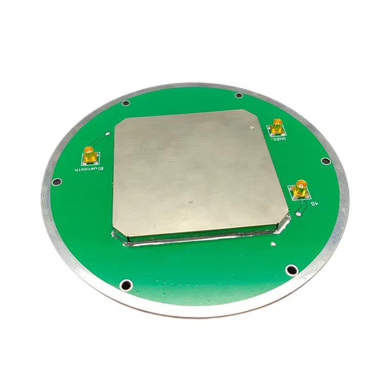
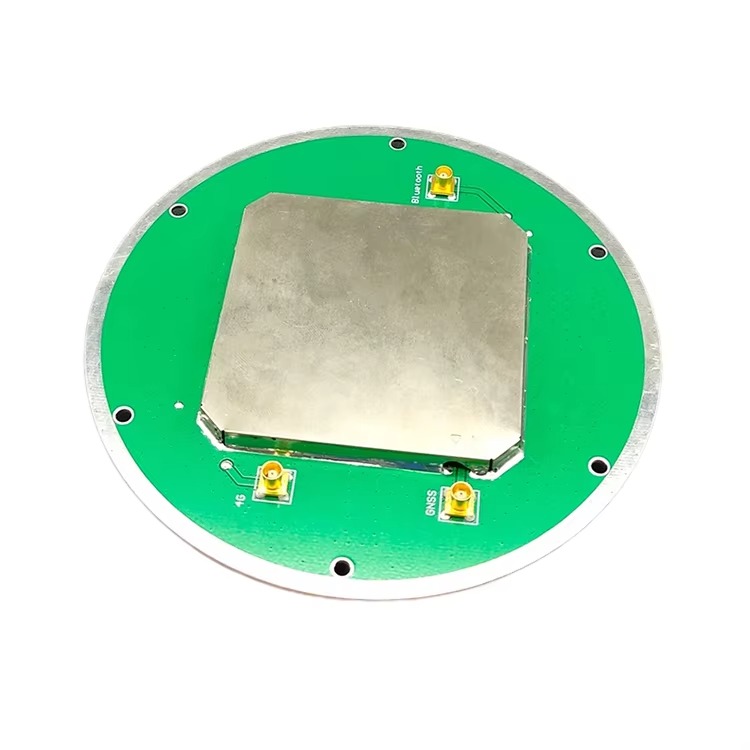
While the processing unit and the communication link are vital, the entire system's performance is fundamentally dependent on the component that first interacts with the satellite signals: the RTK GNSS antenna. It is the gateway through which all positioning data enters the system. Its role is to receive extremely weak radio signals from multiple satellite constellations (like GPS (USA), GLONASS (Russia), Galileo (EU), and BeiDou (China)) orbiting over 20,000 kilometers away, amidst a sea of terrestrial noise and multipath interference.
An RTK antenna is not a simple piece of metal; it is a highly sophisticated electronic device engineered for maximum performance and reliability. Its primary objectives are:
High Gain and Sensitivity: To acquire and lock onto faint GNSS signals reliably, even in challenging environments with obstructions or low satellite visibility.
Phase Center Stability: Perhaps its most critical characteristic. For RTK to achieve centimeter accuracy, the electrical phase center of the antenna must remain physically stable and predictable. Any movement or deviation of this phase center due to satellite elevation, azimuth, or signal frequency introduces error that the system cannot easily correct.
Multipath Rejection: To distinguish between the direct line-of-sight satellite signal and signals that have been reflected off the ground, metal structures, or the machine itself. Multipath signals are a primary source of error in high-precision GNSS.
Multi-Frequency Support: Modern RTK operations require tracking multiple frequencies (e.g., L1, L2, L5) from multiple constellations to quickly resolve integer ambiguities (a key step in RTK processing) and maintain a fixed, centimeter-accurate solution.
In the context of a sprawling farm field, the RTK GNSS antenna mounted on a tractor is the sentinel that allows for feats of precision once thought impossible. It enables autosteer systems to guide a tractor along a perfectly straight path with sub-inch repeatability, season after season. It allows a planter to place seeds at the exact intended depth and spacing, optimizing yield potential. It guides a sprayer to target weeds with herbicide without touching the crop, reducing chemical use by over 90% in some cases. It empowers a harvester to create detailed yield maps that correlate precise geographic locations with productivity, forming the basis for future management decisions.
Therefore, the RTK GNSS antenna is far more than a simple receiver; it is the critical sensory organ of a smart agricultural machine. Its performance directly dictates the accuracy, reliability, and efficiency of every precision agriculture operation. Investing in a high-quality antenna is investing in the foundational integrity of the entire precision farming system.
The exceptional performance of an RTK GNSS antenna is not accidental; it is the result of meticulous design and precision manufacturing aimed at overcoming the profound challenges of reliably receiving microwave signals from space. Every material, shape, and component is chosen to optimize signal reception, minimize error, and withstand the harsh realities of the agricultural environment.
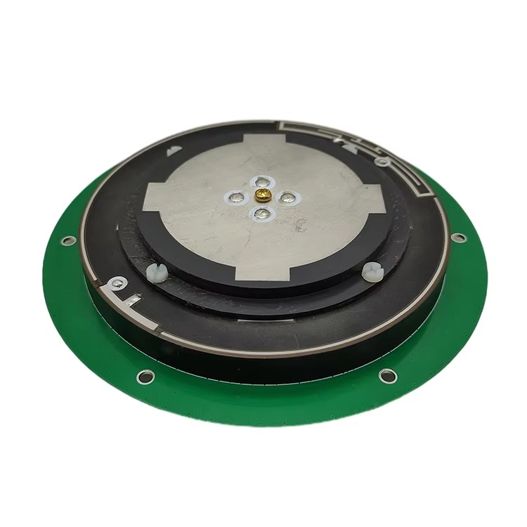
1. The Radiating Element: The Heart of the Antenna
At the core of the antenna is the radiating element, which is directly responsible for converting electromagnetic waves into electrical currents. For RTK applications, a common design is a patched antenna or a quadrifilar helix antenna (QHA).
Patch Antennas: These are often ceramic microstrip patches. They are low-profile, rugged, and can be designed to have a specific radiation pattern. Multiple patches can be arrayed to enhance performance. The ceramic substrate (often alumina) has a high dielectric constant, allowing the patch to be physically small while remaining electrically resonant at GNSS frequencies.
Quadrifilar Helix Antennas (QHA): These are renowned for their excellent hemispherical coverage and good multipath rejection characteristics, particularly at low elevation angles. They are often enclosed in a radome and provide very stable phase center characteristics.
2. The Ground Plane: The Foundation for Performance
The radiating element is mounted on a ground plane, typically a circular or square metal plate. The ground plane is crucial as it:
Shapes the antenna's radiation pattern, directing gain upwards towards the sky and away from the horizon, where multipath and RF noise are prevalent.
Shields the radiating element from signals and noise emanating from below the antenna (e.g., reflections from the vehicle's roof).
Provides a stable reference point that is key to maintaining a stable phase center. The size and quality of the ground plane are directly linked to the antenna's ability to reject multipath signals.
3. The Radome: The Protective Shell
The internal electronics are protected by a durable outer shell called a radome. In agriculture, this is not just for weatherproofing; it must be resistant to UV degradation, chemicals (herbicides, fertilizers), physical impact from branches or debris, and extreme temperatures. Critically, the radome must be made from a material that is virtually transparent to GNSS radio frequencies (1.1-1.6 GHz). Materials like polycarbonate or ABS plastic with specific dielectric properties are used to ensure the signal passes through with minimal attenuation, reflection, or phase distortion.
4. The Feed Network and Low-Noise Amplifier (LNA)
The weak signals captured by the radiating element are passed through a carefully designed feed network to a Low-Noise Amplifier (LNA). The LNA is arguably the second most important component after the radiating element.
Its primary job is to amplify the incredibly weak satellite signals (on the order of -130 dBm) before they are sent down the coaxial cable to the receiver.
It must accomplish this amplification while adding an absolute minimum of electronic noise of its own (measured as a low Noise Figure). A high-quality LNA ensures that the signal-to-noise ratio (SNR) is preserved, which is vital for acquiring and maintaining a lock on satellites.
The LNA is often integrated directly into the antenna housing to amplify the signal before any loss occurs in the cable run, maximizing the signal strength delivered to the receiver.
5. Phase Center and Calibration
The most critical design consideration for an RTK antenna is the stability of its Electrical Phase Center. This is the perceived point from which the radiation appears to emanate. For RTK, which measures the phase of the carrier wave, any movement of this point is interpreted as a movement of the antenna itself, introducing error.
High-quality antennas are designed to have a phase center that is physically stable and consistent across different frequencies, satellite elevations, and azimuths.
To achieve this, manufacturers use symmetric designs, high-precision manufacturing, and stable materials.
The exact offset between the antenna's physical reference point (usually its ARP - Antenna Reference Point) and its average phase center is meticulously measured in an anechoic chamber. These values are published in an antenna calibration file (in ANTEX or IGS format). Using this file in the processing software corrects for this inherent offset, ensuring the reported position is related to the ARP, not the electrical center.
6. Multipath Mitigation Techniques
Designers employ several techniques to combat multipath:
Choke Rings: Some high-end antennas incorporate a "choke ring" ground plane. This is a series of concentric conductive rings that create a high-impedance surface, effectively suppressing horizontally polarized signals that are characteristic of ground-reflected multipath. While highly effective, they are large and heavy, making them less common on agricultural machinery and more common on base stations.
Advanced Ground Planes: Smaller, specially corrugated or textured ground planes can emulate the multipath rejection of a choke ring in a more compact form factor.
Aperture-Coupled Patches: Advanced patch designs can isolate the radiating element from the feed network, reducing leakage and improving backward isolation, which helps reject signals from below.
7. Ruggedization and Connectivity
Finally, the construction must be robust. The antenna must be fully waterproof (IP67 rating or higher), resist corrosion from chemicals and moisture, and be securely mounted. Connectors (typically TNC or N-type) must be high-quality and weather-sealed to prevent signal loss and corrosion. The entire assembly is engineered to perform flawlessly while being shaken, vibrated, baked in the sun, and sprayed with chemicals day after day.
In summary, the design of an RTK GNSS antenna is a complex balancing act of electromagnetic physics, material science, and rugged mechanical engineering. Every detail is optimized to deliver a clean, stable, and powerful signal to the receiver, forming the reliable foundation upon which centimeter-accurate positioning is built.
Understanding how an RTK GNSS antenna functions requires delving into the principles of satellite navigation and the specific method RTK uses to achieve its remarkable accuracy. The antenna's role is passive yet fundamental: it is the transducer that initiates the entire positioning process by capturing the raw signals from space.
The Basic GNSS Signal
GNSS satellites continuously transmit microwave radio signals on several frequencies (e.g., L1, L2, L5). These signals contain:
A Navigation Message: Data about the satellite's orbit (ephemeris), status, and the time the signal was transmitted.
A Coarse/Acquisition (C/A) Code: A unique pseudo-random noise (PRN) code that identifies the satellite and is used by standard GPS receivers for basic positioning.
A Precise (P) Code: An encrypted code used primarily by military receivers.
The Carrier Wave: The fundamental L-band radio wave upon which the codes and data are modulated. The most precise measurements are made on the phase of this carrier wave.
The Challenge of Error
A standard GNSS receiver calculates its position by measuring the time it takes for a signal to travel from a satellite to itself. Multiplying this time by the speed of light gives the distance (pseudorange). With signals from at least four satellites, it can solve for its 3D position (latitude, longitude, height) and time offset. However, this method is plagued by errors:
Ionospheric and Tropospheric Delays: The atmosphere slows down the signal.
Satellite Clock and Ephemeris Errors: Inaccuracies in the satellite's own clock or the broadcasted model of its orbit.
Receiver Noise: Internal electronic noise.
Multipath: Signals bouncing off objects before reaching the antenna.
These errors can cause standard GPS to be accurate only to within 5-10 meters.
The Differential Solution: DGPS and RTK
Differential GNSS (DGPS) improves accuracy by using a base station at a known location. The base station calculates the error in the satellite signals it receives and broadcasts correction data to rovers. This can improve accuracy to about 0.5 - 1 meter by mitigating atmospheric and orbital errors. However, it still relies on the less precise code measurements.
RTK: The Phase-Locked Advantage
RTK takes a radically different and far more precise approach by using the carrier phase of the signal. The carrier wave has a much shorter wavelength (~19 cm for L1) compared to the code chips (~300 m for C/A code). Measuring the phase of this wave is like using a much finer ruler.
The principle of RTK carrier-phase positioning involves:
Initial Ambiguity: The receiver can measure the fractional phase of the carrier wave with extreme precision, but it does not know the initial integer number of full wavelengths between the satellite and the receiver at the moment of lock-on. This is the integer ambiguity (N).
Double Differencing: The RTK processor simultaneously uses data from the base and the rover for the same satellites. It creates "double differences," which mathematically cancel out almost all common errors: satellite clock errors, receiver clock errors, and most atmospheric delays.
Ambiguity Resolution: The processor's task is to solve for the correct integer ambiguities (N). This is a complex mathematical process that uses the code pseudoranges as initial estimates and the ultra-precise phase measurements to search for the one correct integer solution that fits all the data. Once this "integer fix" is achieved, the relative vector between the base and rover is known with centimeter accuracy.
Rover Positioning: Since the base station's position is known with survey-grade accuracy, the rover's precise position can be calculated by adding the resolved vector to the base's coordinates.
The Antenna's Critical Role in this Process
The antenna is the source of all the data used in this complex calculation. Its performance directly dictates the success and speed of ambiguity resolution:
Signal Strength (Gain): A strong signal with a high Signal-to-Noise Ratio (SNR) allows the receiver to maintain lock on satellites more easily, especially during maneuvers or under partial obstruction. Strong signals lead to faster and more reliable integer fixes.
Phase Center Stability: Any movement of the antenna's electrical phase center masquerades as movement of the rover. If the phase center shifts by 5 mm due to a satellite rising in the sky, the RTK engine interprets this as the tractor having moved 5 mm. This "noise" on the phase measurement can prevent the integer resolution algorithm from converging or can cause it to converge on the wrong integers, leading to a "false fix." A stable phase center provides the clean, consistent data the algorithm needs.
Multipath Rejection: Multipath signals introduce error into both the code and, more critically, the carrier phase measurements. A multipath signal that arrives after the direct signal can cause the receiver to miscalculate the phase. An antenna designed to reject low-angle and reflected signals provides a purer data stream, free from these deceptive echoes.
Multi-Constellation, Multi-Frequency Support: Modern RTK receivers track all available satellites from GPS, GLONASS, Galileo, and BeiDou on multiple frequencies (L1, L2, L5, etc.). More satellites mean better geometry (lower Dilution of Precision - DOP), which makes the integer resolution faster and more robust. Tracking multiple frequencies allows the receiver to directly measure and correct for ionospheric delay, further speeding up the time to first fix (TTFF) and maintaining accuracy over long baselines.
In essence, the RTK GNSS antenna provides the raw, high-fidelity "notes"—the precise phase measurements. The receiver is the "conductor," orchestrating the complex double-differencing and ambiguity resolution algorithms. But without a high-quality antenna delivering a clean and stable signal, the most advanced receiver in the world cannot perform its symphony of centimeter accuracy.
The integration of RTK GNSS technology, hinging on a high-performance antenna, brings transformative advantages to modern farming. However, this advanced technology is not without its significant challenges and costs, which farmers and service providers must navigate.
Advantages
Unprecedented Accuracy and Repeatability: The foremost advantage is sub-inch (2-3 cm) accuracy. This allows for:
Precision Guidance: Autosteer systems can guide equipment with incredible accuracy, eliminating overlaps and skips. This directly translates to massive savings in inputs: seed, fertilizer, chemicals, and fuel—often cited as 5-15% reductions.
Season-to-Season Repeatability: A tractor can return to the exact same track year after year. This enables controlled traffic farming (CTF), where wheels consistently run on the same tramlines, drastically reducing soil compaction in the crop-growing zones and improving yield and soil health.
High-Value Crop Operations: Enables precision practices for crops like vegetables, orchards, and vineyards, where accuracy is required for planting, spraying, and harvesting between narrow rows.
Massive Operational Efficiency and Yield Optimization:
24/7 Operation: RTK-guided autosteer enables farming in low-visibility conditions such as dust, fog, and darkness, maximizing the use of short planting and harvesting windows. It reduces operator fatigue, allowing for longer, more productive shifts.
Optimized Input Application: Coupled with variable rate technology (VRT), RTK positioning allows farmers to apply inputs (water, fertilizer, pesticide) at precise rates tailored to the needs of specific areas within a field, boosting overall yield while minimizing waste and environmental impact.
Data-Driven Decisions: The precise georeferencing of operations allows for the creation of high-resolution maps (yield maps, soil maps, elevation models). This data is the foundation for analyzing profitability and making informed decisions for subsequent seasons.
Enhanced Safety and Environmental Sustainability:
Reduced Operator Stress: Automating the tedious task of steering allows the operator to focus on monitoring implement performance and overall machine management, enhancing safety.
Reduced Chemical Usage: Precision spraying and herbicide application minimize chemical runoff into waterways and reduce the overall chemical load on the environment.
Conservation Tillage: Accuracy enables practices like no-till and strip-till, which reduce soil erosion and improve carbon sequestration.
Challenges
High Initial Investment: An RTK system is a significant capital expense. This includes not only the rover antenna and receiver for each machine but also the base station antenna, receiver, radio modem, and mast. For individual farmers, this cost can be a major barrier to adoption, though it is often justified by the ROI through input savings over several seasons.
The Base Station Dilemma and Line-of-Sight Communication:
Ownership vs. Subscription: A farmer must choose between purchasing and maintaining their own base station or subscribing to a correction network service (e.g., NRTN, VRS). Ownership offers independence but has upfront costs and requires managing the station. Subscriptions involve ongoing fees and reliance on cellular coverage.
Radio Link Limitations: Many private RTK systems use UHF radio modems to broadcast corrections from the base to the rovers. This requires a clear line of sight. The curvature of the earth and obstructions like trees, hills, or buildings can limit the effective range to 10-15 km, which may be insufficient for large or geographically divided farms.
Signal Vulnerability and "Integer Fix" Issues:
Satellite Occlusion: Trees, buildings, terraces, and even the operator's own body can block signals. Losing lock on satellites causes the system to revert to a lower-accuracy "float" solution until the integers can be re-resolved.
Multipath: Despite advanced antenna design, severe multipath environments (e.g., working next to metal barns or silos) can still degrade performance and cause positioning errors or loss of fix.
Cycle Slips: A temporary loss of signal or a sharp phase disturbance can cause a "cycle slip," where the receiver loses count of the integer number of carrier waves. It must then re-initialize the ambiguity resolution, which takes time.
Technical Complexity and Reliance on Infrastructure:
Setup and Calibration: Proper setup is non-trivial. The base station must be positioned correctly over a known point, with care taken to avoid multipath sources. Antenna height must be measured accurately.
Cellular Dependency: Network RTN solutions rely entirely on robust, uninterrupted cellular data coverage across the entire farm—a challenge in many rural areas.
Maintenance: The system requires maintenance: keeping firmware updated, ensuring cables and connectors are not damaged, and protecting the base station from lightning strikes or power outages.
In conclusion, the advantages of RTK GNSS in precision agriculture are profound and transformative, leading to a new era of efficiency and sustainability. However, these benefits come with a price tag and a set of technical challenges that require careful consideration, planning, and ongoing management to overcome. The technology is powerful, but it is not yet "plug-and-play" for every scenario.
The centimeter-accurate positioning provided by RTK GNSS antennas is not a technology in search of a purpose; it is the critical enabler for a vast and growing ecosystem of agricultural applications. Furthermore, ongoing advancements are pushing the boundaries of what is possible, paving the way for fully autonomous farming systems.
Current Applications
Automated Steering (Autosteer): This is the most widespread application. It provides the foundational accuracy for all other operations, from basic lightbar guidance to hands-free steering, drastically reducing operator fatigue and optimizing field patterns.
Precision Planting: RTK guidance ensures seed rows are perfectly straight and spaced. More advanced systems use the positioning data to synchronize seed release with ground speed, ensuring precise in-row spacing. This optimizes plant population and eliminates competition between plants, maximizing yield potential.
Variable Rate Application (VRA): Tractors and sprayers equipped with VRA controllers use RTK position data to automatically adjust the application rate of seed, fertilizer, or chemicals on-the-fly. This is done according to a pre-loaded prescription map, ensuring each square meter of the field receives exactly what it needs, nothing more and nothing less.
Yield Monitoring and Mapping: Combines equipped with yield monitors and RTK antennas create high-resolution maps that correlate precise geographic locations with yield data. This is the ultimate feedback loop, allowing farmers to identify high-performing and under-performing areas to investigate causes (soil, water, pests) and manage accordingly.
Controlled Traffic Farming (CTF): RTK enables permanent tramlines where all machinery wheels are confined to specific tracks. This prevents the vast majority of the field soil from ever being compacted by machinery, leading to improved water infiltration, root growth, and yield.
Crop Scouting and Field Mapping: Drones and ground scouts use RTK to geotag weed outbreaks, disease patches, or drainage issues with centimeter accuracy. This allows for targeted interventions rather than whole-field treatments.
Future Trends
Full Machine Automation and Swarming: RTK positioning is the cornerstone of autonomy. The next logical step is moving from automated guidance to fully autonomous machines that can navigate from the shed to the field, perform their task (tilling, planting, spraying), and return without a human operator in the cab. We will see the development of "swarms" of smaller, lighter autonomous implements working collaboratively, managed by a central fleet management system.
Advanced Perception and Sensor Fusion: While RTK provides absolute position, autonomous machines need to perceive and avoid dynamic obstacles (people, animals, other machinery). The future lies in sensor fusion, where data from the RTK antenna is combined in real-time with inputs from cameras, LiDAR, and radar. The RTK provides the robust global position, while the other sensors provide a local, relative understanding of the immediate environment for safe navigation.
Integration with AI and Big Data: RTK-georeferenced data is the fuel for artificial intelligence. AI algorithms will analyze years of high-resolution yield maps, soil data, and drone imagery to generate increasingly sophisticated and predictive prescription maps. The RTK-guided machine will simply be the physical actuator executing the AI's optimized plan for the field.
Next-Generation GNSS and PPP-RTK: The expansion of satellite constellations (like Galileo and BeiDou) and new signals (L5) will provide better global coverage, faster convergence times, and improved robustness. Furthermore, Precise Point Positioning with Real-Time Kinematic (PPP-RTK) is an emerging technology that aims to deliver centimeter accuracy without the need for a local base station or UHF radio link. It uses corrections delivered via satellite or cellular networks that model errors for a wide area. This could greatly simplify adoption and reduce costs.
Miniaturization and Reduced Cost: As technology advances, the cost of high-performance RTK antennas and receivers will continue to fall, making the technology accessible to smaller farms and for use on smaller implements. Miniaturized antennas will be integrated into a wider array of devices, from individual robots to smart irrigation systems.
Enhanced Resilience and Integrity: Future systems will focus on robustness. This includes using multi-antenna setups for attitude determination (roll, pitch, yaw) and advanced algorithms that can detect and exclude faulty signals or multipath, ensuring the system never provides an inaccurate position that could lead to an autonomous machine making a dangerous error.
In the future, the RTK GNSS antenna will become an even more ubiquitous and invisible part of the agricultural landscape. It will be the silent, reliable source of truth for a network of smart, autonomous machines that work tirelessly to cultivate our crops with a level of precision and efficiency that is unimaginable today, ushering in a new agricultural revolution.
Conclusion: The Bedrock of the Smart Farm
The journey through the technology of RTK GNSS antennas for precision agriculture reveals a clear and compelling narrative: this is not a peripheral gadget but the fundamental bedrock upon which the entire edifice of modern, smart farming is constructed. It is the critical enabling technology that bridges the gap between the theoretical potential of data-driven agriculture and its practical, profitable implementation in the field.
The overview established the transformative role of centimeter-accurate positioning in managing field variability. The deep dive into design and construction highlighted the remarkable engineering required to reliably capture faint signals from space while rejecting noise and error, underscoring that not all antennas are created equal. The explanation of working principles demystified the complex dance of carrier-phase measurement and ambiguity resolution, illustrating why the antenna's purity and stability are non-negotiable for achieving a fixed RTK solution.
The analysis of advantages and challenges presented a balanced view, acknowledging the profound benefits in efficiency, sustainability, and profitability while being candid about the costs and technical hurdles that remain. The exploration of applications and future trends painted a picture of a technology that is still rapidly evolving, pushing agriculture toward a future of full autonomy and artificial intelligence-driven decision-making.
In conclusion, the value of an RTK GNSS antenna is ultimately measured by the quality of the data it provides. This data is the seed from which all precision agriculture practices grow. A high-quality antenna ensures that this seed is pure, accurate, and reliable. It maximizes uptime, minimizes errors, and protects the substantial investment made in the entire guidance and automation system. It is the unsung hero on the roof of the tractor, the silent sentinel that allows farmers to harness the power of satellites to cultivate the earth with once-unthinkable precision.
As agriculture continues to face immense challenges—from feeding a growing global population to adapting to climate change and managing environmental impact—the need for efficient and sustainable practices has never been greater. RTK GNSS technology, with a high-performance antenna at its heart, provides a powerful and proven tool to meet these challenges head-on. It empowers farmers to do more with less, to nurture their land with greater care, and to secure the future of food production. Therefore, selecting and maintaining a superior RTK GNSS antenna is not merely a technical specification; it is a strategic investment in the future of the farm itself.

 86 0755 2819 9597
Lucy Yang | lucy.y@toxutech.com
Nicole Li | nicole@toxutech.com
Dotty Zhao | sales04@toxutech.com
Global Business Director / Sales Team / Global Operations


 En
En Cn
Cn Korean
 Home >


