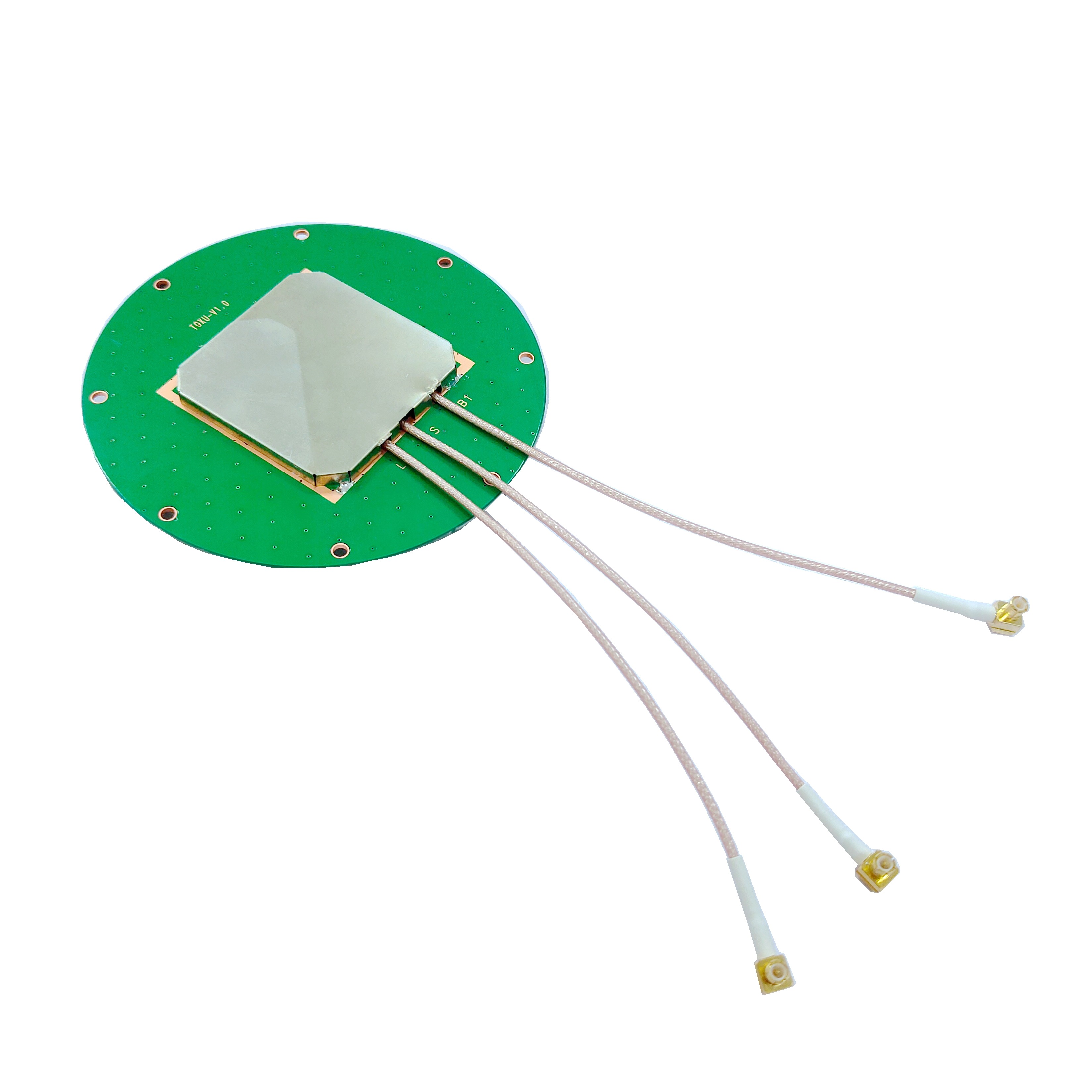
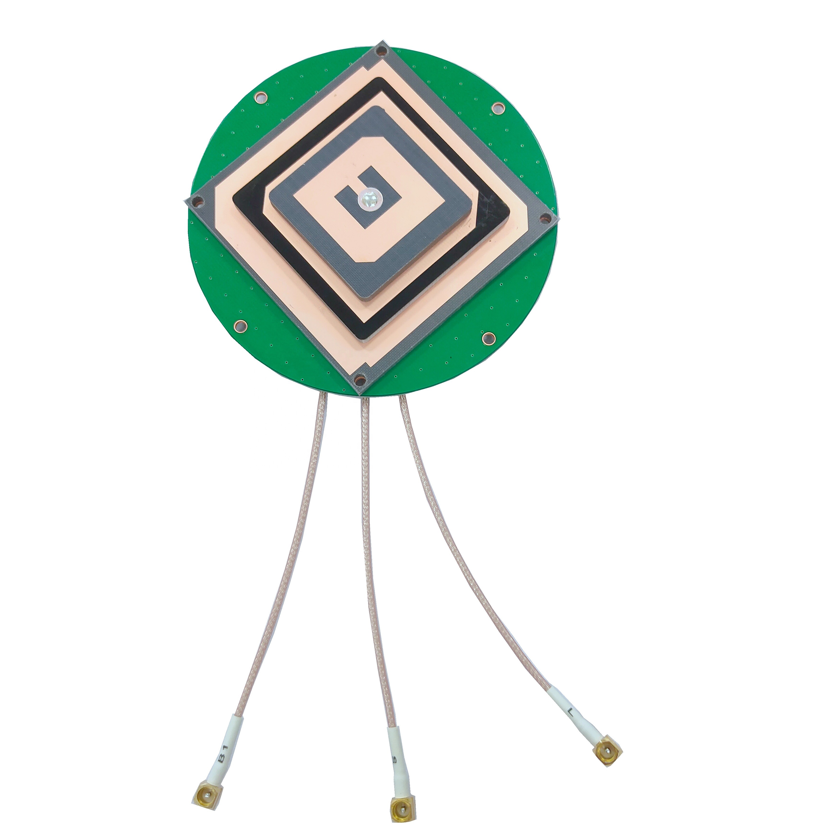
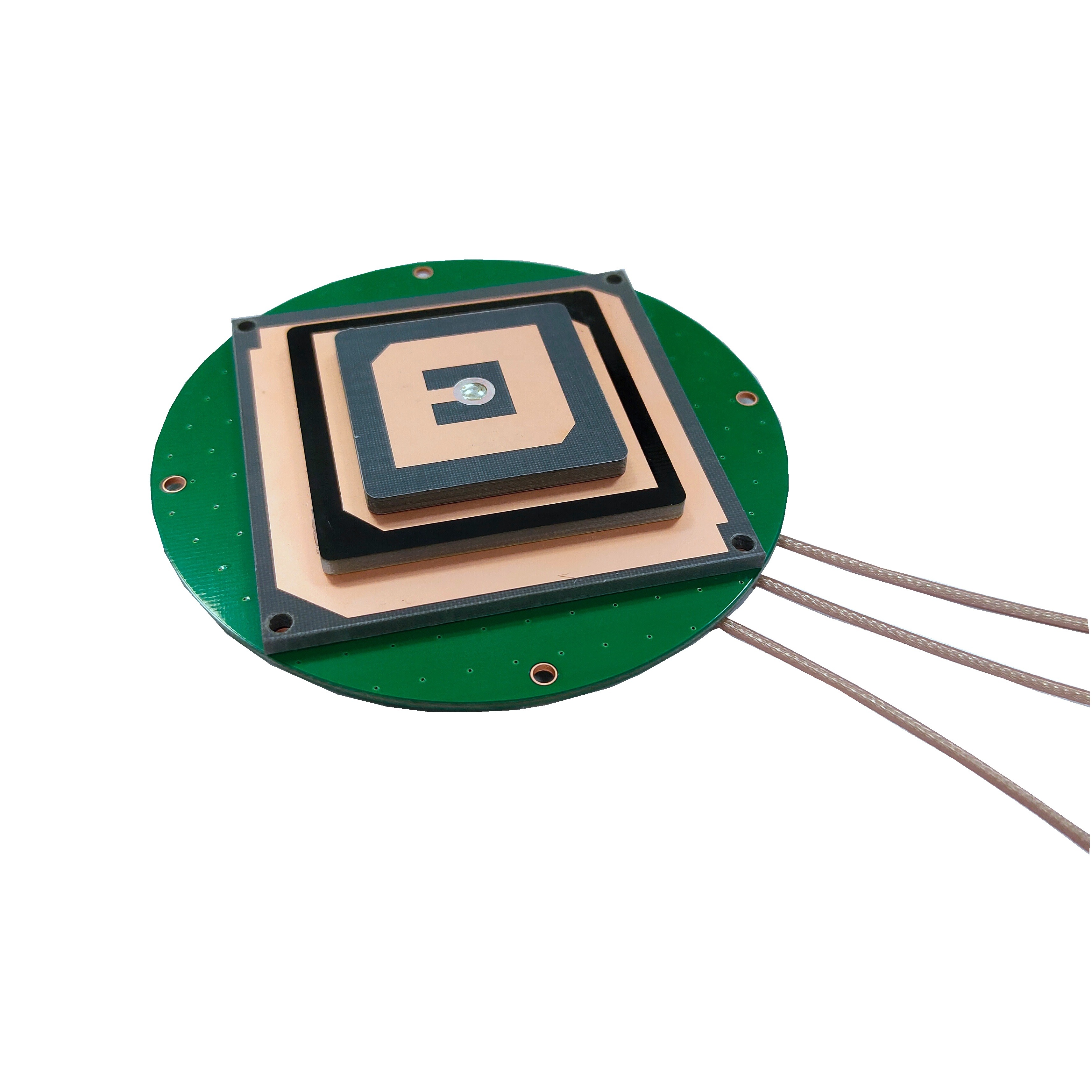
In the realm of geospatial data acquisition and mapping, precision is the cornerstone of reliable decision - making. From large - scale infrastructure projects like highway construction and bridge building to detailed land surveys for property boundary demarcation and environmental monitoring, the need for accurate positioning has never been more critical. At the core of meeting this demand lies the Precision Global Navigation Satellite System (GNSS) Survey Antenna. Unlike standard GNSS antennas used in consumer devices such as smartphones or car navigation systems, which typically offer positioning accuracy within a few meters, precision GNSS survey antennas are engineered to deliver centimeter - level, and in some cases even millimeter - level, positioning accuracy. This level of precision makes them indispensable tools in a wide range of professional surveying applications.
The development of precision GNSS survey antennas is closely tied to the evolution of GNSS technology itself. The initial deployment of the Global Positioning System (GPS) by the United States in the 1970s marked the beginning of a new era in positioning. Early GPS - based surveying systems, while revolutionary at the time, had limitations in terms of accuracy and coverage. However, over the past few decades, significant advancements in satellite technology, signal processing algorithms, and antenna design have transformed the field. Today, precision GNSS survey antennas can leverage multiple satellite constellations, including GPS, Galileo (European Union), GLONASS (Russia), and BeiDou (China), as well as regional systems like QZSS (Japan) and IRNSS (India). This multi - constellation capability greatly enhances the number of available satellites, improves signal availability in challenging environments such as urban canyons and dense forests, and ultimately boosts positioning accuracy and reliability.
The global market for precision GNSS survey equipment, including antennas, has experienced steady growth in recent years. According to a report by MarketsandMarkets, the global GNSS survey equipment market is projected to reach a value of over $10 billion by 2027, with a compound annual growth rate (CAGR) of approximately 8% during the forecast period. This growth is driven by several factors, including the increasing demand for high - precision mapping in the construction and mining industries, the expansion of smart city initiatives that require detailed geospatial data for urban planning and management, and the growing adoption of precision agriculture techniques that rely on accurate positioning for tasks such as variable - rate fertilization and crop mapping.
Different surveying applications have distinct requirements for precision GNSS survey antennas. For example, in deformation monitoring of large structures like dams, bridges, and skyscrapers, the antenna must be capable of detecting extremely small changes in position over time, often on the order of millimeters. This requires the antenna to have exceptional stability and low noise performance. In contrast, in cadastral surveying, which involves defining and mapping property boundaries, the antenna needs to provide high absolute positioning accuracy to ensure the legal validity of the survey results. Additionally, in marine surveying, the antenna must be able to withstand harsh environmental conditions such as saltwater corrosion, high winds, and vibrations, while still maintaining reliable signal reception.
2.1 Materials Selection
The selection of materials for precision GNSS survey antennas is a critical aspect of their design, as it directly impacts the antenna's performance, durability, and accuracy. Each component of the antenna, from the radiating elements to the enclosure, is carefully chosen based on specific functional requirements.
The radiating elements of a precision GNSS survey antenna are responsible for receiving and transmitting GNSS signals. To ensure efficient signal reception, these elements are typically made from high - conductivity metals. Copper is the most commonly used material for radiating elements due to its excellent electrical conductivity (second only to silver) and relatively low cost. Copper allows for minimal signal loss during the conversion of electromagnetic waves to electrical signals, which is essential for maintaining high - precision positioning. In some high - end antennas, silver plating may be applied to the copper radiating elements to further enhance conductivity and reduce signal attenuation. However, silver is more expensive and prone to tarnishing, so it is usually reserved for applications where the highest level of performance is required.
The substrate, which provides mechanical support for the radiating elements and helps define the antenna's electrical properties, is another key component. For precision GNSS survey antennas, substrates with low dielectric loss and high stability over a wide range of temperatures are preferred. Fiberglass - reinforced epoxy laminates, such as FR - 4, are commonly used for substrates in many antennas. FR - 4 offers a good balance of mechanical strength, electrical performance, and cost - effectiveness. However, in applications where higher temperature stability is required, such as in desert or high - altitude environments, materials like polytetrafluoroethylene (PTFE) - based laminates may be used. PTFE has a very low dielectric constant and excellent thermal stability, making it ideal for use in extreme temperature conditions.
The ground plane of the antenna plays a crucial role in improving the antenna's radiation pattern and reducing multipath interference. The ground plane is typically a flat, conductive surface that is placed beneath the radiating elements. Aluminum is a popular choice for the ground plane due to its lightweight nature, good conductivity, and resistance to corrosion. In some cases, a combination of aluminum and other metals, such as brass, may be used to optimize the ground plane's performance. The size and shape of the ground plane are also carefully designed to ensure that it effectively reflects and absorbs electromagnetic waves, minimizing the impact of multipath signals on the antenna's performance.
The enclosure of a precision GNSS survey antenna is designed to protect the internal components from environmental factors such as moisture, dust, temperature extremes, and physical damage. The choice of enclosure material depends on the intended application environment. For land - based surveying applications, enclosures made from high - impact plastics, such as polycarbonate or acrylonitrile - butadiene - styrene (ABS), are commonly used. These materials are lightweight, durable, and resistant to UV radiation, which helps prevent degradation over time. For marine or harsh industrial environments, enclosures made from stainless steel or aluminum alloys are preferred. Stainless steel offers excellent corrosion resistance, while aluminum alloys provide a good balance of strength and weight. In some cases, the enclosure may also be sealed with gaskets or coatings to provide additional protection against water and dust ingress, meeting industry standards such as IP67 or IP68 for ingress protection.
2.2 Structural Design
The structural design of precision GNSS survey antennas is focused on achieving optimal electrical performance, mechanical stability, and ease of integration with surveying equipment. The design must also take into account factors such as signal reception, multipath mitigation, and compatibility with different GNSS receivers.
One of the most common structural designs for precision GNSS survey antennas is the patch antenna design. Patch antennas consist of a thin, flat radiating element (the patch) printed on a dielectric substrate, with a ground plane on the opposite side of the substrate. Patch antennas offer several advantages for precision surveying applications. They have a low profile, which makes them easy to mount on surveying tripods or other equipment. They also have a relatively narrow bandwidth, which helps filter out unwanted signals and interference. Additionally, patch antennas can be designed to have a high degree of circular polarization, which is essential for receiving GNSS signals, as most GNSS satellites transmit circularly polarized signals. The size and shape of the patch, as well as the thickness and dielectric constant of the substrate, are carefully optimized to achieve the desired frequency response and radiation pattern.
Another common structural design is the choke ring antenna. Choke ring antennas are specifically designed to mitigate the effects of multipath interference, which is a major source of positioning errors in precision surveying. The choke ring consists of a series of concentric rings (chokes) that are placed around the radiating element. These rings act as a barrier to reflected signals, preventing them from reaching the radiating element and interfering with the direct signal. Choke ring antennas are particularly effective in environments where there are large reflective surfaces, such as near buildings, water bodies, or flat terrain. The design of the choke rings, including their number, height, and spacing, is critical to their performance. Typically, choke ring antennas have a larger size and weight compared to patch antennas, but their superior multipath mitigation capabilities make them the preferred choice in many high - precision surveying applications.
The integration of the antenna with the GNSS receiver is also an important aspect of the structural design. Precision GNSS survey antennas are typically connected to the receiver via a coaxial cable. The length and quality of the coaxial cable can have a significant impact on signal loss and noise. To minimize signal loss, low - loss coaxial cables with high - quality shielding are used. The connector between the antenna and the cable is also carefully selected to ensure a secure and low - resistance connection. In some cases, the antenna and receiver may be integrated into a single unit, which reduces the number of connections and potential points of failure, and also simplifies the setup and operation of the surveying system.
The mounting structure of the antenna is another key consideration. Precision GNSS survey antennas are usually mounted on a stable tripod or pole to ensure that they remain stationary during the survey. The mounting bracket must be designed to securely hold the antenna in place, while also allowing for precise leveling and alignment. Some mounting brackets include built - in level bubbles or electronic leveling sensors to help the surveyor accurately level the antenna. Additionally, the mounting structure may be designed to dampen vibrations, which can cause small movements of the antenna and introduce positioning errors.
3.1 Signal Reception and Processing
Precision GNSS survey antennas operate based on the fundamental principle of receiving electromagnetic signals transmitted by GNSS satellites and converting them into electrical signals that can be processed by a GNSS receiver to determine the antenna's position. The process of signal reception and processing involves several key steps, each of which is critical to achieving high - precision positioning.
GNSS satellites orbit the Earth at an altitude of approximately 20,000 km (for GPS satellites) and transmit signals in the microwave frequency range. These signals consist of two main components: the carrier wave and the modulated code. The carrier wave is a high - frequency sinusoidal wave that is used to carry the code and other information. The code is a unique sequence of binary digits (0s and 1s) that is used to identify the satellite and measure the time it takes for the signal to travel from the satellite to the antenna.
When a GNSS signal reaches the precision survey antenna, the radiating element absorbs the electromagnetic energy of the signal and converts it into an electrical current. This electrical current is then passed through a low - noise amplifier (LNA) to amplify the signal while adding minimal noise. The LNA is a critical component of the antenna system, as any noise introduced at this stage can significantly degrade the signal - to - noise ratio (SNR) and reduce the positioning accuracy. Precision GNSS survey antennas are equipped with high - performance LNAs that have a low noise figure (typically less than 1 dB) to ensure that the signal is amplified without introducing excessive noise.
After amplification, the signal is passed to the GNSS receiver, where it undergoes further processing. The receiver first demodulates the signal to extract the code and the navigation data. The navigation data contains information about the satellite's orbit (ephemeris data), the satellite's clock correction, and other system parameters. The receiver then uses the code to measure the time of flight (TOF) of the signal from the satellite to the antenna. The TOF is the time it takes for the signal to travel the distance between the satellite and the antenna, and it is calculated by comparing the received code with a locally generated replica of the code.
To achieve high - precision positioning, precision GNSS survey systems use a technique called carrier phase measurement. Unlike code - based positioning, which measures the TOF using the code, carrier phase measurement measures the phase difference between the received carrier wave and a locally generated carrier wave. The carrier wave has a much higher frequency than the code (e.g., 1.57542 GHz for the GPS L1 carrier), which allows for much more precise measurements of the TOF. The phase difference is proportional to the distance between the satellite and the antenna, modulo the wavelength of the carrier wave. By measuring the phase difference for multiple satellites, the receiver can calculate the position of the antenna with centimeter - level accuracy.
However, carrier phase measurement has a major challenge: the integer ambiguity. The phase difference measured by the receiver is the fractional part of the total phase difference, and the integer number of wavelengths between the satellite and the antenna (the integer ambiguity) is unknown. Resolving the integer ambiguity is a critical step in carrier phase - based positioning. Various algorithms, such as the Least Squares Ambiguity Decorrelation Adjustment (LAMBDA) algorithm, are used to resolve the integer ambiguity by leveraging the redundancy of measurements from multiple satellites and multiple epochs (time intervals). Once the integer ambiguity is resolved, the receiver can calculate the precise position of the antenna.
3.2 Multipath Mitigation
Multipath interference is one of the most significant sources of positioning errors in precision GNSS surveying. Multipath occurs when a GNSS signal reaches the antenna via multiple paths: the direct path from the satellite to the antenna, and one or more reflected paths from nearby surfaces such as the ground, buildings, trees, or water. The reflected signals arrive at the antenna with a time delay and a phase shift compared to the direct signal, which can cause errors in the TOF and carrier phase measurements.
Precision GNSS survey antennas are designed with various features to mitigate the effects of multipath interference. One of the most effective design features is the use of a choke ring, as mentioned earlier in the structural design section. The choke ring consists of a series of concentric rings that are placed around the radiating element. These rings create a resonant cavity that absorbs or reflects reflected signals, preventing them from reaching the radiating element. The depth and spacing of the choke rings are optimized to target the frequencies of the GNSS signals, ensuring that they effectively block reflected signals while allowing the direct signal to pass through.
Another multipath mitigation technique is the use of a high - gain, narrow - beamwidth radiation pattern. The radiation pattern of an antenna describes the distribution of the antenna's sensitivity to signals from different directions. A narrow - beamwidth radiation pattern means that the antenna is more sensitive to signals coming from a specific direction (the direction of the satellite) and less sensitive to signals coming from other directions (such as reflected signals from the ground or nearby objects). By focusing the antenna's sensitivity on the direct signal, the impact of multipath signals is reduced. Precision GNSS survey antennas often have a hemispherical radiation pattern with a high gain in the upper hemisphere (where the satellites are located) and low gain in the lower hemisphere (where most reflected signals come from).
The polarization of the antenna also plays a role in multipath mitigation. Most GNSS satellites transmit right - hand circularly polarized (RHCP) signals. Precision GNSS survey antennas are designed to be highly sensitive to RHCP signals and less sensitive to left - hand circularly polarized (LHCP) signals. Reflected signals often undergo a change in polarization, becoming partially or fully LHCP. By being selective to RHCP signals, the antenna can reject a significant portion of the multipath interference.
In addition to antenna design features, signal processing techniques are also used to mitigate multipath interference. One such technique is called multipath estimation and correction. The GNSS receiver uses advanced algorithms to analyze the received signal and estimate the characteristics of the multipath signals (such as their amplitude, time delay, and phase shift). Once the multipath signals are estimated, the receiver can subtract their contribution from the received signal, reducing the impact of multipath on the positioning accuracy. Another technique is the use of adaptive filtering, which adjusts the filter coefficients in real - time based on the characteristics of the received signal to suppress multipath interference.
4.1 Advantages
Precision GNSS survey antennas offer a wide range of advantages that make them essential tools in modern surveying and geospatial applications. These advantages stem from their high - precision positioning capabilities, reliability, and versatility.
One of the most significant advantages of precision GNSS survey antennas is their ability to provide centimeter - level to millimeter - level positioning accuracy. This level of precision is far superior to that of standard GNSS antennas and is essential for applications where accurate geospatial data is critical. For example, in the construction of large infrastructure projects like highways and bridges, precision GNSS survey antennas are used to ensure that the various components of the structure are aligned correctly. Even small positioning errors can lead to significant problems during construction, such as misaligned bridge decks or road segments, which can be costly to correct. With precision GNSS survey antennas, surveyors can achieve the high level of accuracy needed to ensure the structural integrity and safety of these projects.
Another advantage of precision GNSS survey antennas is their high reliability and availability. These antennas are designed to work in a wide range of environmental conditions, including harsh weather conditions like rain, snow, and high winds. They are also capable of receiving signals from multiple GNSS constellations, which increases the number of available satellites and improves signal availability. In urban environments, where tall buildings can block signals from some satellites, the ability to receive signals from multiple constellations ensures that the antenna can still maintain a reliable connection and provide accurate positioning. Additionally, precision GNSS survey antennas are often equipped with features like built - in lightning protection and surge suppression, which help protect the antenna and the connected receiver from damage caused by electrical storms.
Precision GNSS survey antennas also offer high efficiency and productivity. Traditional surveying methods, such as total station surveying, require the surveyor to set up multiple control points and measure distances and angles between them. This process can be time - consuming and labor - intensive, especially for large - scale surveying projects. With precision GNSS survey antennas, surveyors can collect data from a single location, and the antenna can automatically receive signals from multiple satellites and calculate the position. This eliminates the need for multiple control points and reduces the time and labor required to complete the survey. For example, in a large - scale agricultural survey, a single surveyor with a precision GNSS survey antenna can cover a large area in a fraction of the time it would take using traditional methods.
Versatility is another key advantage of precision GNSS survey antennas. These antennas can be used in a wide range of applications, from land surveying and construction to marine surveying and deformation monitoring. They are compatible with a variety of GNSS receivers and surveying software, which allows surveyors to customize their surveying systems to meet the specific requirements of their projects. Additionally, many precision GNSS survey antennas are lightweight and portable, making them easy to transport and set up in remote or difficult - to - access locations.4.2 Challenges
Despite their numerous advantages, precision GNSS survey antennas face several significant challenges that can impact their performance and limit their application in certain scenarios. These challenges range from environmental interference to technical limitations and cost - related barriers.
One of the most persistent challenges is the impact of electromagnetic interference (EMI). In modern urban and industrial environments, there is a dense concentration of electronic devices and systems that emit electromagnetic radiation, such as power lines, radio transmitters, cellular networks, and industrial machinery. This EMI can disrupt the weak GNSS signals received by the precision survey antenna, leading to a degradation in signal - to - noise ratio (SNR) and, consequently, positioning accuracy. For example, in industrial areas with heavy machinery, the electromagnetic radiation from motors and transformers can cause fluctuations in the received GNSS signals, making it difficult for the receiver to accurately measure the carrier phase and resolve the integer ambiguity. Even in urban areas, the signals from 5G cellular networks, which operate in frequency bands close to some GNSS bands (e.g., the GPS L5 band at 1.17645 GHz and some 5G bands around 1.2 GHz), can cause adjacent - channel interference. This interference can corrupt the GNSS signals, leading to positioning errors of several centimeters or more, which is unacceptable for high - precision surveying applications.
Another major challenge is the vulnerability of precision GNSS survey antennas to intentional jamming and spoofing. Jamming involves the transmission of high - power signals in the GNSS frequency bands to overwhelm the received satellite signals, making it impossible for the antenna and receiver to detect and process the legitimate GNSS signals. Spoofing, on the other hand, involves the transmission of fake GNSS signals that mimic the characteristics of legitimate satellite signals, tricking the receiver into calculating an incorrect position. Both jamming and spoofing pose significant threats to precision GNSS surveying, especially in critical applications such as infrastructure construction, border security, and military operations. For instance, if a precision GNSS survey antenna used in the construction of a bridge is jammed, the survey work may have to be halted, leading to project delays and increased costs. In the case of spoofing, the incorrect position data could result in the misalignment of bridge components, compromising the structural integrity of the bridge. Unfortunately, the technology required to perform jamming and spoofing is becoming increasingly accessible and affordable, making these threats more prevalent.
Environmental factors also present significant challenges to precision GNSS survey antennas. While these antennas are designed to withstand harsh weather conditions, extreme environmental conditions can still affect their performance. For example, in areas with heavy precipitation, such as rainforests or during monsoon seasons, the raindrops can absorb and scatter GNSS signals, leading to signal attenuation. This attenuation can reduce the SNR and increase the noise in the measurements, resulting in lower positioning accuracy. Similarly, in snowy conditions, the accumulation of snow on the antenna can block the signals, preventing the antenna from receiving a sufficient number of satellite signals to calculate an accurate position. High - temperature environments, such as deserts, can cause the materials of the antenna to expand or degrade over time, affecting the antenna's electrical properties and mechanical stability. For example, the dielectric constant of the substrate material may change at high temperatures, altering the antenna's frequency response and radiation pattern. This can lead to a reduction in signal reception efficiency and an increase in positioning errors.
Cost is another significant challenge that limits the widespread adoption of precision GNSS survey antennas. Precision GNSS survey antennas, especially those with advanced features such as multi - constellation support, high - performance LNAs, and effective multipath mitigation capabilities, are relatively expensive. The cost of a high - quality precision GNSS survey antenna can range from several thousand to tens of thousands of dollars. In addition to the antenna itself, the associated GNSS receivers, data processing software, and other surveying equipment also add to the overall cost of a precision GNSS survey system. This high cost can be a barrier for small - and medium - sized surveying companies, as well as for organizations in developing countries with limited budgets. As a result, these entities may be forced to use less accurate surveying methods, which can lead to lower - quality geospatial data and potentially costly mistakes in their projects.
5.1 Current Applications
Precision GNSS survey antennas have a wide range of applications across various industries, where their high - precision positioning capabilities are essential for ensuring the accuracy and reliability of geospatial data. These applications leverage the unique features of precision GNSS survey antennas to address specific challenges and meet the demands of different sectors.
In the construction industry, precision GNSS survey antennas are used extensively throughout the entire project lifecycle, from the initial site survey and design phase to the construction and maintenance phases. During the site survey phase, these antennas are used to create detailed topographic maps of the construction site, which provide critical information for the design of the project. For example, in the construction of a highway, a precision GNSS survey antenna can be used to measure the elevation, slope, and curvature of the terrain, allowing engineers to design a highway that is both safe and cost - effective. During the construction phase, precision GNSS survey antennas are used to guide the placement of construction equipment and materials. For instance, in the construction of a high - rise building, a precision GNSS survey antenna can be mounted on a crane to accurately position steel beams and concrete slabs, ensuring that they are aligned correctly according to the design plans. This not only improves the efficiency of the construction process but also reduces the risk of errors and rework. After the construction is completed, precision GNSS survey antennas are used for maintenance and monitoring. For example, they can be used to monitor the deformation of the building over time, detecting any small changes in position that may indicate structural problems.
The mining industry is another major user of precision GNSS survey antennas. In mining operations, accurate positioning is crucial for a variety of tasks, including mine planning, ore extraction, and safety management. During the mine planning phase, precision GNSS survey antennas are used to map the surface and underground features of the mine, such as the location of ore deposits, tunnels, and shafts. This information is used to design the mining layout and determine the most efficient way to extract the ore. During ore extraction, precision GNSS survey antennas are used to track the position of mining equipment, such as excavators, haul trucks, and loaders. This allows mine operators to optimize the movement of the equipment, reducing fuel consumption and increasing productivity. For example, by using a precision GNSS survey antenna to track the position of a haul truck, the operator can ensure that the truck takes the shortest and most efficient route from the excavation site to the ore processing plant. Precision GNSS survey antennas are also used for safety management in mines. They can be used to monitor the stability of the mine walls and roofs, detecting any potential collapses before they occur. Additionally, they can be used to track the location of miners underground, ensuring that they are in safe areas and can be quickly evacuated in case of an emergency.
In the field of agriculture, precision GNSS survey antennas are playing an increasingly important role in the adoption of precision agriculture techniques. Precision agriculture aims to optimize crop production by using advanced technologies to monitor and manage agricultural fields on a site - specific basis. Precision GNSS survey antennas are used to provide accurate positioning data for a variety of precision agriculture applications, such as variable - rate application (VRA) of fertilizers, pesticides, and irrigation water. With the help of a precision GNSS survey antenna, a farmer can create a detailed map of the field that shows variations in soil fertility, crop yield, and other factors. Based on this map, the farmer can then apply the appropriate amount of fertilizers, pesticides, or irrigation water to each specific area of the field, rather than applying a uniform amount across the entire field. This not only reduces the cost of inputs but also minimizes the environmental impact of agriculture by reducing the amount of chemicals and water used. Precision GNSS survey antennas are also used for automated guidance of agricultural machinery, such as tractors and harvesters. By mounting a precision GNSS survey antenna on a tractor, the farmer can program the tractor to follow a precise path across the field, ensuring that the machinery does not overlap or miss any areas. This improves the efficiency of the farming process and reduces the operator's workload.
The environmental monitoring sector also relies heavily on precision GNSS survey antennas. These antennas are used to collect accurate geospatial data for a variety of environmental monitoring applications, such as monitoring the melting of glaciers, tracking the movement of tectonic plates, and assessing the impact of climate change on ecosystems. For example, in glaciology, precision GNSS survey antennas are installed on glaciers to measure their movement and thickness changes over time. By tracking the position of the antenna, scientists can determine the rate at which the glacier is melting and predict how it will respond to future climate change. This information is crucial for understanding the impact of climate change on sea levels and for developing strategies to mitigate its effects. In seismology, precision GNSS survey antennas are used to monitor the movement of tectonic plates. The data collected from these antennas can help scientists better understand the processes that cause earthquakes and volcanic eruptions, and improve the accuracy of earthquake predictions. Additionally, precision GNSS survey antennas are used to monitor the health of ecosystems, such as forests and wetlands. By mapping the location and extent of these ecosystems, scientists can assess the impact of human activities, such as deforestation and urbanization, and develop conservation strategies to protect them.
5.2 Future Trends
The field of precision GNSS survey antennas is constantly evolving, driven by advancements in technology and the growing demand for more accurate, reliable, and efficient geospatial data. Several key trends are emerging that are expected to shape the future of precision GNSS survey antennas and expand their applications across various industries.
One of the most significant future trends is the integration of artificial intelligence (AI) and machine learning (ML) technologies into precision GNSS survey antenna systems. AI and ML have the potential to revolutionize the way precision GNSS survey antennas operate by enabling them to adapt to changing environmental conditions, improve signal processing efficiency, and enhance positioning accuracy. For example, AI - powered algorithms can be used to analyze the characteristics of the received GNSS signals in real - time and automatically adjust the antenna's parameters, such as the gain of the LNA and the filter settings, to optimize signal reception. This adaptive adjustment can help the antenna maintain high performance even in the presence of EMI, multipath interference, and other environmental factors. ML algorithms can also be used to improve the accuracy of multipath mitigation. By training ML models on large datasets of GNSS signals that include both direct and multipath components, the models can learn to identify and predict the characteristics of multipath signals. This allows the receiver to more effectively subtract the multipath component from the received signal, reducing the impact of multipath on positioning accuracy. Additionally, AI and ML can be used for the early detection of jamming and spoofing attacks. By analyzing patterns in the received signals, AI algorithms can identify anomalies that indicate the presence of jamming or spoofing and trigger alerts to the user. This enables the user to take appropriate countermeasures, such as switching to a backup positioning system or adjusting the antenna's location.
Another important future trend is the development of miniaturized and low - power precision GNSS survey antennas. As the demand for portable and wearable surveying devices increases, there is a growing need for smaller and more energy - efficient precision GNSS survey antennas. Miniaturization of the antenna can be achieved through the use of advanced manufacturing techniques, such as microelectromechanical systems (MEMS) technology and 3D printing. MEMS technology allows for the fabrication of tiny antenna components with high precision, enabling the development of compact antennas that can be integrated into small devices such as smartphones, tablets, and wearable sensors. 3D printing, on the other hand, offers the flexibility to create complex antenna structures that are difficult to manufacture using traditional methods, while also reducing the weight and cost of the antenna. Low - power design is also crucial for portable and wearable devices, as they typically rely on battery power. Future precision GNSS survey antennas will be designed with low - power LNAs and other components that consume minimal energy, while still maintaining high performance. This will allow the antennas to operate for longer periods of time on a single battery charge, making them more suitable for field surveying applications where access to power sources is limited.
The expansion of multi - constellation and multi - frequency capabilities is another key future trend for precision GNSS survey antennas. Currently, most precision GNSS survey antennas support multiple constellations such as GPS, Galileo, GLONASS, and BeiDou. However, future antennas will likely support an even wider range of constellations, including regional systems like QZSS and IRNSS, as well as emerging constellations such as the Chinese BeiDou - 3 and the European Galileo Second Generation. This increased constellation support will provide a greater number of available satellites, improving signal availability and positioning accuracy in challenging environments. In addition to multi - constellation support, future precision GNSS survey antennas will also support more frequency bands. GNSS satellites transmit signals in multiple frequency bands, each with different characteristics. For example, the GPS L1 band (1.57542 GHz) is widely used for civilian applications, while the L2 (1227.60 MHz) and L5 (1176.45 MHz) bands offer higher precision and better resistance to interference. By supporting multiple frequency bands, precision GNSS survey antennas can take advantage of the unique features of each band to improve positioning accuracy and reliability. For example, using signals from both the L1 and L5 bands can help mitigate the effects of ionospheric delay, which is a major source of positioning errors. Ionospheric delay occurs when GNSS signals pass through the Earth's ionosphere, where the charged particles in the ionosphere cause the signals to slow down. The delay varies depending on the frequency of the signal, so by measuring the delay at two different frequencies, the receiver can calculate and correct for the ionospheric delay, improving the positioning accuracy.
The development of smart and connected precision GNSS survey antenna systems is also expected to be a major future trend. Smart antenna systems will be equipped with a variety of sensors, such as temperature sensors, humidity sensors, and vibration sensors, to monitor the environmental conditions and the status of the antenna itself. This sensor data can be used to optimize the antenna's performance and provide early warning of potential failures. For example, if the temperature sensor detects that the antenna is operating at a temperature above its recommended range, the system can automatically adjust the cooling mechanism or alert the user to take action. Connected antenna systems will be able to communicate with other devices and systems, such as GNSS receivers, data processing centers, and cloud - based platforms, via wireless networks such as Wi - Fi, Bluetooth, and cellular networks. This connectivity will enable real - time data transmission and remote monitoring and control of the antenna system. For example, surveyors can remotely access the data collected by the antenna from a data processing center, allowing them to analyze the data and make decisions in real - time. Additionally, connected antenna systems can be updated with new firmware and software remotely, ensuring that they always have the latest features and performance improvements.
Conclusion
Precision GNSS survey antennas have emerged as indispensable tools in the field of geospatial data acquisition and mapping, providing the high - precision positioning capabilities that are essential for a wide range of applications across various industries. Throughout this comprehensive study, we have explored the key aspects of precision GNSS survey antennas, including their overview, design and construction, working principles, advantages and challenges, applications, and future trends.
In the overview section, we highlighted the critical role of precision GNSS survey antennas in meeting the demand for accurate positioning in modern surveying and geospatial applications. We discussed how these antennas have evolved alongside GNSS technology, from the early days of GPS to the current multi - constellation era, and how they have become essential for applications requiring centimeter - level to millimeter - level positioning accuracy. We also examined the growth of the global market for precision GNSS survey equipment and the distinct requirements of different surveying applications.
The design and construction section delved into the materials selection and structural design of precision GNSS survey antennas. We discussed the importance of choosing high - conductivity metals for radiating elements, low - dielectric - loss materials for substrates, and durable materials for enclosures to ensure optimal performance, durability, and accuracy. We also explored the different structural designs, such as patch antennas and choke ring antennas, and their respective advantages and applications. The integration of the antenna with the GNSS receiver and the mounting structure were also highlighted as critical aspects of the design process.
In the working principles section, we explained how precision GNSS survey antennas receive and process GNSS signals to determine the antenna's position. We detailed the steps involved in signal reception, including the conversion of electromagnetic waves to electrical signals, amplification by the LNA, and processing by the GNSS receiver. We also discussed the use of carrier phase measurement for high - precision positioning and the challenges of resolving the integer ambiguity. Additionally, we explored the various techniques used to mitigate multipath interference, including the use of choke rings, narrow - beamwidth radiation patterns, and signal processing algorithms.
The advantages and challenges section provided a balanced view of the strengths and limitations of precision GNSS survey antennas. We emphasized their high - precision positioning capabilities, reliability, efficiency, and versatility, which make them essential for applications in construction, mining, agriculture, and environmental monitoring. However, we also acknowledged the challenges they face, such as EMI, jamming and spoofing, environmental factors, and high cost, which can impact their performance and limit their widespread adoption.
In the applications and future trends section, we examined the current uses of precision GNSS survey antennas across different industries and explored the emerging trends that are expected to shape their future. We discussed the integration of AI and ML, the development of miniaturized and low - power antennas, the expansion of multi - constellation and multi - frequency capabilities, and the development of smart and connected antenna systems. These trends hold great promise for improving the performance, efficiency, and functionality of precision GNSS survey antennas and expanding their applications in new and emerging fields.
In conclusion, precision GNSS survey antennas have revolutionized the field of surveying and geospatial data acquisition, enabling accurate and reliable positioning in a wide range of applications. While they face several challenges, the ongoing advancements in technology are expected to overcome these limitations and drive further innovation in the field. As the demand for high - precision geospatial data continues to grow, precision GNSS survey antennas will play an increasingly important role in shaping the future of various industries, from construction and mining to agriculture and environmental monitoring. By staying at the forefront of these technological advancements, we can unlock the full potential of precision GNSS survey antennas and continue to push the boundaries of what is possible in the field of geospatial
18665803017 (Macro)