

-
Products -PCBA Manufacturing RF Connectors RF Cable Assemblys Embedded Antennas External Antennas Positioning Chips and Modules
RF Connectors

RF Cable Assemblys
Embedded Antennas
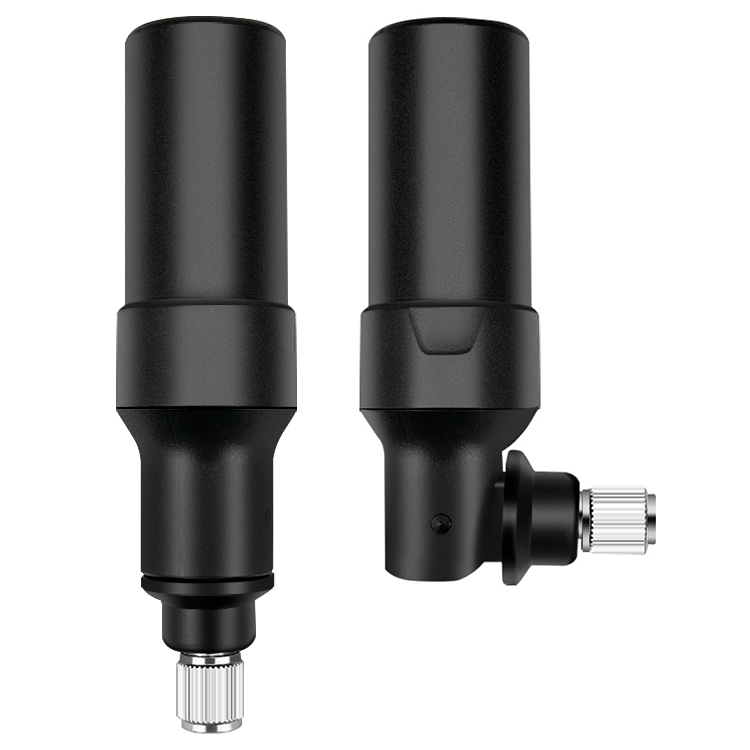
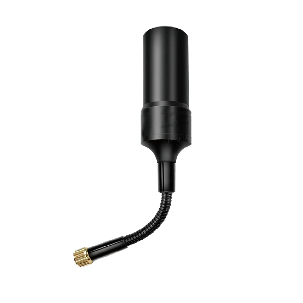
External Antennas
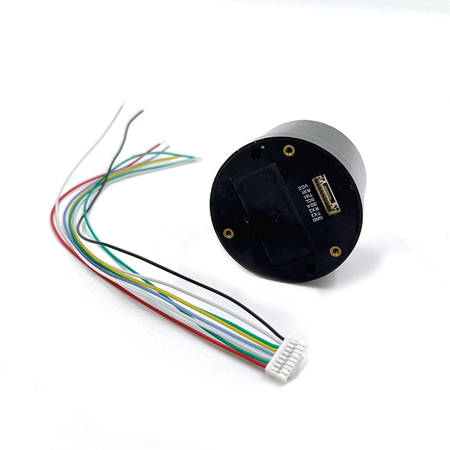
Positioning Chips and Modules


 Language


Language


In the rapidly evolving domain of unmanned aerial systems (UAS), or drones, the Global Navigation Satellite System (GNSS) antenna has transcended its role as a simple positioning tool to become the cornerstone of autonomy, safety, and high-precision operation. Among these, the multi-band GNSS antenna represents the pinnacle of this technology, enabling drones to achieve centimeter-level accuracy that unlocks a new realm of professional and industrial applications. This overview explores the critical function, fundamental importance, and defining characteristics of these sophisticated aerial navigators.
For any drone, from a consumer quadcopter to an industrial inspection platform, knowing its precise location in three-dimensional space is non-negotiable. This goes far beyond simply displaying a position on a map for a pilot. GNSS data is fed directly into the drone's flight controller, where it is essential for:
Position Hold (Hovering): Maintaining a stable position against wind and other disturbances.
Return-to-Home (RTH): Safely and automatically navigating back to its launch point, critical in cases of low battery or lost communication link.
Autonomous Flight: Executing pre-programmed flight paths (waypoints) for mapping, surveying, or inspection without manual piloting.
Geofencing: Enforcing virtual boundaries to prevent flight into restricted airspace.
A single-band antenna (typically receiving only the GPS L1 C/A signal) can provide basic functionality for casual flying. However, its accuracy is limited to several meters, which is insufficient for applications where precision is paramount. This is where multi-band technology becomes transformative.
A multi-band GNSS drone antenna is designed to receive signals on multiple frequency bands from multiple satellite constellations simultaneously. This means it can process:
GPS (USA): L1 C/A, L2C, and L5 signals.
GLONASS (Russia): L1 and L2 signals.
Galileo (EU): E1, E5a, E5b, and E6 signals.
BeiDou (China): B1, B2, and B3 signals.
The primary advantage of this capability is the mitigation of the ionospheric delay—the single largest source of error in standard GNSS positioning. The ionosphere, a layer of charged particles in the upper atmosphere, slows down GNSS signals in a frequency-dependent manner. By measuring the same signal on two different frequencies (e.g., L1 and L2), a dual-band receiver can calculate the delay and effectively cancel it out. Multi-band receivers take this further, using signals like L5 and E5a, which are more robust and have higher power, to achieve even faster convergence and greater reliability.
The form factor of a drone antenna is uniquely challenging. It must be extremely lightweight to avoid impacting flight performance and battery life, yet incredibly robust to withstand vibrations, wind buffeting, and potential crashes. Furthermore, its aerodynamic profile must be minimal to avoid creating drag. Consequently, most high-end multi-band drone antennas are low-profile patch antennas, often housed in a sleek, aerodynamic radome made of materials like ABS plastic or polycarbonate that are RF-transparent at GNSS frequencies.
Another critical design consideration is the antenna's radiation pattern. Unlike a marine antenna that can assume a stable horizon, a drone is a dynamic platform that pitches, rolls, and yaws aggressively. Therefore, the antenna must have a wide, hemispherical (zenith-focused) coverage pattern to maintain lock on satellites even when the drone is banked at steep angles. Any loss of signal during critical maneuvers could be catastrophic.
These antennas are almost always "active," meaning they contain an integrated Low-Noise Amplifier (LNA). This is crucial because the signal from the satellites is incredibly weak, and the cable run to the drone's flight controller is short but must be of minimal weight. The LNA boosts the signal right at the source, ensuring a strong, clean signal is delivered to the receiver with minimal degradation.
In summary, the multi-band GNSS antenna is the technological key that elevates a drone from a remotely piloted toy to a precision aerial data collection platform. It is a sophisticated device that embodies the convergence of aerospace engineering, advanced RF design, and software-defined signal processing. By harnessing the full spectrum of global navigation signals, it provides the rock-solid positional integrity required for drones to perform complex tasks safely, reliably, and with unparalleled accuracy, truly enabling the future of automated flight.
The operation of a multi-band GNSS drone antenna is a sophisticated process that extends far beyond simple signal reception. It is the foundational step in a complex chain of signal processing that enables a drone to know its position with extraordinary precision. Its function is to act as a highly selective, ultra-sensitive ear, tuned to the faint whispers of multiple satellite constellations, while intelligently ignoring the electrical cacophony of its own platform and the environment.
The Multi-Band Advantage: Neutralizing the Ionosphere
The core principle that separates a multi-band antenna from a single-band one is its ability to correct for ionospheric delay. The ionosphere is a layer of the upper atmosphere filled with ions and free electrons. This plasma slows down the propagation of GNSS radio waves in a frequency-dependent manner; lower frequencies are delayed more than higher ones. This delay introduces a significant error—often several meters—into the calculated distance (pseudo-range) to each satellite.
Dual-Frequency Correction: By receiving the same navigation message on two different frequencies (e.g., L1 and L2), the receiver can precisely measure the difference in the time of arrival caused by the ionosphere. Since the delay is mathematically related to the frequency, the receiver can solve for the exact ionospheric error and remove it from the calculation. This is the primary reason dual-band systems can achieve sub-meter accuracy.
Tri-Band and Multi-Band Enhancement: Adding a third frequency (e.g., the aeronautical-grade L5 or E5a) brings further benefits. L5 signals have higher power, a wider bandwidth, and a more advanced modulation scheme, making them more robust against interference and multipath. They allow for faster resolution of the integer ambiguity in carrier-phase positioning (used in RTK) and provide redundancy, making the position solution more reliable and robust.
The Radiation Pattern: Maintaining Lock in a Dynamic Environment
A drone is not a stable platform like a surveyor's tripod. It pitches, rolls, and yaws constantly. A standard antenna with a narrow beamwidth would lose satellite lock every time the drone banked, as its view of the satellites would be obstructed by the drone's own structure.
Wide Hemispherical Coverage: Drone antennas are specifically engineered to have a very wide, hemispherical (or even slightly beyond) radiation pattern. This ensures that even when the drone is tilted at extreme angles (up to 30-40 degrees or more), the antenna can still "see" a sufficient number of satellites across a large portion of the sky. This wide field-of-view is critical for maintaining a continuous and reliable position solution during all flight maneuvers.
Multipath Rejection: While needing to see the horizon, the antenna must also reject signals coming from below, which are typically multipath reflections from the ground, buildings, or water. A well-designed ground plane ensures the antenna pattern has low gain towards the nadir (downward direction), naturally filtering out these reflected signals that would corrupt the accuracy.
Signal Conditioning: The Battle Against Noise
The signal path inside the antenna is a fight to preserve integrity.
Reception: The antenna element (the patch array) is designed to be efficient across a wide bandwidth, resonating at the desired L1, L2, and L5 frequencies to convert the electromagnetic waves into electrical currents.
Immediate Amplification and Filtering: The faint electrical signal is immediately fed into the integrated LNA. Its ultra-low noise figure ensures almost no additional noise is added. Crucially, bandpass filters at the LNA's input block powerful out-of-band interference. On a drone, this is vital to reject noise from:
Motors and ESCs: These generate significant broadband electrical noise.
Video Transmitters (VTx): Operating at 2.4 GHz or 5.8 GHz, these are very powerful nearby transmitters.
Radio Control (RC) Link: Operating at 433 MHz, 900 MHz, or 2.4 GHz.
Without this filtering, these signals could easily overload the sensitive GNSS receiver, causing a total loss of lock.
DC Biasing and Transmission: The amplified and cleaned signal is sent down the lightweight coaxial cable to the drone's flight controller. The DC power for the LNA is supplied on the same cable via a bias tee circuit, simplifying the wiring.
Enabling Advanced Positioning: RTK and PPK
The pristine signal provided by a multi-band antenna is the raw material for high-precision techniques:
Real-Time Kinematic (RTK): RTK uses the carrier phase of the GNSS signal, which is much more precise than the code phase used in standard positioning. The multi-band antenna provides the stable, low-noise signal required for the receiver to maintain "lock" on the carrier phase cycle. It also enables faster and more reliable resolution of the integer ambiguity problem, especially when using triple-frequency signals. RTK corrections (from a base station or network) are applied in real-time, giving the drone centimeter-level accuracy while it flies.
Post-Processed Kinematic (PPK): In PPK, the raw GNSS data (carrier phase and pseudo-range) from both the drone (rover) and a base station are recorded during flight and processed afterwards. The quality of the data recorded by the drone is entirely dependent on the antenna's performance. A multi-band antenna ensures the highest quality data, leading to the most robust and accurate post-processed results, even if the communication link to a base station was lost during flight.
In essence, the working principle of the multi-band drone antenna is one of acquisition, purification, and preparation. It acquires the weakest of signals from dozens of satellites across multiple frequencies, purifies them by amplifying them without adding noise and filtering out interference, and prepares them for the complex algorithms that ultimately transform them into a precise, reliable, and dynamic point in space—the position of the drone.
The integration of a multi-band GNSS antenna is a transformative upgrade for a drone, unlocking unparalleled capabilities. However, this advanced technology introduces a set of trade-offs and challenges that designers, manufacturers, and pilots must carefully navigate. This section provides a clear-eyed analysis of the profound benefits and the inherent complexities of this critical technology.
Advantages:
Unprecedented Accuracy and Precision: This is the paramount advantage. Multi-band technology directly mitigates the largest source of GNSS error—ionospheric delay—enabling real-time positioning accuracy within centimeters when coupled with RTK or PPP technology, and consistently sub-meter accuracy in standard mode. This is the foundation for professional-grade applications.
Enhanced Reliability and Robustness: Access to multiple constellations (GPS, GLONASS, Galileo, BeiDou) means the drone can "see" many more satellites at any given time, often 30-50 or more. This dramatically improves satellite geometry (lowering DOP values) and provides redundancy. If signals from one constellation are blocked or degraded, the others can maintain a high-integrity position solution. This is critical for flight in challenging environments like urban canyons or under partial tree cover.
Faster Convergence and Time-To-First-Fix (TTFF): The use of modern signals like L5 and E5a, which have advanced codes and higher power, allows the receiver to acquire satellites more quickly and resolve integer ambiguities in RTK mode faster. This means less waiting on the ground before a mission can begin and quicker re-acquisition if signal lock is temporarily lost.
Superior Resistance to Interference and Multipath: The inherent robustness of multi-frequency signals, combined with the sophisticated filtering in the antenna's LNA, makes the system far more resilient to jamming (intentional or unintentional) and multipath errors caused by signals reflecting off buildings, terrain, or water.
Enables Autonomy and Complex Applications: The reliable, centimeter-accurate positioning is the key that unlocks advanced drone functionalities: automated precise landing on a target, formation flying, complex 3D mapping and modeling, and autonomous inspection workflows where the drone must know its exact position relative to a structure.
Challenges and Limitations:
Increased Cost: Multi-band antennas and the compatible receivers are significantly more expensive than their single-band counterparts. This cost is passed on, making RTK/PPK-enabled drones a substantial investment, often placing them firmly in the professional and industrial market segment.
Higher Power Consumption: The LNA in the antenna requires power, and the receiver must process signals from multiple constellations and frequencies, which is computationally intensive. This draws more current from the drone's battery, marginally reducing flight times—a critical parameter for any UAS operation.
Size and Weight Constraints: While engineers strive for miniaturization, a multi-band antenna element with its stacked patches and associated LNA/filtering circuitry will always be larger and heavier than a simple single-band patch. Every gram counts on a drone, and integrating this component requires careful design to avoid negatively impacting payload capacity and flight dynamics.
Complex System Integration: Incorporating a multi-band GNSS system is not just about the antenna. It requires a compatible multi-frequency receiver, careful electromagnetic compatibility (EMC) design to prevent onboard noise from drowning out the signals, and sophisticated software algorithms to process the data. This integration complexity increases the R&D cost for drone manufacturers.
Calibration and Accuracy Verification: For RTK systems, achieving stated centimeter-level accuracy requires precise calibration of the antenna's phase center relative to the drone's center of gravity or the payload (e.g., the camera). Any error in this measurement (a lever arm error) will directly translate into a positional error in the collected data. Users must understand and correctly apply these calibration procedures.
Vulnerability to Physical Damage: Located on the top of the drone for optimal sky view, the antenna is exposed and can be damaged in a crash or a hard landing. Given its cost and complexity, repair or replacement is a significant consideration.
In conclusion, the advantages of multi-band GNSS antennas for professional drone applications are overwhelming, providing the accuracy and reliability that define modern commercial drones. However, these benefits come at a cost—financial, operational, and technical. The decision to utilize this technology is a calculated one, where the requirement for extreme positional integrity justifies the associated investments and complexities. For missions where "close enough" is not acceptable, the multi-band antenna is not an option; it is a necessity.
The multi-band GNSS antenna is not merely an incremental improvement; it is a foundational technology that has created entirely new industries and transformed existing ones by enabling a level of aerial precision previously unimaginable. Its applications are vast and growing, and ongoing technological trends promise to further expand its capabilities and redefine the possibilities of unmanned flight.
Current Applications:
Precision Agriculture: This is a flagship application. Drones equipped with multi-band GNSS fly autonomous patterns over fields, using the precise positioning to:
Create High-Resolution Maps: Generating accurate orthomosaics and digital elevation models for analyzing crop health, drainage, and soil variation.
Variable Rate Application (VRA): Precisely targeting specific areas with fertilizer, pesticide, or seed, reducing waste and environmental impact by up to 90% compared to blanket spraying.
Crop Scouting and Health Monitoring: Pinpointing the exact location of diseased or stressed plants for targeted intervention.
Surveying, Mapping, and GIS: Multi-band GNSS, especially with RTK/PPK, has revolutionized geomatics.
Topographic Surveys: Capturing highly accurate 3D point clouds for engineering design, volume calculations (e.g., for stockpiles and quarries), and contour mapping without the need for ground control points (GCPs) in many cases.
Cadastral Surveying: Accurately mapping property boundaries.
Construction Site Monitoring: Tracking earthwork progress, measuring cut and fill volumes, and ensuring buildings are constructed to design specifications.
Infrastructure Inspection: The ability to position a drone centimeters from a structure autonomously and safely is transformative.
Wind Turbine Inspection: Flying pre-programmed paths around blades and towers to capture high-resolution imagery.
Cell Tower and Power Line Inspection: Navigating complex environments with precision to assess assets.
Bridge and Dam Inspection: Creating detailed 3D models to identify cracks, spalling, and other defects.
Public Safety and Disaster Response:
Search and Rescue: Creating accurate maps of search areas and precisely marking the location of found objects or persons.
Accident Reconstruction: Documenting crash scenes with photogrammetry to create accurate scale diagrams for investigation.
Disaster Assessment: Rapidly mapping areas after earthquakes, floods, or fires to assess damage and plan relief efforts.
Cinematography and Videography: High-end drone cinematography uses multi-band GNSS for incredibly smooth and stable "follow-me" modes, precise orbiting of moving subjects, and repeatable camera moves for shooting multiple takes.
Future Trends:
Tighter Sensor Fusion with IMUs and Cameras: The future lies in deeply coupling the GNSS position with data from onboard inertial measurement units (IMUs), visual odometry (from cameras), and LiDAR. This will create navigation systems that are resilient to total GNSS outage (e.g., indoors, under dense canopy, or near tall buildings) by using other sensors to dead reckon with high accuracy for short periods.
Miniaturization and Cost Reduction: As with all electronics, components will become smaller, more power-efficient, and less expensive. This will democratize multi-band technology, bringing centimeter-level accuracy down to smaller, more affordable drones and expanding its use into new market segments.
Advanced Anti-Jamming and Anti-Spoofing (AJS): As drones become more critical to infrastructure, they also become targets. Future multi-band antennas will incorporate adaptive nulling techniques to automatically detect and reject intentional jamming or spoofing signals, ensuring operational security and safety.
Networked Swarm Operations: Multi-band GNSS providing a common, precise time and position reference is the key to enabling coordinated drone swarms. This will allow multiple drones to operate collaboratively on large tasks, such as mapping vast areas simultaneously or performing coordinated light shows with absolute precision.
Seamless LEO Satellite Constellation Integration: The advent of Low Earth Orbit (LEO) satellite communication systems (e.g., Starlink) will provide ubiquitous data links. This will allow drones to access state-space representation (SSR) correction data from global GNSS networks anywhere in the world in real-time, making high-precision PPP-RTK as easy and reliable as using a local RTK base station is today.
AI-Enhanced Positioning: Artificial intelligence and machine learning algorithms will be applied to the raw GNSS data to further filter noise, predict and correct for multipath errors in urban environments, and provide even more robust and reliable position solutions in challenging signal environments.
In summary, the multi-band GNSS antenna has already proven to be a catalyst for innovation in the drone industry. Its ongoing evolution will be the backbone of the next generation of autonomous systems, enabling drones to navigate our world with a level of assurance, safety, and precision that will make them indispensable tools across every facet of the economy.
6. Conclusion: The Indispensable Linchpin of Modern UAS Operations
The multi-band GNSS antenna is a powerful testament to the principle that true technological advancement often comes from perfecting the fundamental components upon which entire systems are built. It is far more than a peripheral accessory; it is the central nervous system of a modern professional drone, providing the precise geospatial awareness that separates controlled, automated flight from mere remote-controlled operation. Its development and integration represent a critical inflection point in the history of unmanned aviation, enabling a transition from visual-line-of-sight hobbyism to beyond-visual-line-of-sight industrial tool.
Its significance is rooted in its ability to solve the most fundamental challenge of navigation: knowing where you are, not approximately, but exactly. By harnessing the power of multiple satellite constellations and frequencies, it systematically dismantles the largest sources of error, transforming a signal susceptible to atmospheric whims and environmental reflection into a robust and reliable metric of truth. This capability is the non-negotiable foundation for the entire value proposition of commercial drones—accuracy, repeatability, and efficiency.
The antenna's design is a marvel of interdisciplinary engineering, embodying the extreme constraints of its application. It is a device where grams are scrutinized, where milliseconds of signal delay are critical, and where resilience is baked into every material choice. It demonstrates that achieving high performance does not always require larger size but rather smarter design, sophisticated materials science, and a deep understanding of electromagnetic theory.
While the challenges of cost, power, integration, and calibration are real, they are not impediments to adoption but rather markers of a mature, high-end technology. The market has clearly voted that the advantages—centimeter-level accuracy, unparalleled reliability, and the enablement of autonomous workflows—overwhelmingly justify the investment for professional applications. These challenges are also the drivers for ongoing innovation, pushing the industry towards smaller, cheaper, and more efficient solutions.
Looking forward, the role of the multi-band GNSS antenna will only become more profound. It is the key sensor that will allow drones to navigate increasingly complex airspace, collaborate in swarms, and perform tasks with a level of autonomy that is currently the realm of science fiction. It will be the cornerstone upon which urban air mobility (UAM) and automated logistics are built, where safety-critical operations will demand nothing less than flawless and continuous positional integrity.
In conclusion, the multi-band GNSS drone antenna is a quintessential enabling technology. It is the unsung hero that works silently in the background, yet its performance is the very factor that determines the success or failure of a mission. It has elevated the drone from a novel gadget to a precision instrument, and it will continue to be the linchpin that unlocks the next great chapters of the aerial revolution. For any serious application of drone technology, investing in a high-quality multi-band GNSS system is not an option; it is the first and most important decision on the path to success.

 86 0755 2819 9597
Lucy Yang | lucy.y@toxutech.com
Nicole Li | nicole@toxutech.com
Dotty Zhao | sales04@toxutech.com
Global Business Director / Sales Team / Global Operations


 En
En Cn
Cn Korean
 Home >


