

-
Products -PCBA Manufacturing RF Connectors RF Cable Assemblys Embedded Antennas External Antennas Positioning Chips and Modules
RF Connectors

RF Cable Assemblys
Embedded Antennas
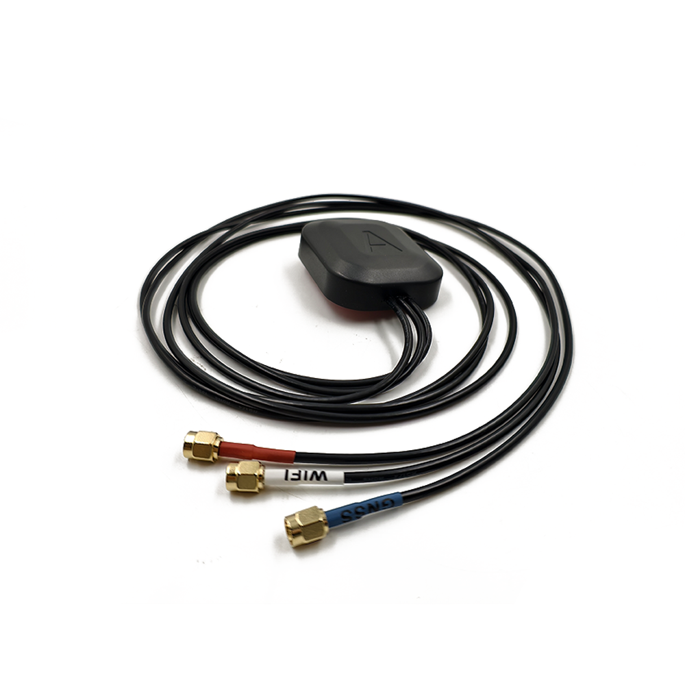
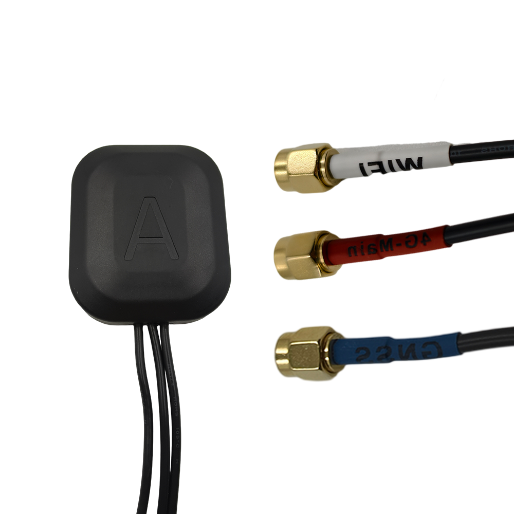
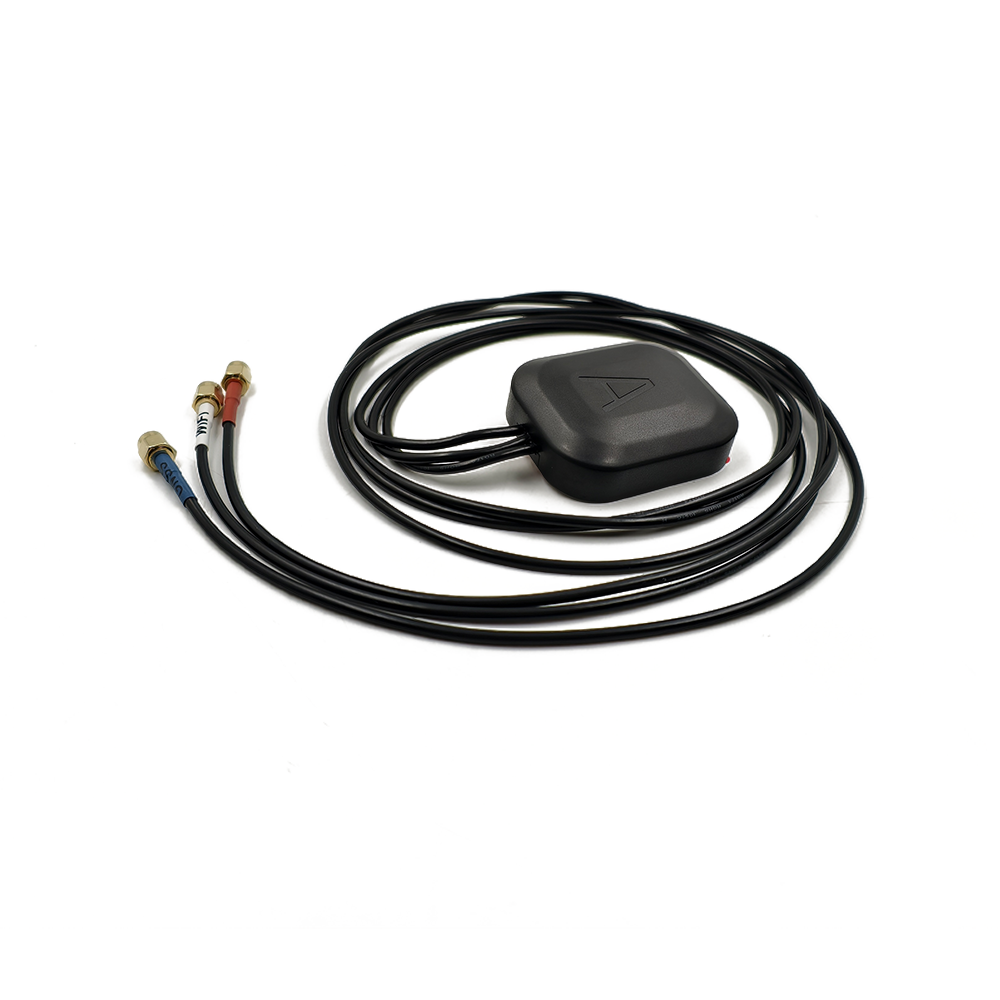
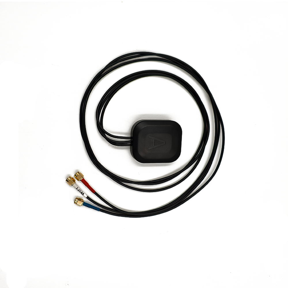
External Antennas
Positioning Chips and Modules


 Language


Language


In the rapidly evolving landscape of geospatial data collection, surveying drones have emerged as game - changers, offering unparalleled efficiency and flexibility in mapping and surveying tasks. At the heart of a surveying drone's ability to deliver accurate and reliable results lies its positioning system, and the multi - band GNSS (Global Navigation Satellite System) antenna is a linchpin in this setup. As surveying projects demand ever - higher precision and coverage, multi - band GNSS antennas have become essential for surveying drones, enabling them to operate effectively in diverse and challenging environments.
GNSS comprises multiple satellite constellations, such as GPS (USA), GLONASS (Russia), Galileo (Europe), and BeiDou (China), each transmitting signals at specific frequency bands. Single - band GNSS antennas, which are limited to receiving signals from one frequency band, often face significant limitations in accuracy and reliability. In contrast, multi - band GNSS antennas are engineered to simultaneously capture signals from multiple frequency bands across different constellations. For instance, GPS operates on L1 (1.575 GHz), L2 (1.227 GHz), and L5 (1.176 GHz) bands, while GLONASS uses a distinct set of frequencies. By leveraging signals from multiple bands, these antennas can exploit the unique characteristics of each frequency, compensating for errors caused by factors like ionospheric delays, multipath interference, and signal blockage.
Surveying drones frequently operate in complex environments, including urban canyons with tall buildings, mountainous terrains, and areas with dense vegetation. In such settings, single - band antennas may struggle to maintain consistent positioning due to signal reflections, obstructions, or interference. Multi - band GNSS antennas, however, enhance the resilience of surveying drones by providing redundant signal sources. If one frequency band is compromised, the antenna can rely on signals from other bands to ensure continuous and accurate positioning. This redundancy is crucial for surveying applications, where even minor positioning errors can lead to significant inaccuracies in the final survey data, affecting tasks such as topographic mapping, land boundary determination, and construction site monitoring.
Moreover, multi - band GNSS antennas enable surveying drones to take advantage of the increasing number of GNSS constellations in operation. The ability to receive signals from multiple constellations simultaneously not only improves the availability of positioning data but also enhances the overall reliability of the system. As the demand for high - precision surveying data continues to grow across industries such as construction, agriculture, and environmental monitoring, the role of multi - band GNSS antennas in surveying drones is becoming increasingly indispensable. These antennas are not only enabling more accurate and efficient surveying operations but also opening up new possibilities for large - scale and remote - area surveys that were previously challenging to execute.
The design and construction of a multi - band GNSS antenna for surveying drones are intricate processes that demand a harmonious blend of advanced electromagnetic engineering, material science, and miniaturization techniques. Given the unique operational requirements of drones, such as limited space, weight constraints, and exposure to harsh environmental conditions, the antenna must be carefully crafted to optimize performance, durability, and integration.
Antenna Element Design
The antenna element is the fundamental component responsible for capturing GNSS signals from satellites. For multi - band GNSS antennas in surveying drones, microstrip antenna arrays are commonly employed due to their compact form factor, low profile, and suitability for multi - band operation. A microstrip antenna array typically consists of multiple metallic patches, each meticulously designed to resonate at specific frequencies corresponding to different GNSS bands.
The design of the metallic patches involves in - depth electromagnetic simulations and calculations. Engineers optimize the shape, size, and layout of each patch to ensure efficient signal reception across the target frequency bands. For example, to resonate at the GPS L1, L2, and L5 bands, the patches are configured with precise dimensions and geometries. These simulations also help in achieving high gain, which is essential for capturing weak satellite signals, and good impedance matching to minimize signal reflections and maximize power transfer. High gain ensures that the antenna can effectively receive signals even in areas with low satellite visibility or in the presence of signal obstructions.
The choice of dielectric substrate for the microstrip antenna is a critical decision. Substrates with stable electrical properties over a wide range of frequencies, temperatures, and environmental conditions are preferred. Ceramic - based substrates are popular due to their high dielectric constant, which enables miniaturization of the antenna, and their excellent thermal and mechanical stability. However, other materials like Rogers RT/duroid series may be selected based on specific performance requirements, cost considerations, and manufacturing feasibility. The substrate's characteristics significantly impact the antenna's resonant frequencies, radiation patterns, and overall efficiency, making it a key factor in the design process.
Multiplexer and Filter Design
A multiplexer is a vital component in a multi - band GNSS antenna, serving the crucial function of separating signals received from different frequency bands and directing them to the appropriate signal processing channels. In the context of surveying drones, the multiplexer must exhibit high isolation between frequency channels to prevent interference among signals from various bands. This isolation is achieved through meticulous design of the multiplexer circuitry, incorporating techniques such as impedance matching and filtering.
Filters play an equally important role in enhancing the performance of the multi - band GNSS antenna. Band - pass filters are used to allow only frequencies within the desired GNSS bands to pass through while attenuating frequencies outside these bands. This filtering mechanism helps to reject interference from other radio - frequency sources, such as wireless communication devices, Wi - Fi networks, and radio transmitters operating in the vicinity of the surveying drone. Additionally, notch filters may be integrated to specifically target and suppress certain frequencies known to cause interference, further improving the signal quality received by the antenna. The design of these filters requires a thorough understanding of the frequency characteristics of GNSS signals and the potential interference sources in the drone's operational environment.
Signal Processing Unit Integration
The signals captured by the antenna element and processed by the multiplexer and filters need to be amplified and digitized for further processing by the drone's GNSS receiver. A low - noise amplifier (LNA) is integrated into the antenna design to boost the weak GNSS signals while minimizing the addition of noise. The LNA is carefully selected based on its high gain, low noise figure, and wide bandwidth to ensure effective amplification of signals across multiple frequency bands. Since the signals received from GNSS satellites are extremely weak, any additional noise introduced during amplification can severely degrade the accuracy of the positioning calculations.
Following amplification, the analog signals are converted into digital format using an analog - to - digital converter (ADC). The digitized signals are then ready to be transmitted to the GNSS receiver for subsequent processing, including signal acquisition, tracking, and position calculation. The integration of the signal processing unit within the antenna design is carefully planned to minimize signal losses and interference. The layout of components, routing of signal traces, and shielding of sensitive parts are all optimized to ensure that the signals reach the receiver in the best possible condition, facilitating accurate positioning.
Enclosure and Packaging
The enclosure of a multi - band GNSS antenna for surveying drones serves as a protective barrier against physical damage, electromagnetic interference, and environmental factors. Given the dynamic nature of drone operations, which may involve high - speed flight, vibrations, and exposure to harsh weather conditions, the enclosure must be lightweight yet robust. Engineering plastics are commonly used for the enclosure due to their favorable properties, such as lightweight construction, good impact resistance, UV resistance, and chemical resistance. These materials can withstand the rigors of drone flight and outdoor operation while keeping the overall weight of the antenna to a minimum, which is crucial for maintaining the drone's flight performance and battery life.
The enclosure design also takes into account heat dissipation, as the operation of the antenna and its associated components generates heat. Adequate heat dissipation mechanisms, such as heat sinks or ventilation holes, are incorporated to ensure that the internal components operate within their optimal temperature range, preventing performance degradation due to overheating. Additionally, the enclosure is designed to provide effective electromagnetic shielding to protect the antenna from external electromagnetic interference, ensuring reliable signal reception. It includes features for easy installation and connection to the drone's frame and electronic systems, such as mounting holes, connectors, and interfaces specifically tailored for drone applications.
The working principles of a multi - band GNSS antenna for surveying drones involve a series of coordinated processes that enable the antenna to capture, process, and transmit GNSS signals accurately, ultimately providing the drone with precise positioning information essential for surveying tasks.
Signal Reception
The operation of the multi - band GNSS antenna commences with the antenna element capturing the weak radio - frequency signals transmitted by GNSS satellites. These signals, carrying critical information about the satellite's position and time, traverse the Earth's atmosphere before reaching the antenna. The multi - band design of the antenna element allows it to efficiently couple with incoming signals from multiple frequency bands simultaneously.
When the frequencies of the incoming GNSS signals align with the resonant frequencies of the corresponding metallic patches in the antenna element, a resonance effect occurs. This resonance significantly enhances the antenna's ability to absorb the energy of the signals, converting the electromagnetic energy of the GNSS signals into electrical signals. However, in real - world scenarios, these initial signals are often subject to various impairments. Ionospheric delays, which vary depending on the frequency of the signal, can distort the signal's arrival time. Tropospheric delays, caused by the signal's passage through the Earth's atmosphere, also introduce errors. Moreover, multipath interference, where the signal reaches the antenna via multiple reflected paths, can further complicate signal reception, especially in environments with numerous reflective surfaces such as urban areas or near bodies of water.
Signal Separation and Filtering
The signals received by the antenna element, which are a mixture of signals from different frequency bands, are then directed to the multiplexer. The multiplexer acts as a signal sorter, separating the signals based on their frequency and routing each frequency band's signal to the appropriate processing channel. This separation is essential because each frequency band has distinct characteristics and error patterns. For example, some bands may be more susceptible to ionospheric disturbances, while others may be less affected by multipath interference.
After separation, the signals pass through band - pass filters. These filters are designed to allow only frequencies within the desired GNSS bands to pass through while attenuating frequencies outside these bands. This filtering process effectively rejects interference from other radio - frequency sources operating in the vicinity of the surveying drone. Additionally, notch filters may be employed to specifically target and suppress certain frequencies known to cause interference, such as those from nearby wireless communication devices or radio transmitters. By filtering out unwanted frequencies, the antenna ensures that only clean and relevant GNSS signals are passed on for further processing.
Signal Amplification and Digitization
The filtered signals from each frequency band are then amplified by a low - noise amplifier (LNA). The LNA boosts the weak GNSS signals to a level suitable for further processing while keeping the added noise to an absolute minimum. This is of utmost importance because the signals received from satellites are extremely weak, and any additional noise could significantly degrade the accuracy of the positioning calculations performed by the drone's GNSS receiver.
Following amplification, the analog signals are converted into digital format using an analog - to - digital converter (ADC). The digitized signals are now in a form that can be easily processed by the GNSS receiver. The receiver utilizes these digital signals, along with correction data from reference stations in the case of Real - Time Kinematic (RTK) positioning, to calculate the precise position of the drone. By combining the information from multiple frequency bands, the receiver can more accurately model and correct for errors caused by ionospheric delays, multipath interference, and other factors, resulting in high - accuracy positioning that meets the stringent requirements of surveying applications.
Position Calculation and Data Transmission
Once the GNSS receiver has processed the digitized signals and applied the necessary corrections, it calculates the precise position of the surveying drone. This position information, along with other relevant data such as altitude, speed, and orientation, is then transmitted to the drone's onboard computer. The onboard computer uses this positioning data to control the drone's flight path, ensuring that it follows the pre - planned survey route accurately.
In many cases, the positioning data is also transmitted to a ground control station. Surveyors at the ground control station can monitor the drone's progress in real - time, review the survey data, and make any necessary adjustments to the surveying operation. This real - time data transmission enables seamless coordination between the drone and the survey team, facilitating efficient and accurate surveying tasks. The accurate positioning provided by the multi - band GNSS antenna is the foundation for generating reliable survey data, which is used for a wide range of applications, from creating detailed topographic maps to monitoring construction site progress.
Advantages
One of the most significant advantages of multi - band GNSS antennas for surveying drones is the substantial enhancement in positioning accuracy they offer. By simultaneously receiving signals from multiple frequency bands, these antennas can more effectively correct for errors caused by ionospheric delays, which are frequency - dependent. During periods of high solar activity, ionospheric delays can cause significant inaccuracies in single - frequency GNSS positioning. Multi - band antennas, however, can use the data from different frequencies to create a more accurate model of these delays and apply precise corrections, resulting in positioning accuracies that can reach centimeter - level or even millimeter - level in some cases. This high - precision positioning is invaluable for creating detailed and accurate survey maps, which are essential for applications such as land development, infrastructure planning, and environmental monitoring.
Another key advantage is the improved reliability of surveying drones in challenging environments. Surveying drones often operate in areas with complex terrain, tall buildings, or dense vegetation, where single - band antennas may experience signal blockage, multipath interference, or interference from other radio - frequency sources. Multi - band GNSS antennas, with their ability to receive signals from multiple bands and constellations, can cross - check and correct for these errors. If one frequency band is affected by interference or blockage, the antenna can rely on signals from other bands to maintain continuous and accurate positioning. This resilience ensures that the drone can complete its surveying tasks without interruption, even in adverse conditions, increasing the efficiency and effectiveness of surveying operations.
Multi - band GNSS antennas also offer greater compatibility with multiple GNSS constellations. With the increasing number of constellations in operation, including GPS, GLONASS, Galileo, and BeiDou, multi - band antennas can receive signals from all these systems simultaneously. This provides enhanced redundancy and improved signal availability, as the antenna can utilize signals from any available constellation to calculate the position. It reduces the dependence on a single constellation, making the positioning system more robust and reliable. For surveying drones, this means they can operate effectively in areas where the signals from one constellation may be weak or unavailable, expanding their operational range and capabilities.
Challenges
Despite their numerous advantages, multi - band GNSS antennas for surveying drones face several significant challenges. One of the primary challenges is the complexity of design and manufacturing. Designing an antenna that can efficiently receive and process signals from multiple frequency bands requires in - depth knowledge of electromagnetic theory, signal processing, and material science. The manufacturing process must also be highly precise to ensure that the antenna elements resonate at the correct frequencies and that the multiplexer, filters, and other components function optimally. This complexity often leads to higher production costs compared to single - band antennas, which can be a barrier for some surveying companies, especially those with limited budgets.
Another major challenge is related to power consumption. The operation of multi - band antennas, particularly when processing signals from multiple bands simultaneously, requires more power than single - band antennas. This increased power consumption can be a significant limitation for surveying drones, which typically have limited battery capacity. Balancing the need for high - performance multi - band positioning with the power constraints of drones is an ongoing challenge. Engineers are constantly exploring ways to optimize the design of the antenna and its associated components to reduce power consumption without sacrificing performance, such as using more energy - efficient materials and advanced signal processing algorithms.
Interference management is also a critical challenge for multi - band GNSS antennas in surveying drones. As the number of radio - frequency devices in use continues to grow, the potential for interference with GNSS signals is increasing. Surveying drones may operate in environments with numerous wireless communication devices, such as mobile phones, Wi - Fi routers, and radio transmitters. Multi - band antennas need to be equipped with effective interference mitigation techniques to ensure that the received GNSS signals are not degraded by these other radio - frequency sources. This may involve the use of advanced filtering, shielding, and signal processing algorithms, which add to the complexity and cost of the antenna design. Additionally, as new communication technologies emerge, the antenna design must be adaptable to address potential future interference challenges.
Applications
Multi - band GNSS antennas for surveying drones have a wide array of applications across various industries. In the land surveying industry, they are used for creating detailed topographic maps, measuring land boundaries, and monitoring land deformation. Drones equipped with multi - band GNSS antennas can quickly and accurately survey large areas of land, significantly reducing the time and cost associated with traditional surveying methods. The high - accuracy positioning provided by these antennas ensures that the survey maps are highly detailed and reliable, which is essential for land development projects, property management, and urban planning.
In the construction industry, surveying drones with multi - band GNSS antennas play a crucial role in site planning, grading, and progress monitoring. They can rapidly survey construction sites, providing real - time data on the terrain, the location of construction equipment, and the progress of the construction project. This information helps construction managers make informed decisions, optimize construction processes, and ensure that the project is completed on time and within budget. The ability to accurately map the construction site and monitor changes over time using surveying drones with multi - band GNSS antennas improves the efficiency and quality of construction operations.
In the environmental monitoring field, multi - band GNSS - equipped surveying drones are used to track the movement of natural resources, monitor changes in the environment, and assess the impact of human activities on ecosystems. For example, they can be used to monitor the migration patterns of wildlife, track the spread of invasive species, and measure changes in forest cover. The accurate positioning provided by the multi - band GNSS antennas enables precise data collection, which is essential for scientific research, environmental management, and conservation efforts.
Future Trends
Looking ahead, several future trends are expected to shape the development of multi - band GNSS antennas for surveying drones. One significant trend is the further miniaturization of these antennas. As technology advances, new materials and manufacturing techniques, such as nanotechnology and 3D printing, will be explored to reduce the size and weight of multi - band GNSS antennas without sacrificing performance. This miniaturization will enable the integration of these antennas into smaller and more lightweight surveying drones, expanding the range of applications and improving the flight performance of the drones. Smaller antennas also mean less drag, which can contribute to longer flight times and increased maneuverability.
The integration of artificial intelligence (AI) and machine learning (ML) algorithms with multi - band GNSS antennas is an emerging and highly promising trend. AI and ML can be used to optimize the performance of the antennas in real - time. These algorithms can analyze the received signals, detect changes in the signal environment, and adjust the antenna's operation parameters, such as gain, filtering, and interference mitigation, to adapt to different conditions. For example, AI - powered systems can predict and mitigate the effects of ionospheric disturbances or multipath interference by analyzing historical data and current signal patterns. ML algorithms can continuously learn from the data collected during drone operations and improve the accuracy of position calculations over time. This integration will not only enhance the accuracy and reliability of the positioning system but also make the antennas more autonomous and intelligent.
Advancements in communication technologies will also have a profound impact on multi - band GNSS antennas for surveying drones. The development of 5G and other high - speed, low - latency communication networks will enable faster and more reliable transmission of GNSS correction data. This will improve the overall performance of the positioning system, allowing for even more accurate positioning. Multi - band antennas will need to be designed to take full advantage of these new communication technologies, enabling seamless integration with the drone's communication systems and ground control stations. Additionally, the advent of technologies like low - power wide - area networks (LPWANs) offers the potential for long - range communication with minimal power consumption, which is highly beneficial for surveying drones operating in remote areas.
There is also a growing trend towards the development of multi - functional antennas. Future multi - band GNSS antennas for surveying drones may integrate additional functions, such as wireless communication capabilities, sensor integration, or energy harvesting. For instance, an antenna could be designed to not only receive GNSS signals but also act as a Wi - Fi or 5G antenna for data transmission, reducing the number of antennas required on the drone and saving space. Sensor integration could enable the antenna to gather environmental data, such as temperature, humidity, or air pressure, which can be useful for surveying applications. Energy - harvesting capabilities, such as solar or kinetic energy harvesting, could help power the antenna and reduce the overall power consumption of the drone, further extending its flight time.
Another trend is the improvement of antenna efficiency through advanced electromagnetic design techniques. Researchers are exploring new antenna structures and metamaterials that can enhance the radiation patterns, gain, and impedance matching of multi - band GNSS antennas. Metamaterials, with their unique electromagnetic properties, can be engineered to manipulate the propagation of electromagnetic waves in ways that are not possible with conventional materials. This could lead to antennas that are more efficient at capturing GNSS signals, reducing the power required for signal reception and improving the overall performance of the antenna in challenging environments.
Conclusion
In conclusion, multi - band GNSS antennas have become indispensable components for surveying drones, enabling them to achieve high - accuracy positioning in diverse and challenging environments. Their ability to receive signals from multiple frequency bands and constellations provides enhanced accuracy, reliability, and compatibility, which are crucial for a wide range of surveying applications across various industries.
However, the design and implementation of these antennas are not without challenges. The complexity of design and manufacturing, high power consumption, and interference management remain significant hurdles that need to be overcome. The high production costs associated with multi - band GNSS antennas can limit their adoption, especially for smaller surveying companies. The power constraints of drones also pose a challenge, as multi - band antennas typically consume more power than single - band counterparts. Additionally, the increasing prevalence of radio - frequency devices in the environment makes interference management a critical aspect of antenna design.
Despite these challenges, the future of multi - band GNSS antennas for surveying drones looks extremely promising. With ongoing advancements in technology, such as miniaturization, the integration of AI and ML, the development of new communication technologies, and the exploration of multi - functional and more efficient antenna designs, these antennas will continue to evolve and improve. They will play an even more significant role in the future of surveying, enabling more accurate, efficient, and autonomous surveying operations. As the demand for high - precision geospatial data continues to grow, multi - band GNSS antennas will be at the forefront of innovation, driving the development of surveying drones and shaping the future of the surveying industry.

 86 0755 2819 9597
Lucy Yang | lucy.y@toxutech.com
Nicole Li | nicole@toxutech.com
Dotty Zhao | sales04@toxutech.com
Global Business Director / Sales Team / Global Operations


 En
En Cn
Cn Korean
 Home >


