

-
Products -PCBA Manufacturing RF Connectors RF Cable Assemblys Embedded Antennas External Antennas Positioning Chips and Modules
RF Connectors

RF Cable Assemblys
Embedded Antennas
External Antennas
Positioning Chips and Modules


 Language


Language


The convergence of high-precision GPS technology with the ubiquity and power of the Android platform represents one of the most significant democratizations of geospatial technology in recent history. At the heart of this convergence is a specific type of hardware: the GPS Real-Time Kinematic (RTK) antenna compatible with Android devices. This overview explores the genesis, significance, and ecosystem of these antennas, which are transforming professional-grade positioning from a specialized discipline into a tool accessible to millions.
For decades, achieving centimeter-level accuracy with GPS was the exclusive domain of professional surveyors, civil engineers, and scientific researchers. This required expensive, proprietary hardware—ruggedized receivers, dedicated controllers, and sophisticated antennas often costing tens of thousands of dollars. The software was closed, complex, and required specialized training. This high barrier to entry locked out a vast potential user base, including students, hobbyists, small construction firms, and application developers.
The rise of the Android operating system and the proliferation of powerful, affordable smartphones and tablets created a perfect storm of opportunity. Android devices offered a potent combination of high-performance multi-core processors, abundant memory, vibrant touchscreen displays, multiple connectivity options (Bluetooth, Wi-Fi, USB-OTG), and a ubiquitous operating system. Crucially, they provided a flexible and open platform for software development. The missing piece was a means to feed high-precision GNSS data into these devices.
Enter the Android-compatible GPS RTK antenna. This term typically refers not just to the antenna itself, but to an integrated system—often called an "RTK receiver" or "GNSS receiver." It is a unit that combines a high-quality multi-frequency GNSS antenna (frequently a ceramic patch antenna) with a sophisticated RTK-capable receiver chipset. Its primary function is to receive signals from multiple satellite constellations (GPS, GLONASS, Galileo, BeiDou), perform the complex calculations for carrier-phase tracking, and output a stream of high-precision location data in a format an Android device can understand.
The compatibility with Android is achieved through standard communication interfaces. The most common are:
Bluetooth (BT): The wireless standard for connectivity. The RTK antenna module acts as a Bluetooth serial device, pairing with the Android phone or tablet. The surveying or mapping app on the Android device connects to this BT serial port to receive the raw data stream (typically in NMEA 0183 or a proprietary binary format).
USB On-The-Go (USB-OTG): A wired connection that provides power and data. This is often preferred for its reliability (no wireless interference), ability to charge the Android device from the antenna's battery (or vice versa), and stable, high-speed data transfer. The antenna appears as a serial device over USB.
The form factors of these devices vary. Some are designed as compact "puck" or "bean" styles that can be mounted on a pole or a backpack. Others are more integrated, featuring built-in batteries, ruggedized casings, and mounting options. The key unifying factor is their ability to bypass the Android device's built-in, low-accuracy GPS receiver and supply it with professional-grade positioning data.
This ecosystem has unlocked a revolution in accessibility. A student can now download a free or low-cost RTK surveying app from the Google Play Store, connect a $500-$2000 RTK antenna via Bluetooth to their existing Android phone, and instantly have a capable high-precision surveying system. A farmer can use a tablet mounted in their tractor cab with a compatible RTK receiver for auto-guidance at a fraction of the cost of a traditional agricultural system.
The applications are boundless and growing every day, spanning precision agriculture, construction, drone mapping, utility mapping, environmental monitoring, and education. This overview sets the stage for understanding the technical intricacies, advantages, and transformative potential of these devices that are putting centimeter-accuracy in the palm of your hand.
The design of a GPS RTK antenna for the Android market is a masterclass in engineering compromise, balancing high-performance requirements with the consumer-driven demands of connectivity, form factor, power efficiency, and cost. Unlike a traditional survey-grade antenna which prioritizes performance above all else, an Android-compatible unit must be a holistic system designed for seamless integration with a consumer mobile platform.
1. The Integrated System Architecture:
It is critical to understand that we are rarely discussing just an antenna. We are discussing a complete GNSS receiver system packaged for mobility and Android connectivity. Its architecture typically consists of:
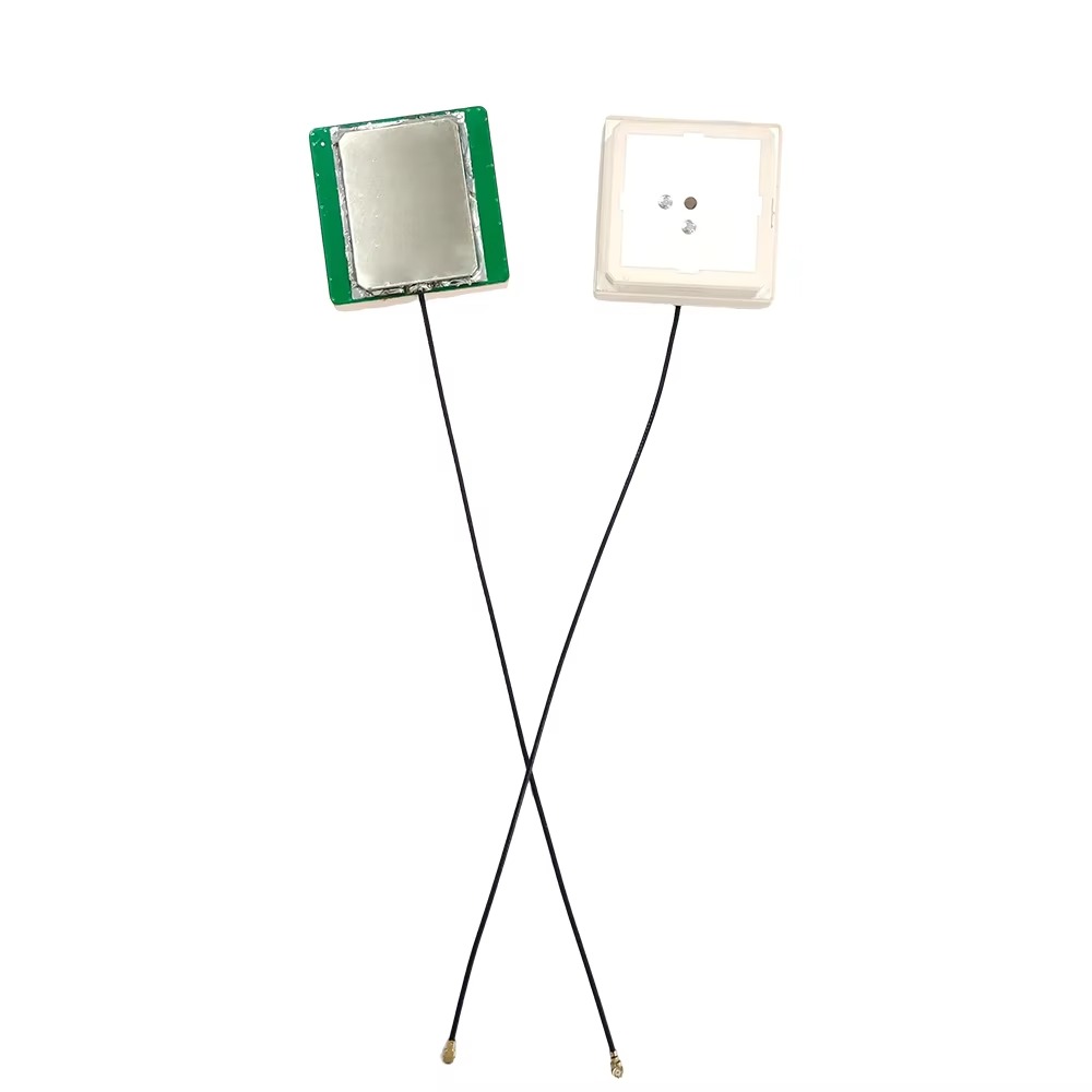
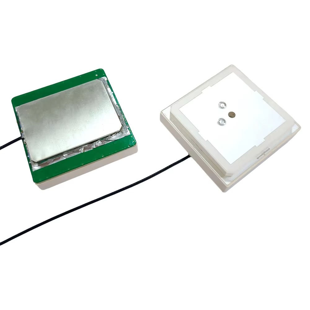
The Antenna Element: This is the actual physical antenna, almost always a multi-frequency, multi-constellation (GNSS) ceramic patch antenna, as described in the previous series. It is designed to receive L1, L2, and increasingly L5/E5a signals from GPS, GLONASS, Galileo, and BeiDou. Its design prioritizes a low profile and a stable phase center to ensure the high-quality carrier-phase measurements needed for RTK. It is embedded within the device's housing, protected by a radome.
The RF Front-End: Immediately behind the antenna element is the RF section. This includes low-noise amplifiers (LNAs) to boost the incredibly weak satellite signals without adding too much noise, filters to reject out-of-band interference (e.g., from cellular signals), and down-converters to shift the RF signal to a lower frequency for processing.
The GNSS SoC (System-on-Chip): The brain of the unit. This is a specialized microprocessor containing multiple high-precision GNSS correlators capable of tracking the carrier phase of the signals. Leading chipsets from companies like u-blox (e.g., F9 series), Broadcom, and STMicroelectronics are common. These SoCs are marvels of modern electronics, capable of tracking dozens of satellites across multiple frequencies simultaneously with extremely low power consumption.
The Microcontroller (MCU): Often, a separate MCU manages the overall system functions: communicating with the GNSS SoC, parsing its data output, handling the user interface (e.g., LED status lights, buttons), managing power, and most importantly, facilitating the communication link (Bluetooth stack or USB serial protocol) to the Android device.
Power Management and Battery: As a mobile device, it requires an integrated power solution. This includes a rechargeable lithium-ion or lithium-polymer battery, a battery charging circuit (often supporting charging via USB-C), and sophisticated power management to maximize battery life, a critical selling point for field users.
Connectivity Modules: This is the defining hardware for Android compatibility.
Bluetooth Module: A pre-certified BT module (often Bluetooth Classic for its Serial Port Profile (SPP) reliability) is integrated to handle the wireless connection.
USB Interface: A USB controller, almost always supporting USB-OTG, allows the device to act as a USB peripheral, presenting itself as a virtual COM (serial) port to the Android device.
2. Mechanical and Industrial Design:
The physical construction is tailored for field use and user experience:
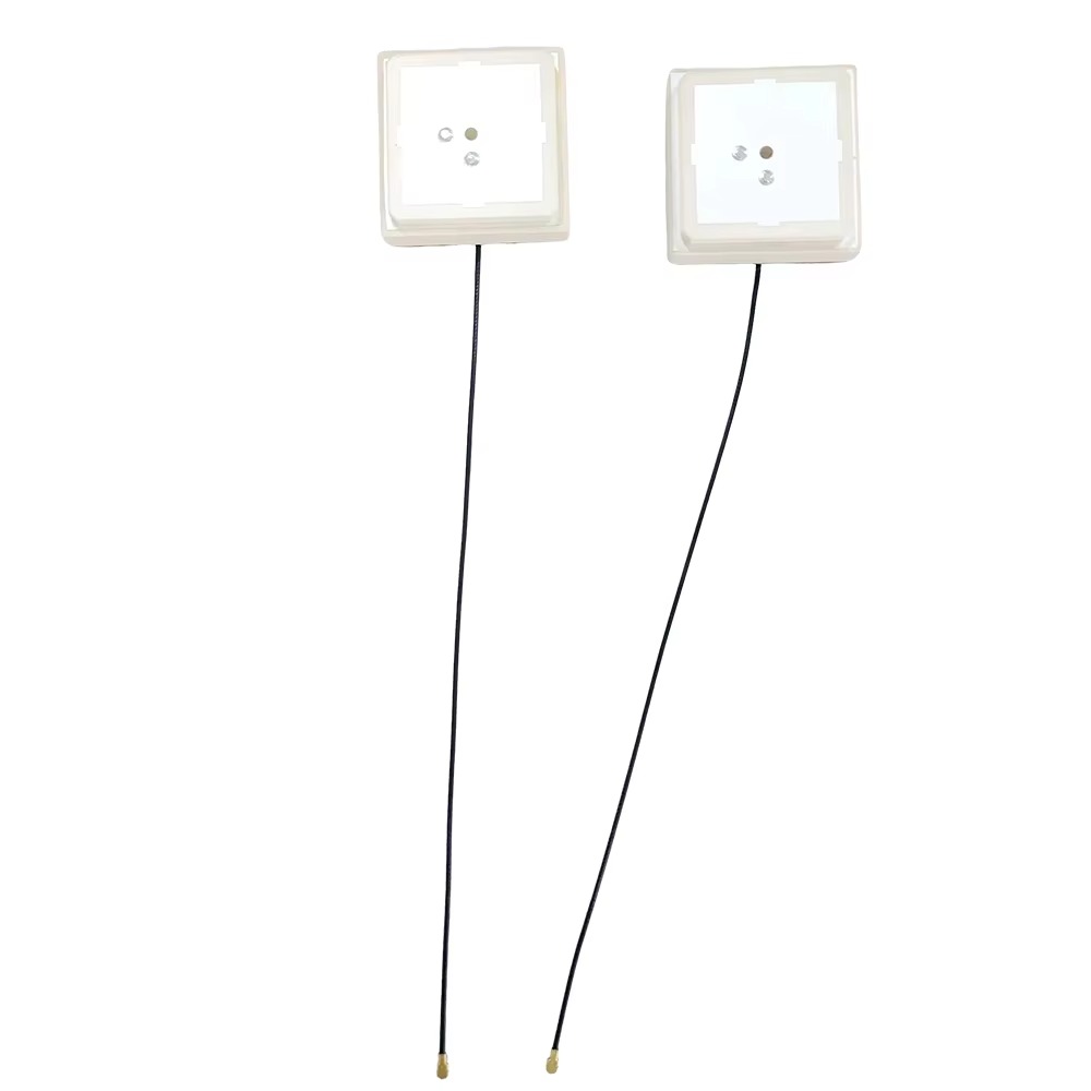
Housing: Typically made from a durable, often IP67-rated, plastic to provide protection against dust and water immersion. The housing must be RF-transparent over the GNSS frequency bands, influencing material choice.
Form Factor: Designs are compact and portable. Common forms include:
The Puck: A small, cylindrical device that can easily be mounted on a pole or placed on a surface.
The Bean: A more elongated oval shape, often designed to be pocketable.
Modular Designs: Some systems feature a separate antenna head connected by a cable to a receiver/battery module, offering flexibility in mounting.
User Interface (UI): Simple but effective UI is crucial. This usually consists of multi-color LEDs to indicate power, battery status, Bluetooth pairing status, and RTK fix status (e.g., single, float, fix). A single button for power on/off and Bluetooth pairing is standard.
Mounting Options: Most units include a standard threaded socket (e.g., 5/8"-11 or 1/4"-20) to attach to surveyor's poles, camera tripods, or vehicle mounts.
3. The "Compatibility" in Design:
A significant part of the design effort goes into ensuring seamless operation with the vast and fragmented Android ecosystem. This involves:
Driverless Operation: The device must work without requiring the user to install custom drivers on their Android device. This is achieved by adhering strictly to standard communication protocols like Bluetooth SPP and the USB Communications Device Class (CDC) profile, which Android recognizes natively as a serial port.
Power Negotiation (USB-OTG): The device must correctly handle power delivery over USB-OTG, deciding when to draw power from the phone to charge its own battery or when to supply power to the phone to prevent it from draining.
Data Protocol Design: The data stream sent to the Android device is meticulously designed. It almost always includes standard NMEA 0183 sentences (e.g., GGA, RMC) for basic position and time, which any mapping app can understand. Crucially, it also outputs proprietary binary messages (e.g., UBX for u-blox, RTCM 3.x for correction data input) that contain the raw observation data (carrier phase, pseudorange) needed for the Android app to perform RTK calculations or to relay to a correction service.
In essence, the design of an Android-compatible RTK antenna is a symphony of RF engineering, digital processing, industrial design, and software integration, all orchestrated to deliver a plug-and-play high-precision experience to the mass market.
The journey from a satellite orbiting 20,000 km away to a centimeter-accurate point on an Android tablet screen is a complex process involving physics, mathematics, and clever engineering. The Android-compatible RTK antenna is the crucial bridge in this process, responsible for the first and most critical steps.
1. Signal Reception and Initial Processing:
The process begins at the antenna element, which captures the faint, right-hand circularly polarized (RHCP) electromagnetic waves transmitted by the GNSS satellites. These signals, traveling at the speed of light, contain ranging codes (C/A code, P code) and a carrier wave (L1, L2, L5). The antenna's low-noise amplifier (LNA) boosts these signals while adding minimal noise.
Inside the GNSS System-on-Chip (SoC), the following occurs:
Correlation and Tracking: The receiver generates replicas of the satellites' ranging codes. It then correlates these internal replicas with the incoming signals from the antenna. By sliding the internal code until it aligns (correlates) with the incoming code, it measures the time delay, which is used to calculate the pseudorange—a rough distance measurement corrupted by clock errors and atmospheric delays.
Carrier-Phase Tracking: This is the key to RTK. The receiver also locks onto the carrier wave itself and tracks its phase with extreme precision. The wavelength of the L1 carrier is only 19 cm. The receiver can measure the phase of this wave to within a small fraction of a wavelength, potentially enabling millimeter-level measurements. However, this measurement only provides the fractional part of the wavelength; the integer number of full wavelengths between the satellite and receiver (the integer ambiguity) is unknown initially.
2. The Role of Correction Data:
For standalone GPS, errors from satellite clocks, orbits, and the atmosphere (ionosphere and troposphere) limit accuracy to several meters. RTK eliminates these errors by using a base station. This is a second GNSS receiver set up on a known, precisely surveyed location.
The base station, knowing its exact location, calculates what the pseudorange and carrier-phase measurements should be for each satellite it sees.
It compares these calculated values to its actual measurements. The differences are the errors.
These error corrections are formatted into a standard protocol, typically RTCM 3.x (Radio Technical Commission for Maritime Services), and broadcast to the rover—the Android-compatible RTK antenna in the field.
3. Data Flow in the Android Ecosystem:
This is where the "Android-compatible" functionality takes center stage. There are two primary operational modes:
Mode 1: Rover receives corrections via its own connection (e.g., cellular). The Android device, with its internet connectivity (4G/5G), uses an app to connect to an NTRIP (Networked Transport of RTCM via Internet Protocol) caster service. This service streams the RTCM correction data from a nearby base station. The app then relays this correction data to the RTK antenna module via the Bluetooth or USB connection.
Mode 2: Rover receives corrections directly from a base station. A dedicated base station (which could be another identical unit) broadcasts corrections via its own radio link (e.g., UHF, LoRa). The Android-compatible rover antenna has a separate radio receiver built-in to receive this signal directly.
Upon receiving the RTCM corrections, the rover's GNSS SoC performs the RTK engine magic. It uses the corrections to virtually eliminate the common errors (satellite clock, orbit, atmosphere) from its own measurements. It then engages in a complex mathematical process to resolve the integer ambiguities on its carrier-phase measurements. Once these integers are resolved, the position solution "fixes" and jumps from meter-level ("float" solution) to centimeter-level ("fixed" solution) accuracy.
4. Delivering the Precision to the App:
The final step is outputting this precise location. The antenna module constructs standard NMEA 0183 sentences, most importantly the GGA sentence, which contains latitude, longitude, altitude, and—crucially—a flag indicating the type of fix (None, GPS, DGPS, RTK Float, RTK Fixed). When the Android app receives a GGA sentence with the RTK Fixed flag and centimeter-level coordinates, it can then display the precise point on its map interface, record it for mapping, or use it for guidance.
Importantly, some advanced workflows bypass the receiver's internal RTK engine. The antenna can output the raw observation data (pseudorange, carrier-phase, Doppler) to the Android device. Powerful apps can then perform the entire RTK calculation process themselves using the phone's processor, offering developers more flexibility and control over the positioning algorithm. This raw data interface is a key feature for advanced applications and research.
The integration of high-precision GNSS with the Android platform creates a powerful synergy, but it also introduces a unique set of advantages and challenges that distinguish it from traditional, proprietary RTK systems.
Advantages:
Extreme Cost Accessibility: This is the most transformative advantage. Users can leverage a device they already own (a smartphone or tablet) as the display, processor, and data link. They only need to purchase the antenna/receiver module, which costs a fraction of a full proprietary system. This opens up high-precision mapping to individuals, small businesses, and educational institutions with limited budgets.
Unmatched Software Flexibility and Choice: The Android ecosystem is defined by choice. Users are not locked into a single vendor's proprietary software. They can choose from dozens of apps on the Google Play Store tailored for specific tasks: general surveying, agricultural area mapping, construction stakeout, utility asset mapping, etc. This fosters innovation and allows users to select the best tool for their specific job.
Familiar and Powerful User Interface: Android devices offer large, high-resolution, capacitive touchscreens that are far more intuitive and user-friendly than the often-clunky keypads and smaller screens of dedicated survey controllers. The learning curve for operating the system is significantly reduced.
Integrated Connectivity: The Android device provides built-in, high-speed internet connectivity via cellular data for easily receiving NTRIP correction streams. It also has Wi-Fi, Bluetooth, and USB, simplifying the entire data workflow from receiving corrections to exporting final maps and reports.
Rapid Innovation and Update Cycles: The pace of innovation in the consumer mobile market is breathtaking. New Android devices with faster processors, better batteries, and improved displays are released annually. By leveraging this platform, the GNSS industry effectively rides this wave of innovation, constantly benefiting from improved hardware without having to develop it themselves.
Challenges and Limitations:
Device and OS Fragmentation: The great strength of Android—its openness—is also a significant challenge. The vast array of device manufacturers, models, and Android OS versions creates a compatibility nightmare. An app might work perfectly on a Google Pixel but crash on a Samsung tablet due to driver issues, Bluetooth stack implementation differences, or USB-OTG support that isn't fully compliant. Developers must test on a huge range of hardware.
Ruggedness and Fieldworthiness: A consumer smartphone is not designed for the harsh conditions of a construction site or a muddy field. They are susceptible to water, dust, drops, and extreme temperatures. While ruggedized cases exist, they add bulk and cost. Dedicated survey controllers are typically MIL-STD-810 rated and built to withstand these conditions inherently.
Battery Life and Power Management: Running the GNSS receiver, Bluetooth, cellular data, and a bright screen simultaneously places a huge drain on the Android device's battery. A full day of work in the field often requires external battery packs, which adds another piece of gear to manage. In contrast, dedicated controllers are optimized for power efficiency in this specific task.
Screen Visibility: Consumer phone and tablet screens can be very difficult to read in direct, bright sunlight, unlike dedicated controllers that often use transflective displays designed for outdoor visibility.
Professional Perception and Support: For some traditional industries like professional land surveying, the use of a consumer phone and an "app" can be perceived as less professional or less reliable than a purpose-built, certified, and supported proprietary system. Furthermore, warranty and technical support can be more complex when dealing with two different manufacturers (phone and antenna) instead of one integrated vendor.
Mitigating the Challenges:
The industry is actively addressing these challenges. App developers perform extensive compatibility testing and maintain lists of supported devices. Manufacturers are building more ruggedized Android devices aimed at the enterprise market. External battery cases and high-brightness sunlight-readable tablets are available, albeit at a higher cost. As the technology proves its reliability and accuracy in demanding applications, professional perception is gradually changing.
The advantages of cost, flexibility, and a superior user interface are so compelling that for a massive segment of the market, these challenges are not deal-breakers but merely hurdles to be managed. The trend is unequivocally moving towards the adoption of Android-based solutions for an ever-widening range of precision positioning tasks.
The fusion of Android's computing power with centimeter-accurate positioning has catalyzed a wave of innovation, creating new applications and transforming existing workflows across numerous industries. The future points towards even deeper integration and smarter systems.
Current Applications:
Precision Agriculture: Farmers use Android tablets mounted in tractors with connected RTK receivers for auto-guidance, reducing overlap and saving on inputs. They are also used for field mapping, yield monitoring, and variable rate application planning using simple, intuitive apps.
Construction and Earthworks: Site foremen and machine operators use Android devices for quick verification of grades, layout of points, and as-built surveying. Small excavation companies can now afford RTK for machine control and site grading.
Drone Mapping (UAV): Drones equipped with RTK modules use an Android device as the ground control station (GCS). The RTK connection provides precise real-time positioning of the drone itself, enabling highly accurate mapping without the need for ground control points (GCPs), drastically reducing fieldwork time.
Utilities and Asset Management: Gas, water, and electricity companies use these systems for mapping underground assets, recording manhole locations, and inspecting infrastructure. The affordability allows them to equip many more field crews with high-precision tools.
Environmental and Scientific Monitoring: Researchers and conservationists map invasive species, monitor erosion, record archaeological sites, and conduct forestry inventories with a level of precision previously unavailable outside well-funded projects.
Education and Training: Universities and technical colleges can now afford to equip entire classrooms with RTK systems, allowing students to gain hands-on experience with high-precision GNSS, which is becoming an essential skill in many geospatial fields.
Future Trends:
Tighter Hardware Integration: The next logical step is the complete integration of the RTK receiver directly into the Android device. We are already seeing the beginning of this with chipsets like the Broadcom BCM4778, which offers dual-frequency GNSS and is integrated into some smartphones. Future devices may feature built-in multi-frequency antennas and full RTK engine support, making centimeter-accuracy a native feature of every high-end phone.
Enhanced Correction Services and Cloud Processing: The proliferation of low-cost GNSS reference station networks and the rise of PPP-RTK (Precise Point Positioning - Real Time Kinematic) correction services will make it easier than ever to get a centimeter-accurate fix anywhere, without the need for a local base station. The Android device will seamlessly pull these corrections from the cloud. Furthermore, raw data might be sent to the cloud for processing, offloading complex calculations from the device.
Deep Sensor Fusion with Android APIs: Android provides rich APIs for accessing onboard sensors like the IMU (Inertial Measurement Unit), camera, and barometer. Future apps will deeply fuse RTK positioning with visual odometry from the camera and inertia from the IMU. This will provide continuous, reliable positioning even when the satellite signal is temporarily blocked—in urban canyons, under tree canopy, or indoors—by using the other sensors to "dead reckon" until the GNSS signal returns.
AR (Augmented Reality) Integration: Centimeter-accurate positioning is the missing link for outdoor AR. Imagine looking at your Android phone's camera view and seeing underground utilities painted onto the pavement, property boundaries overlayed on the landscape, or construction designs visualized on the empty site. This "X-ray vision" for infrastructure and planning will become a reality.
The Autonomous Everything Revolution: As we move towards autonomous vehicles, robots, and smart city infrastructure, the demand for reliable, affordable, and precise positioning will explode. The Android platform, with its vast developer community and powerful hardware, is poised to be the central computing hub for many of these systems, with the external RTK antenna providing the essential ground-truth location data.
The Android-compatible RTK antenna is not just a peripheral; it is a key that has unlocked the door to a future where precise location is a ubiquitous utility, integrated into every aspect of how we measure, manage, and interact with the physical world.
Conclusion
The advent of the GPS RTK antenna compatible with Android devices is far more than a mere technical novelty; it is a profound democratizing force that is reshaping the landscape of geospatial technology. It represents a classic disruptive innovation: taking a capability that was expensive, complex, and confined to experts, and making it affordable, accessible, and simple enough for a much broader audience to use.
This transition has been powered by a powerful synergy. On one side, the relentless innovation of the consumer electronics industry provided a potent, connected, and user-friendly computing platform in the form of Android smartphones and tablets. On the other side, advancements in semiconductor technology miniaturized and reduced the cost of high-precision GNSS receivers. The Bluetooth and USB-OTG interfaces provided the simple, standard bridge between these two worlds.
The impact is tangible. A farmer can now achieve sub-inch guidance for a fraction of the historical cost. A student can learn the principles of geomatics with professional-grade tools. A small construction firm can compete with larger players by adopting efficient precision layout techniques. This widespread accessibility fosters innovation, as developers create niche applications for problems that large GNSS manufacturers would never have considered addressing.
Of course, this new paradigm is not without its challenges. The variability of the Android ecosystem, the ruggedness of consumer devices, and power management concerns are real considerations for professional users. However, these are not inherent flaws but rather practical hurdles that are being overcome through better hardware, more robust software, and a growing understanding of how to deploy these systems effectively in the field.
Looking forward, the boundary between the external antenna and the Android device itself will continue to blur. Native, chip-level integration of multi-frequency GNSS and RTK capabilities into smartphones is the inevitable endpoint. When centimeter-accuracy becomes a standard feature on mobile devices, it will trigger a second wave of innovation, enabling applications in augmented reality, hyper-contextual services, and large-scale IoT that we can only begin to imagine.
In conclusion, the Android-compatible RTK antenna is a catalyst. It has broken down economic and technical barriers, empowered a new generation of users, and accelerated the integration of precise location intelligence into our daily workflows. It stands as a testament to the power of open platforms and standardized interfaces, proving that the most significant technological advances often come not from creating something entirely new, but from creatively connecting existing technologies in ways that unlock their collective potential for everyone.

 86 0755 2819 9597
Lucy Yang | lucy.y@toxutech.com
Nicole Li | nicole@toxutech.com
Dotty Zhao | sales04@toxutech.com
Global Business Director / Sales Team / Global Operations


 En
En Cn
Cn Korean
 Home >


