

-
Products -PCBA Manufacturing RF Connectors RF Cable Assemblys Embedded Antennas External Antennas Positioning Chips and Modules
RF Connectors

RF Cable Assemblys
Embedded Antennas
External Antennas
Positioning Chips and Modules


 Language


Language


The revolution in Unmanned Aerial Vehicle (UAV) mapping, or drone surveying, has fundamentally altered the geospatial industry. It enables the rapid, safe, and cost-effective creation of high-resolution orthomosaics, digital surface models (DSMs), and 3D point clouds for vast areas. The accuracy of these products, however, is intrinsically tied to the precision of the geolocation data assigned to each captured image. This is where the GPS Real-Time Kinematic (RTK) active antenna transitions from a peripheral component to the central linchpin of the entire aerial mapping workflow. It is the critical sensor that elevates a drone from a simple flying camera to a powerful geospatial data collection platform.
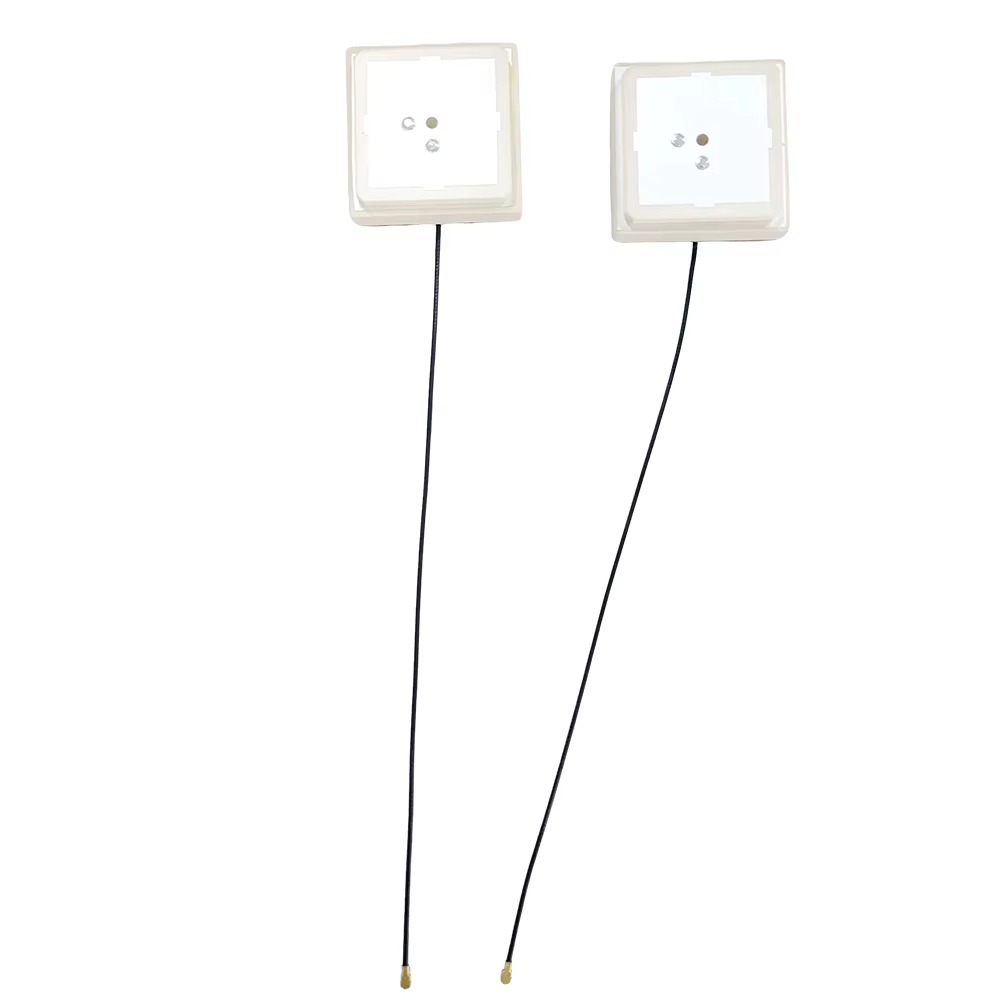
A UAV-mounted RTK antenna is a specialized variant of the geodetic antenna, engineered for the unique demands of aerial operation. Its primary function is to receive faint signals from multiple Global Navigation Satellite Systems (GNSS)—including GPS (USA), GLONASS (Russia), Galileo (EU), and BeiDou (China)—and provide a stable, centimeter-accurate position for the camera's perspective center at the moment of each image capture. This process, known as direct georeferencing, minimizes or even eliminates the need for numerous ground control points (GCPs), which are traditionally surveyed in and placed throughout the project area. The elimination of GCPs represents a massive saving in time, labor, and cost, while also enhancing safety by reducing the need for personnel to access potentially hazardous terrain.
The core challenge for a UAV RTK antenna is operating in a dynamic, vibrating, and electrically noisy environment. Unlike a static survey antenna on a tripod, the drone antenna is subject to constant movement, high-frequency vibrations from the motors and propellers, rapid changes in attitude (pitch, roll, yaw), and potential interference from the drone's own electronics, including flight controllers, video transmitters, and power systems. Furthermore, it must do all this while adhering to the strict constraints of UAV design: it must be extremely lightweight to not impact flight time, have a low aerodynamic profile to minimize drag, and be physically robust to withstand wind gusts and the occasional rough landing.
The evolution of these antennas has been rapid. Early drone mapping often involved strapping a generic survey antenna to the drone's frame, leading to suboptimal performance due to multipath from the drone's body, EMI noise, and poor phase center stability. Today's antennas are purpose-built. They are meticulously integrated into the airframe's design, often mounted on a dedicated ground plane or a mast that positions them above the propellers and away from noise-generating components. They are designed to be low-profile, lightweight, and to have a radiation pattern that is near-omnidirectional to maintain satellite lock even during aggressive maneuvers.
The value proposition is clear: by providing a precise position for every image, the RTK antenna enables photogrammetric software to process imagery with极高的精度 (extremely high accuracy), stitching it together into a geographically accurate model. The accuracy is no longer solely dependent on the manual measurement of features in overlapping images; it is anchored from the outset to a known global coordinate system. This makes the GPS RTK active antenna not just an accessory, but the foundational element that unlocks the full potential of survey-grade drone mapping, transforming raw imagery into trustworthy, measurable, and actionable spatial intelligence.
The design and construction of a GPS RTK active antenna for UAV applications is a masterclass in multi-objective optimization. Engineers must balance the uncompromising demand for geodetic performance with the harsh physical and environmental realities of aerial deployment. Every gram, every millimeter, and every material choice is scrutinized for its impact on both RF performance and flight characteristics.
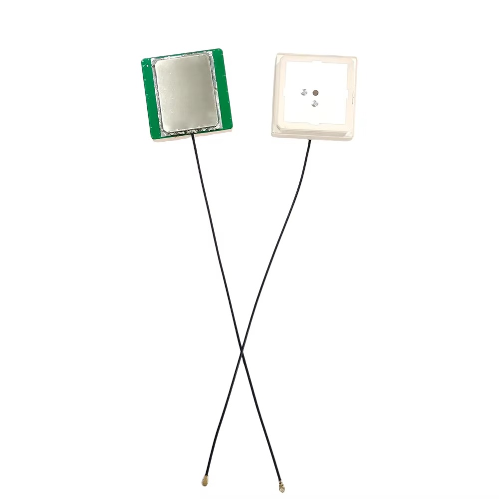
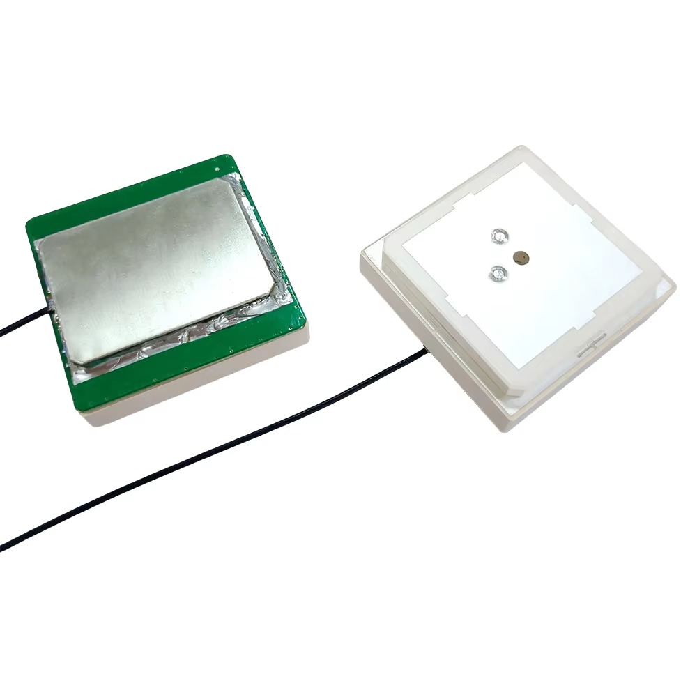
The most critical design element is the antenna element itself. The majority of high-performance UAV antennas use a stacked patch design. This involves multiple conductive patches separated by dielectric layers. This design is favored because it provides several key benefits essential for UAVs:
Multi-Band Operation: A single stacked patch can be designed to resonate efficiently across all major GNSS frequency bands (L1, L2, L5 for GPS; E1, E5a, E5b for Galileo; etc.). This is non-negotiable for rapid and reliable integer ambiguity resolution in an RTK system.
Low Profile: The stacked patch is inherently flat, allowing for a radome height of often less than 15mm. This minimizes aerodynamic drag, a crucial factor for maximizing flight time.
Mechanical Robustness: With no protruding elements, the patch antenna is rugged and can be securely bonded to its substrate, making it highly resistant to vibration.
The second pillar of the design is multipath mitigation. On a drone, multipath doesn't just come from the ground; it comes from the drone itself. Signals can reflect off the carbon fiber arms, the battery, the camera gimbal, and the landing gear. A large ground plane is the traditional solution, but weight prohibits this. Therefore, UAV antennas employ advanced techniques:
Integrated Ground Plane: A finite-sized ground plane, often made of aluminum, is standard. It provides a reference for the antenna element and helps to pattern the radiation away from the drone's body.
Artificial Magnetic Conductors (AMCs) / Metamaterials: This is the cutting-edge solution. An AMC is a periodic structure (e.g., a pattern of metallic patches) on a dielectric substrate that, for a specific frequency band, behaves like a perfect magnetic conductor. When placed between the antenna element and the drone's body, it creates a "stop band" that prevents waves from penetrating towards the noisy drone electronics and reflects them with a 0-degree phase shift (unlike a normal metal plane's 180-degree shift). This enhances gain towards the sky and suppresses sensitivity to noise and multipath from below.
The radome is far more than a simple cover. For a UAV antenna, it must be:
Extremely Lightweight: Often made from high-grade RF-transparent thermoplastics like Polyetherimide (PEI) or advanced composites.
Aerodynamically Shaped: Designed to slice through the air with minimal resistance. Cylindrical or tear-drop shapes are common.
Environmentally Sealed: Rated to at least IP67 to prevent moisture ingress from rain, fog, or condensation, which would detune the antenna and destroy its calibration.
Inside, the Low-Noise Amplifier (LNA) is mission-critical. Its specifications are paramount:
Ultra-Low Noise Figure: Typically < 2 dB. Any noise added here is amplified down the chain, directly impacting the receiver's ability to track weak signals.
High Gain: Usually between 25-40 dB. This is necessary to overcome the loss in the cable running to the drone's RTK receiver and to elevate the signal well above the receiver's noise floor.
Exceptional Filtering: It must include band-pass filters that are specifically tuned to GNSS frequencies. This is the first line of defense against out-of-band interference from the drone's other systems, such as telemetry radios, video downlinks, and motor controllers.
Minimal Power Consumption: To preserve the drone's flight time, the LNA must be highly efficient, often drawing less than 50mA.
Finally, phase center stability is the holy grail. The antenna must be mechanically rigid. The element, AMC, ground plane, and radome must be bonded into a single, solid unit that does not flex or shift with changes in temperature, humidity, or vibration. Any movement of the internal components translates directly into a movement of the electrical phase center, which the RTK system interprets as a physical movement of the drone, introducing error. The antenna is rigorously calibrated in an anechoic chamber to characterize its Phase Center Offset (PCO) and Phase Center Variations (PCV) across all frequencies and elevation angles. This calibration data (in ANTEX format) is essential for post-processing software to achieve centimeter-level accuracy.
The working principle of a UAV RTK antenna is a continuous battle to extract pristine satellite signals from a profoundly challenging operational environment. It functions as the highly sensitive, always-on ear of the drone's navigation system, but it must listen carefully amidst a cacophony of self-generated noise and constant motion.
The process begins with the antenna's radiation pattern. Through careful design, its sensitivity is maximized for signals arriving from above the horizon (the sky where satellites are) and minimized for signals from below (the drone body and the earth). This shaped pattern is the first filter against multipath and noise. When a right-hand circularly polarized (RHCP) signal from a satellite arrives, it induces a tiny current in the antenna element. The stacked patch design ensures this happens with high efficiency across all targeted GNSS bands.
The incredibly weak signal (around -130 dBm) is immediately passed to the Low-Noise Amplifier (LNA). The LNA's placement directly at the source is strategic. Its ultra-low noise figure ensures it adds minimal electronic "hiss," while its high gain boosts the signal strength significantly. This is crucial because the signal must then travel through a coaxial cable to the RTK receiver, which is typically located inside the drone's body to protect it from the elements. Cable loss can be significant, and without this initial boost, the signal might be irrecoverably buried in the receiver's internal noise. The LNA's integrated filtering is vital here, stripping away powerful RF interference from the drone's other systems that could otherwise saturate the receiver.
The amplified and filtered signal is sent down the cable. The receiver, often integrated with an Inertial Measurement Unit (IMU) in a GNSS-Inertial Navigation System (GNSS-INS), performs the complex task of correlation and carrier-phase tracking. It locks onto the phase of the carrier wave, the key to centimeter accuracy.
However, the drone's environment is dynamic. This is where phase center stability becomes the most critical factor. The antenna's electrical reference point must remain absolutely fixed in relation to the drone's body, specifically relative to the IMU's origin and the camera's perspective center. As the drone vibrates, banks, and accelerates, the physical antenna moves, but its electrical phase center must not wobble or shift independently. If it does, the phase measurements become "noisy," and the Kalman filter inside the RTK/INS system has a much harder time fusing the GNSS data with the inertial data. This can lead to slower integer ambiguity resolution, dropped RTK fixes, or, worst of all, undetected position errors.
During mapping, the drone follows a pre-planned flight path, capturing images at specific geolocated points. At the exact moment of each camera exposure, the precise position of the antenna's phase center is recorded. Using the pre-calibrated lever arm offsets (the precise 3D distance between the antenna's phase center, the IMU's center, and the camera's lens), the post-processing software can calculate the exact location of the camera in space. This process, called Direct Georeferencing, is what allows for the creation of accurately positioned models without ground control.
The antenna, therefore, is not just providing a position. It is providing the stable, high-integrity raw data that allows the entire complex navigation and positioning system to function correctly. It is the bedrock upon which the drone's precise autopilot, the camera's trigger command, and the final map's accuracy are all built.
Integrating an RTK active antenna into a UAV mapping system offers transformative advantages but introduces a set of complex challenges that must be meticulously managed to realize its full potential.
Advantages:
Elimination or Radical Reduction of Ground Control Points (GCPs): This is the most significant advantage. It drastically reduces fieldwork time and cost by up to 90%, removes the safety risk of placing points in dangerous areas, and simplifies the overall workflow.
Superior Absolute Accuracy: While traditional photogrammetry without GCPs can achieve good relative accuracy, it lacks absolute positional accuracy. RTK/PPK provides centimeter-level absolute accuracy directly in a global coordinate system (e.g., ITRF, WGS84) or a local grid.
Consistent Accuracy Across the Project Area: GCPs provide accurate control only at their specific locations. Accuracy can diminish between GCPs. An RTK-enabled drone provides uniform, high accuracy across the entire project area, including areas inaccessible for GCP placement like rivers, cliffs, or active construction sites.
Direct Georeferencing for Efficiency: The precise geotagging of images streamlines the photogrammetric processing workflow. It provides strong initial estimates for image alignment, reducing processing time and increasing the robustness of the bundle adjustment, especially in areas with limited texture or repetitive patterns.
Support for Corridor and Linear Mapping: Mapping long, thin projects like roads, railways, and pipelines with GCPs is logistically challenging. An RTK/PPK drone can fly these missions efficiently without the need for a continuous line of GCPs.
Challenges and Limitations:
System Integration Complexity: The antenna is not a standalone solution. Its performance is tied to the quality of the RTK receiver, the IMU, and the precision of the calibration between them. Determining the exact lever arms between the antenna phase center, the IMU origin, and the camera perspective center is a critical and sensitive process. A error of just 1 cm in a lever arm measurement will manifest as a 1 cm error in the final model.
Vibration and Phase Center Stability: Despite robust construction, extreme vibration can still subtly affect the antenna's performance and phase center stability. While rare in high-quality units, it remains a potential source of error that is difficult to diagnose.
Electromagnetic Interference (EMI): The drone's platform is electrically noisy. Despite filtering in the LNA, strong interference from poorly shielded components can still degrade performance, leading to a lower number of tracked satellites or increased noise.
Cost: A high-quality UAV RTK antenna, coupled with the necessary GNSS-INS receiver, represents a significant investment, often adding thousands of dollars to the cost of a mapping drone. This can be a barrier to entry for smaller operations.
Calibration Criticality: The system's accuracy is entirely dependent on the use of the correct antenna calibration file (ANTEX) and accurate lever arm measurements. Using a generic antenna model or estimating lever arms will introduce systematic errors that invalidate the promised centimeter-level accuracy.
PPK vs. RTK Workflow: Maintaining a continuous, robust RTK correction link during flight can be challenging over long ranges or in areas with poor communication. Many operators prefer a Post-Processed Kinematic (PPK) workflow, which records raw data on the drone and base station for processing after the flight. This adds a post-processing step but is generally more reliable.
The integration of precise GNSS positioning has unlocked a vast array of applications for UAVs that extend far beyond basic mapping.
Applications:
Surveying and Construction: Volumetric calculations for stockpiles and cut/fill, progress monitoring, site inspection, and as-built verification against CAD models.
Precision Agriculture: Creating accurate elevation models for drainage planning, assessing crop health through NDVI maps, and enabling variable rate application of inputs.
Corridor Mapping: Surveying highways, railways, pipelines, and power lines with unparalleled efficiency and safety, minimizing disruption to operations.
Mining: Large-scale topographic surveying for reserve calculation, planning, and compliance monitoring in open-pit mines.
Environmental Monitoring: Tracking coastal erosion, mapping forestry assets, monitoring wildlife habitats, and assessing flood or fire damage.
Public Safety and Disaster Response: Rapidly mapping disaster zones (earthquakes, landslides, floods) for situational awareness and planning response efforts, often in environments too dangerous for personnel.
Future Trends:
Tighter Sensor Integration: The future lies in fully unified GNSS-IMU-Antenna modules. The antenna will be physically and electronically integrated with the IMU and receiver into a single, factory-calibrated unit. This will eliminate lever arm measurement errors and simplify system integration for drone manufacturers.
On-the-Fly Calibration and AI: Future systems may use AI to continuously monitor the antenna's performance and the quality of the raw data, automatically detecting and compensating for subtle phase center instabilities or multipath effects in real-time.
Miniaturization and Reduced Power: Antennas and LNAs will become even smaller, lighter, and more power-efficient, enabling their use on smaller drones and longer flight times.
Multi-Frequency, Multi-Constellation as Standard: Support for all signals from all constellations will become the baseline, maximizing satellite availability and enabling ever-faster and more reliable integer fixes in challenging environments.
PPP-RTK Integration: The emergence of Precise Point Positioning (PPP) corrections delivered via satellite or cellular networks, combined with the core stability of a good antenna, will allow for centimeter-level accuracy without the need for a local base station, revolutionizing mapping in remote areas.
Conclusion
The GPS RTK active antenna is the unsung hero and indispensable enabler of modern, survey-grade UAV mapping. It is far more than a simple receiver of satellite signals; it is a sophisticated, precision-engineered component that sits at the very beginning of the data collection chain. Its performance directly dictates the quality of everything that follows.
By providing a stable, precise, and reliable geometric reference point in space, it empowers drones to become more than just data collectors—they become accurate measurement instruments. The ability to know the exact location of each pixel in an image transforms aerial photography into quantifiable spatial intelligence, driving efficiency, safety, and insight across countless industries.
While the challenges of integration, calibration, and operating in a noisy environment are non-trivial, the advantages it confers—most notably the liberation from dense ground control—are transformative. The future of UAV mapping is inextricably linked to the continued evolution of this critical technology. As antennas become smarter, more integrated, and more robust, they will further solidify the drone's position as the premier tool for capturing the precise geometry of our world from above, proving that the foundation of aerial accuracy is built not on wings alone, but on a tiny, powerful, and meticulously designed antenna.

 86 0755 2819 9597
Lucy Yang | lucy.y@toxutech.com
Nicole Li | nicole@toxutech.com
Dotty Zhao | sales04@toxutech.com
Global Business Director / Sales Team / Global Operations


 En
En Cn
Cn Korean
 Home >


