

-
Products -PCBA Manufacturing RF Connectors RF Cable Assemblys Embedded Antennas External Antennas Positioning Chips and Modules
RF Connectors

RF Cable Assemblys
Embedded Antennas
External Antennas
Positioning Chips and Modules


 Language


Language


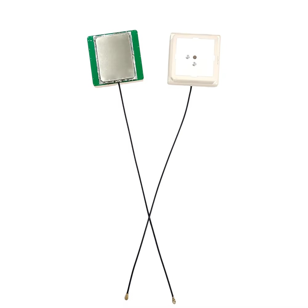


In the domain of precision geospatial technology, the GPS RTK Antenna stands as a pivotal component, enabling real-time kinematic (RTK) systems to achieve centimeter-level positioning accuracy across diverse and challenging environments. As a GNSS RTK Full Band Antenna, it is engineered to capture signals from a comprehensive array of global navigation satellite systems (GNSS), ensuring robust performance in applications ranging from land surveying and construction to precision agriculture and autonomous vehicle navigation. This antenna’s ability to operate across multiple frequency bands, combined with its efficient signal processing and durable design, makes it an indispensable tool for professionals who demand uncompromising accuracy in their work. This detailed analysis explores the technical specifications, operational mechanisms, and practical applications of the GPS RTK Antenna, highlighting its role as a cornerstone of modern precision positioning systems.
RTK technology revolutionizes positioning by leveraging carrier-phase measurements from satellite signals, correcting for errors in real time to achieve sub-centimeter accuracy. At the heart of this system is the GPS RTK Antenna, which captures these critical signals and delivers them to the receiver for processing. Unlike standard GPS antennas, which may only track a single satellite constellation, this full-band antenna is designed to access multiple GNSS networks, including GPS (L1/L2/L5), GLONASS (L1/L2), BDS (B1/B2/B3), and GALILEO (E1/E2/E5a/E5b). This multi-constellation support is essential for maintaining accuracy in environments where satellite visibility is limited, such as urban canyons, dense forests, or remote mountainous regions. By tapping into dozens of satellites simultaneously, the antenna reduces reliance on any single system, ensuring continuous operation even if some satellites are temporarily unavailable.
The antenna’s performance is further enhanced by its ability to process signals across these diverse bands. Each frequency band interacts differently with the atmosphere, allowing the RTK receiver to calculate and correct for ionospheric and tropospheric delays—two major sources of positioning error. For example, GPS L1 and L2 signals experience varying degrees of ionospheric refraction; by comparing these signals, the receiver can refine its calculations, significantly improving accuracy. This multi-band capability is what distinguishes RTK systems from standard GPS, enabling the precision required for critical applications like land surveying and infrastructure construction.
Technical Specifications: Engineering for Precision
The GPS RTK Antenna’s technical parameters are carefully optimized to support high-precision positioning, ensuring reliable signal capture and efficient data transfer:
Frequency Range: Covering GPS L1/L2/L5, GLONASS L1/L2, BDS B1/B2/B3, and GALILEO E1/E2/E5a/E5b, the antenna ensures compatibility with all major global satellite systems. This breadth of coverage is critical for RTK performance, as it allows the antenna to lock onto the strongest available signals, even in challenging environments. For instance, in regions where GPS coverage is sparse, the antenna can seamlessly switch to GLONASS or BDS, maintaining continuous positioning data for the receiver.
Gain: The antenna offers a maximum gain of ≥5.5 dBi for GNSS signals, a value that balances signal amplification with broad beamwidth. This gain is sufficient to amplify weak satellite signals—traveling over 20,000 kilometers from space to Earth—while ensuring the antenna can track satellites across a wide angular range. This is particularly important for mobile applications, such as surveying rovers or agricultural machinery, where the antenna’s orientation relative to the satellites changes constantly. For GSM900/GSM1800 bands (used for transmitting RTK correction data via cellular networks), the antenna provides a gain of ≥-1 dB, ensuring reliable communication with base stations or network RTK services.
Output Standing Wave Ratio (VSWR) ≤2.0: VSWR measures the efficiency of signal transfer between the antenna and the receiver. A value of ≤2.0 indicates that over 90% of the captured signal is transmitted with minimal reflection, preserving the integrity of the carrier-phase data essential for RTK calculations. This efficiency is crucial, as signal loss or reflection can introduce errors, reducing positioning accuracy. The antenna’s design ensures that even weak signals are transmitted effectively, maximizing the receiver’s ability to compute precise positions.
Axial Ratio of ≤3 dB at the Apex: Axial ratio quantifies the antenna’s ability to maintain circular polarization, which is critical for matching the polarization of GNSS satellite signals. A low axial ratio (≤3 dB) ensures that the antenna efficiently captures signals from satellites at varying elevations, minimizing loss due to polarization mismatch. This is especially valuable in dynamic applications, such as moving vehicles or drones, where the antenna’s orientation changes rapidly, and maintaining signal integrity is paramount.
Impedance of 50 Ohms: This industry-standard impedance ensures seamless integration with RTK receivers, coaxial cables, and other system components, maximizing power transfer and reducing signal reflections. Proper impedance matching is essential for maintaining signal integrity, particularly in high-frequency applications where even small mismatches can cause significant loss.
Electrical Efficiency: Operating on a working voltage of 3–18 VDC and a working current of ≤40 mA, the antenna is energy-efficient, making it suitable for battery-powered devices such as portable surveying equipment or drones. This low power consumption extends operational life in the field, reducing the need for frequent recharging or battery replacement.
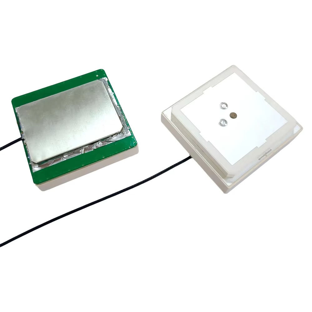
Design and Durability: Built for Field Operations
The GPS RTK Antenna’s design prioritizes durability, ease of integration, and reliable performance in harsh environments:
Connector Type: Equipped with MCX-KHD connectors for both GNSS and 4G signals, the antenna ensures secure, low-loss connections to receivers and communication modules. MCX connectors are compact and feature a threaded coupling mechanism, preventing accidental disconnection in high-vibration environments—common in construction, agriculture, or transportation applications. This robust connectivity is critical for maintaining continuous data flow, which is essential for RTK accuracy.
Material and Construction: While specific materials are not detailed, the antenna is engineered to withstand the rigors of outdoor use, including exposure to moisture, dust, extreme temperatures, and physical impact. Its rugged design ensures reliable performance in rain, snow, or intense sunlight, making it suitable for year-round field operations in diverse climates.
Form Factor: The antenna’s compact design allows for flexible mounting on surveying poles, vehicle roofs, drones, or agricultural machinery. Its low profile minimizes wind resistance and reduces the risk of damage, while its lightweight construction ensures it does not interfere with the operation of mobile equipment.
The GPS RTK Antenna’s versatility and precision make it indispensable across a range of industries:
Land Surveying and Mapping: Surveyors rely on the antenna to collect accurate data for boundary mapping, topographic surveys, and construction site planning. The antenna’s multi-constellation support ensures reliable performance even in urban areas or under tree cover, where traditional GPS antennas might struggle. RTK technology, enabled by this antenna, reduces survey time by up to 50% compared to conventional methods, while delivering sub-centimeter accuracy.
Construction and Infrastructure: In construction, the antenna guides heavy machinery such as excavators, graders, and pavers, ensuring that work is performed to exact specifications. For example, when grading a construction site, the antenna provides real-time positioning data to the machine’s control system, ensuring the terrain is shaped to within centimeters of the design plans. This precision reduces rework, minimizes material waste, and accelerates project timelines.
Precision Agriculture: Farmers use RTK-equipped machinery, paired with this antenna, to optimize planting, fertilization, and harvesting. By maintaining sub-centimeter accuracy, the equipment can plant seeds in straight lines with uniform spacing, apply fertilizers only where needed, and harvest crops with minimal waste. This not only increases yields but also reduces input costs and environmental impact, making farming more sustainable.
Autonomous Vehicles and Drones: Self-driving cars, agricultural drones, and robotic equipment depend on the antenna for precise navigation. For instance, a drone used for crop monitoring can use the antenna to maintain a stable position over a field, capturing consistent images for analysis. Autonomous tractors use the antenna to navigate between rows of crops, avoiding damage and ensuring efficient operation.
Marine and Coastal Surveying: Hydrographic surveyors use the antenna to map seabeds, chart coastal erosion, and locate underwater infrastructure such as pipelines or cables. The antenna’s multi-constellation support ensures accuracy even in remote oceanic regions, where satellite visibility may be limited.
The GPS RTK Antenna offers several key advantages over standard GPS antennas:
Multi-Constellation Support: By accessing multiple GNSS networks, the antenna ensures reliability and accuracy in regions where single-constellation coverage is weak.
High Precision: The antenna’s design, including its gain, VSWR, and axial ratio, enables carrier-phase measurements essential for RTK’s sub-centimeter accuracy.
Versatility: Integration with GSM bands allows for seamless transmission of RTK correction data, eliminating the need for separate communication antennas.
Durability: Built to withstand harsh environmental conditions, the antenna ensures reliable performance in the field, reducing downtime and maintenance costs.
The GPS RTK Antenna is a critical component in modern precision positioning systems, enabling applications that demand sub-centimeter accuracy. Its ability to capture signals from multiple GNSS constellations, combined with its efficient design and durable construction, makes it an indispensable tool for surveyors, construction workers, farmers, and autonomous system developers. As global satellite networks continue to expand and improve, the role of this antenna in enabling precision will only grow, driving innovation across industries and making our world more efficient, sustainable, and connected.
In a world where accuracy is increasingly important, the GPS RTK Antenna stands as a testament to engineering excellence, proving that the right technology can transform how we interact with and shape our environment. Whether mapping a remote wilderness, building a skyscraper, or cultivating a field, this antenna ensures that every measurement is precise, every movement is guided, and every project is executed with unparalleled accuracy.

 86 0755 2819 9597
Lucy Yang | lucy.y@toxutech.com
Nicole Li | nicole@toxutech.com
Dotty Zhao | sales04@toxutech.com
Global Business Director / Sales Team / Global Operations


 En
En Cn
Cn Korean
 Home >


