

-
Products -PCBA Manufacturing RF Connectors RF Cable Assemblys Embedded Antennas External Antennas Positioning Chips and Modules
RF Connectors

RF Cable Assemblys
Embedded Antennas
External Antennas
Positioning Chips and Modules


 Language


Language


In the dynamic world of unmanned aerial vehicles (UAVs), or drones, the GNSS drone antenna emerges as a linchpin technology that enables these sophisticated machines to navigate with pinpoint accuracy, execute complex missions, and deliver reliable data across industries ranging from agriculture and surveying to search and rescue. At the core of this capability lies a seamless integration with advanced GNSS receivers, such as the specified GNSS RTK Receiver, which combines multi-constellation support, real-time kinematic (RTK) precision, and robust performance to meet the rigorous demands of aerial operations. With compatibility across GPS, GLONASS, BDS, Galileo, and QZSS, RTK accuracy of 0.01 m + 1 ppm CEP, standard accuracy of 1.5 m CEP, and a suite of other high-performance features, the GNSS drone antenna, working in tandem with such a receiver, redefines what is possible in drone navigation.
The ability to tap into multiple global navigation satellite systems (GNSS) is a defining feature of this setup, and it forms the foundation of its reliability and accuracy. The inclusion of GPS (United States), GLONASS (Russia), BDS (China), Galileo (Europe), and QZSS (Japan) ensures that the drone has access to a vast network of satellites orbiting the Earth, significantly reducing the risk of signal loss or degradation in challenging environments. In contrast to antennas that rely on a single constellation, this multi-constellation support provides redundancy—if signals from one system are obstructed by terrain, buildings, or atmospheric interference, the antenna can seamlessly switch to another. For example, in urban canyons where tall buildings block low-elevation GPS satellites, GLONASS or BDS satellites positioned at different angles may still be visible, ensuring the drone maintains a stable position fix. This is particularly critical for applications like urban mapping or infrastructure inspection, where even momentary loss of navigation data could lead to collisions or mission failure. Additionally, each constellation operates on slightly different frequencies and signal structures, which helps mitigate the effects of multipath interference—where signals reflect off surfaces before reaching the antenna—by providing diverse data points for position calculation.
The RTK accuracy of 0.01 m + 1 ppm CEP (Circular Error Probable) is a game-changer for drone applications that demand sub-centimeter precision. RTK technology works by combining signals from the drone’s GNSS receiver with corrections from a fixed base station, which is precisely surveyed at a known location. The base station calculates the difference between its measured position and its actual position, then broadcasts these correction data to the drone in real time. This allows the drone’s receiver to adjust its position calculations, eliminating most of the errors introduced by atmospheric conditions, satellite clock inaccuracies, and orbital variations. The 0.01 m (1 centimeter) baseline accuracy, combined with a 1 ppm (parts per million) error for distance traveled, ensures that even over long missions, the drone’s position remains remarkably precise. For instance, in agricultural drone operations, this level of accuracy enables precise application of fertilizers or pesticides, avoiding overlap and reducing waste. In construction surveying, drones can capture 3D models of job sites with millimeter-level detail, allowing contractors to monitor progress with unprecedented accuracy. Without such a high-performance antenna to receive both the satellite signals and the RTK corrections, this level of precision would be unattainable, as any signal degradation would introduce errors that negate the benefits of the correction data.
Complementing the RTK capability is the standard accuracy of 1.5 m CEP, which serves as a reliable fallback when RTK corrections are unavailable—such as in remote areas without base station coverage—or during temporary signal disruptions. CEP is a statistical measure indicating that 50% of position fixes will fall within a circle of the specified radius, so a 1.5 m CEP means that half of the drone’s position readings will be within 1.5 meters of its true location. This level of accuracy is more than sufficient for many general drone missions, such as aerial photography, wildlife monitoring, or search and rescue operations where a broader area is being covered. The antenna’s design plays a crucial role in maintaining this standard accuracy by ensuring consistent reception of satellite signals even in less-than-ideal conditions. Its radiation pattern, for example, is optimized to capture signals from satellites across a wide portion of the sky, including those near the horizon, which is essential for maintaining a sufficient number of satellite locks (typically 4 or more) to calculate a position. Additionally, the antenna’s noise figure—a measure of how much it amplifies unwanted noise relative to the signal—is minimized to ensure that even weak signals from low-elevation satellites are detected and processed correctly by the receiver.
The output protocols supported by the receiver—NMEA, UBX, and RTCM 3.3—highlight the antenna’s role in facilitating seamless data flow between the drone’s navigation system and its other components. NMEA (National Marine Electronics Association) protocols are the industry standard for GNSS data, ensuring compatibility with most drone flight controllers, mapping software, and third-party applications. UBX protocols, specific to u-blox (the manufacturer of the ZED-F9P chip), provide more detailed and proprietary data, such as raw measurement information, which is essential for advanced applications like RTK processing. RTCM 3.3 (Radio Technical Commission for Maritime Services) is the standard for broadcasting RTK correction data, enabling the drone to receive corrections from base stations or network RTK services. The antenna’s ability to receive and pass along these diverse data formats without corruption is critical, as any loss or distortion of protocol data could lead to misinterpretation of position information by the drone’s flight controller. This underscores the importance of the antenna’s signal integrity—from reception of satellite signals to transmission of data through its cable and connectors—ensuring that the raw data is preserved for accurate processing by the receiver.
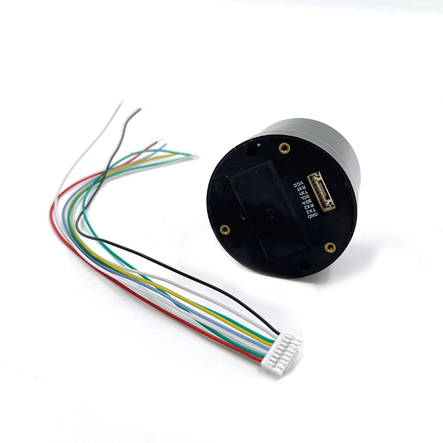
At the heart of the system is the ZED-F9P main chip, a high-performance GNSS receiver module from u-blox that sets the standard for precision navigation in demanding applications. The ZED-F9P is specifically designed for RTK operations, with advanced features such as multi-band reception (supporting L1 and L5 frequencies for GPS, among others), which enhances its ability to mitigate interference and improve accuracy. The chip’s tight integration with the drone antenna is essential, as the antenna’s performance directly impacts the quality of the signals that the ZED-F9P processes. For example, the antenna’s polarization (typically right-hand circular polarization, RHCP, to match satellite signals) ensures that the ZED-F9P receives strong, consistent signals, allowing it to track satellites even in high-dynamic environments—such as when the drone is performing rapid maneuvers or flying at high speeds. The chip’s low power consumption is also a boon for drone applications, where battery life is critical, and the antenna’s design complements this by minimizing signal loss, ensuring that the receiver can operate efficiently without drawing excessive power.
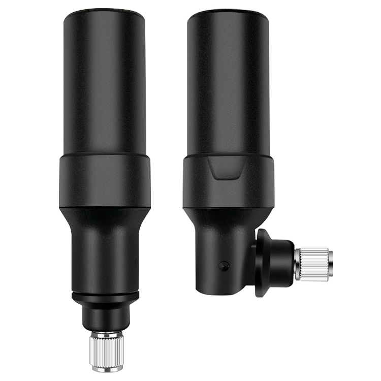
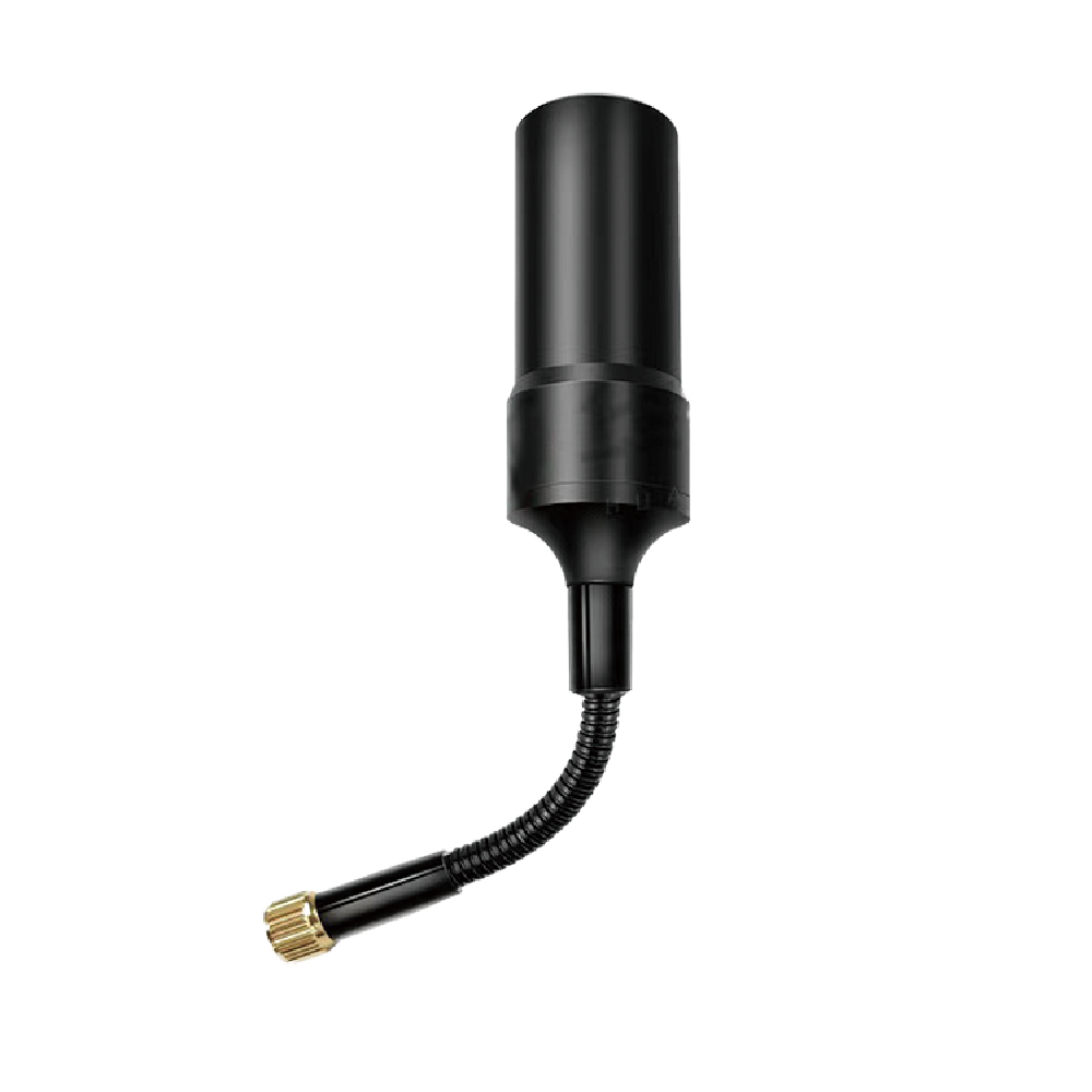
The drone antenna’s physical characteristics, including its lightweight design (20g) and compact dimensions (47*35.9mm), are tailored to the unique constraints of UAV operations. Drones have strict weight limits to maximize flight time and maneuverability, and a 20g antenna adds minimal burden, ensuring that the drone’s performance—including battery life and payload capacity—is not compromised. This is particularly important for small to medium-sized drones used in applications like hobbyist photography, agricultural scouting, or infrastructure inspection, where every gram counts. The compact dimensions (47mm in length and 35.9mm in width) allow for flexible mounting options, whether integrated into the drone’s body, attached to the underside of the frame, or mounted on a gimbal to avoid obstruction by the drone’s propellers or payload. A low-profile design also reduces wind resistance, which is crucial for maintaining stability during high-speed flights or in windy conditions. Additionally, the antenna’s rugged construction—often featuring weather-resistant materials—ensures it can withstand the vibrations, temperature fluctuations, and occasional impacts that are part of drone operations, from dusty construction sites to rainy agricultural fields.
The cold start time of 24 seconds is a key performance metric that reflects the antenna and receiver’s ability to quickly acquire satellite signals and begin navigating, even when powering up from a completely off state. In drone operations, time is often critical—whether launching for an emergency response mission or maximizing flight time during daylight hours—and a fast cold start ensures that the drone can be airborne and operational with minimal delay. The antenna’s design contributes to this rapid acquisition by efficiently capturing weak signals from satellites, even when the receiver has no prior knowledge of their positions (as is the case during a cold start). This is achieved through a combination of a wide radiation pattern, high gain in the direction of typical satellite orbits, and low noise amplification, which allows the receiver to detect and lock onto satellites quickly. Once locked, the antenna maintains these locks through dynamic maneuvers, ensuring that the receiver can continue processing signals without interruption, even as the drone pitches, rolls, or yaws during flight.
In practical applications, the synergy between the GNSS drone antenna and the RTK receiver transforms the capabilities of UAVs across industries. In precision agriculture, for example, drones equipped with this technology can map crop health with sub-meter accuracy, enabling farmers to apply resources only where needed, reducing costs and environmental impact. Surveyors use these drones to create detailed topographic maps and 3D models of construction sites, with accuracy that rivals traditional ground-based methods but at a fraction of the time and cost. In search and rescue missions, the drone’s reliable navigation ensures it can cover large areas with precision, even in remote or rugged terrain, helping locate missing persons or assess disaster zones safely. For delivery drones, the RTK accuracy allows for precise landing at designated drop-off points, even in crowded urban environments, minimizing the risk of accidents.
Looking ahead, as drone technology continues to advance—with longer flight times, heavier payloads, and more autonomous capabilities—the role of the GNSS antenna will only grow in importance. Future applications, such as urban air mobility (UAM) where drones transport passengers or cargo in cities, will demand even higher levels of precision and reliability, requiring antennas that can operate in the most challenging RF environments, surrounded by tall buildings, other drones, and dense wireless networks. The multi-constellation support, RTK readiness, and compact design of today’s GNSS drone antennas provide a foundation for these next-generation applications, ensuring that drones can navigate safely and efficiently in increasingly complex airspace.
In conclusion, the GNSS drone antenna, when paired with a high-performance RTK receiver like the one specified, is an indispensable component that enables UAVs to achieve unprecedented levels of precision, reliability, and versatility. Its ability to harness signals from multiple satellite constellations, support RTK corrections for sub-centimeter accuracy, and integrate seamlessly with advanced receiver chips like the ZED-F9P makes it a cornerstone of modern drone technology. From its lightweight and compact design to its rapid cold start and robust signal reception, every aspect of the antenna is engineered to meet the unique demands of aerial operations. As drones continue to revolutionize industries around the world, the GNSS drone antenna will remain a critical enabler, empowering these remarkable machines to push the boundaries of what is possible in navigation and data collection.

 86 0755 2819 9597
Lucy Yang | lucy.y@toxutech.com
Nicole Li | nicole@toxutech.com
Dotty Zhao | sales04@toxutech.com
Global Business Director / Sales Team / Global Operations


 En
En Cn
Cn Korean
 Home >


