

-
Products -PCBA Manufacturing RF Connectors RF Cable Assemblys Embedded Antennas External Antennas Positioning Chips and Modules
RF Connectors

RF Cable Assemblys
Embedded Antennas
External Antennas
Positioning Chips and Modules


 Language


Language


In the field of geographic information systems (GIS), the accuracy of spatial data is the cornerstone of informed decision-making, whether for urban planning, environmental monitoring, or infrastructure development. At the heart of this data collection process lies the GIS survey antenna—a specialized device designed to capture signals from global navigation satellite systems (GNSS) with unparalleled precision, enabling surveyors to map the Earth’s surface with centimeter-level accuracy. This article explores a high-performance GIS survey antenna, examining its technical specifications, design features, and the critical role it plays in transforming raw satellite signals into actionable geospatial insights.
A defining feature of this antenna is its multi-band compatibility, supporting a comprehensive range of GNSS frequencies: GPS L1/L2, GLONASS G1/G2, Compass (BeiDou) B1/B2/B3, and Galileo E1/L1/E2/E5b/E6. This extensive frequency coverage is a game-changer for GIS surveys, where reliance on a single constellation or band can introduce errors due to signal interference, atmospheric conditions, or satellite availability. By tapping into multiple bands across four global constellations, the antenna ensures redundancy and robustness, even in challenging environments such as dense forests, urban canyons, or remote wilderness areas.
GPS L1 (1575.42 MHz) and L2 (1227.60 MHz) are workhorses of navigation, with L2 offering enhanced accuracy through carrier phase measurements—a critical feature for surveying. GLONASS G1 (1602 MHz) and G2 (1246 MHz) provide global coverage with a focus on high-latitude performance, making them invaluable for surveys in polar regions. Compass (BeiDou) B1 (1561.098 MHz), B2 (1207.14 MHz), and B3 (1268.52 MHz) add layers of precision, particularly in Asia-Pacific regions where BeiDou signals are strongest. Galileo, Europe’s GNSS, contributes E1 (1575.42 MHz), E2 (1278.75 MHz), E5b (1207.14 MHz), and E6 (1278.75 MHz), offering advanced signal integrity and compatibility with modern surveying equipment. Together, these bands enable the antenna to leverage the strengths of each constellation, minimizing errors and maximizing data reliability.
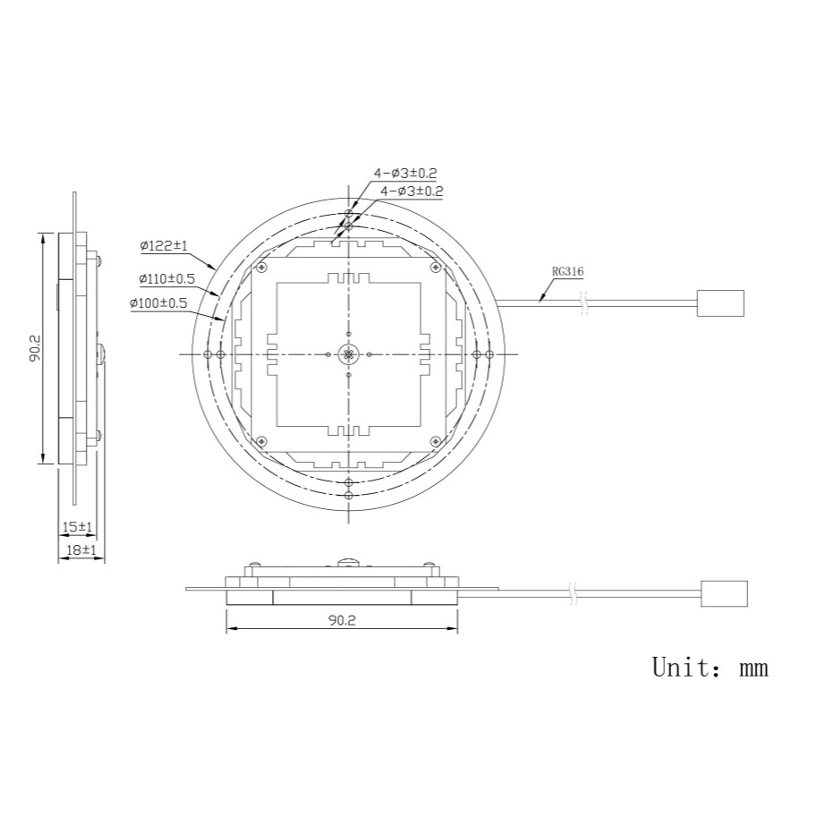
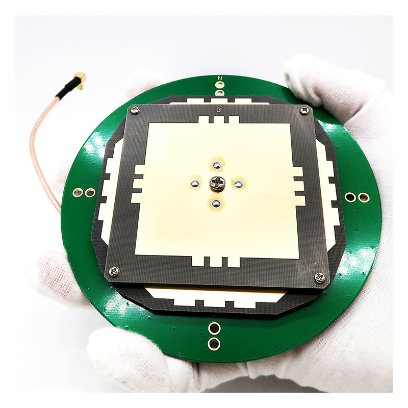
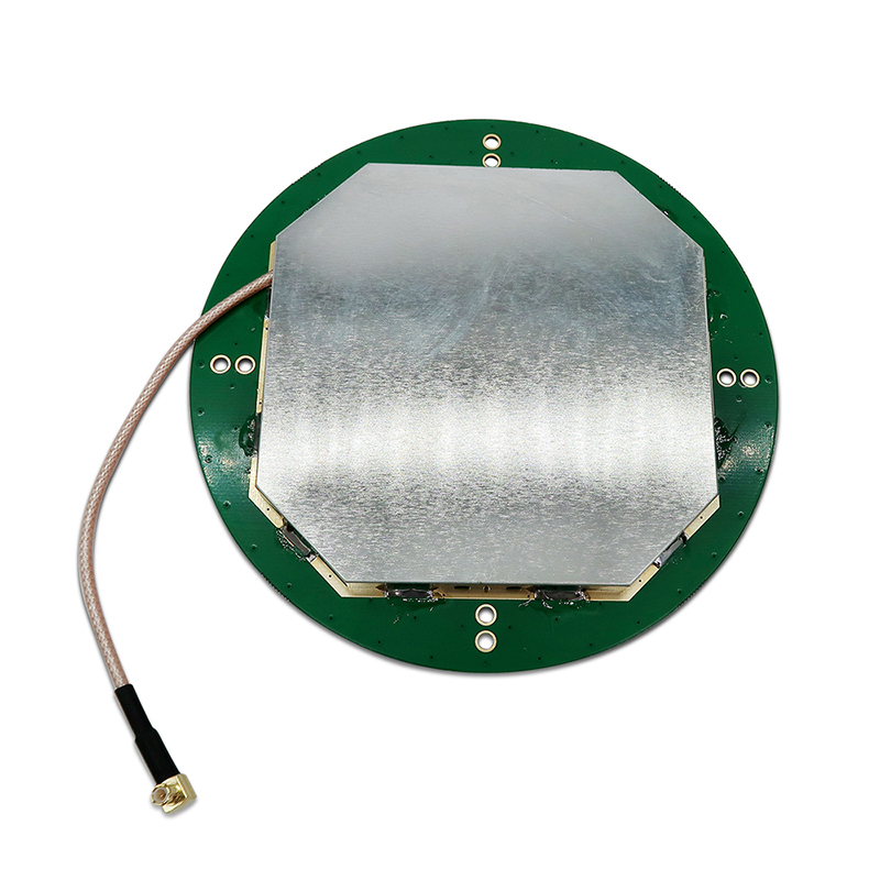
The antenna’s size—D146.5*62.5mm—strikes a balance between portability and performance, a critical consideration for field surveyors who often carry equipment over long distances or challenging terrain. While larger antennas can sometimes offer higher gain, this compact design ensures that the antenna is lightweight enough for backpack mounting or integration into survey rovers, without sacrificing signal reception. The dimensions also allow for stable placement on tripods or survey poles, a key requirement for maintaining consistent orientation during data collection. The form factor is optimized for durability, with a robust housing that protects internal components from dust, moisture, and impacts—essential for withstanding the rigors of outdoor fieldwork.
Axial ratio is a key metric for circularly polarized antennas, measuring how closely the polarization matches a perfect circle. This antenna boasts an axial ratio of ≤3dB, a value that places it among the most precise GNSS antennas available. A low axial ratio ensures that the antenna efficiently receives circularly polarized satellite signals, minimizing signal loss caused by polarization mismatches. This is particularly important in surveying, where even minor signal degradation can translate into significant positional errors. By maintaining a near-perfect circular polarization, the antenna maximizes signal strength across all azimuths, ensuring reliable performance regardless of the satellite’s position in the sky.
Peak gain is a measure of the antenna’s ability to amplify weak satellite signals, and this model delivers a peak gain of ≥5dBi. While this may seem modest compared to high-gain antennas used in other applications, it is deliberately optimized for surveying. High gain can sometimes lead to narrow radiation patterns, which require precise antenna alignment—a challenge in dynamic field conditions. The 5dBi gain, by contrast, provides a balance between signal amplification and radiation pattern width, ensuring that the antenna captures signals from a wide range of satellite elevations without requiring constant repositioning. This stability is critical for long-duration surveys, where consistent data collection is essential.
The 360° horizontal coverage angle is another standout feature, ensuring that the antenna can receive signals from satellites in all azimuth directions. In GIS surveying, satellites are distributed across the entire sky, and a full horizontal coverage angle eliminates “blind spots” that could lead to data gaps. This is particularly valuable in environments where satellite visibility is limited, such as in mountainous regions or near tall buildings. By capturing signals from all directions, the antenna ensures that the receiver can track a sufficient number of satellites to calculate precise positions, even when some satellites are obstructed.
Phase center error is a critical specification for survey-grade antennas, referring to the difference between the antenna’s electrical center (where signals are processed) and its mechanical center (where measurements are taken). This antenna achieves a phase center error of 2mm, a level of precision that is essential for centimeter-level positioning. A small phase center error ensures that measurements are consistent across all satellite elevations and azimuths, eliminating systematic errors that could accumulate over large survey areas. For surveyors, this means that data collected from multiple stations can be seamlessly integrated, resulting in accurate, reliable maps and models.
The antenna is designed to operate in extreme temperatures, with a range of -40°C to +85°C. This wide operating temperature range ensures reliability in the most challenging field conditions, from frigid arctic surveys to scorching desert expeditions. The internal components are engineered to withstand thermal expansion and contraction, maintaining performance even as temperatures fluctuate. For example, in cold climates, the antenna’s electronics remain stable, preventing signal drift that could compromise accuracy. In hot environments, the housing dissipates heat effectively, avoiding overheating that could degrade performance. This temperature resilience makes the antenna a versatile tool for global surveying projects, regardless of the climate.
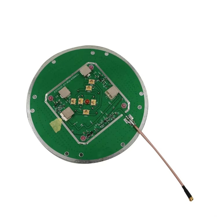
The mounting method—screw-based—ensures secure and repeatable installation, a key requirement for surveying. Screw mounting allows the antenna to be firmly attached to tripods, survey poles, or vehicle mounts, minimizing movement during data collection. This stability is critical because even minor vibrations or shifts can introduce positional errors. The screw mount also enables precise leveling, a necessary step in ensuring that the antenna’s phase center is aligned with the survey marker. For field teams, this translates into faster setup times and reduced risk of measurement errors caused by improper mounting.
The MCX connector provides a reliable interface between the antenna and the survey receiver. MCX connectors are known for their compact size, robust construction, and low signal loss—qualities that make them ideal for high-precision applications. The connector’s threaded design ensures a secure connection, preventing accidental disconnections during fieldwork. Additionally, MCX connectors are compatible with a wide range of coaxial cables, allowing surveyors to use cables optimized for minimal signal attenuation. This compatibility is essential for integrating the antenna with various survey receivers, ensuring flexibility in equipment selection.
While the product name mentions a TNC-K connector, it is important to note that MCX and TNC connectors are both widely used in GNSS applications, with TNC offering a larger, more rugged design suitable for heavy-duty use. The availability of both connector types highlights the antenna’s versatility, allowing it to be adapted to different receiver models and field conditions. TNC-K connectors, with their threaded coupling mechanism, provide enhanced durability in harsh environments, making them a popular choice for industrial surveying applications.
Now, let’s explore the specific applications where this GIS survey antenna excels, leveraging its precision and versatility to deliver accurate geospatial data. One of the primary applications is land surveying, where the antenna is used to map property boundaries, topographic features, and construction sites. The 2mm phase center error and multi-band capability ensure that boundary lines are defined with legal precision, while the 360° coverage angle enables data collection in complex terrains such as forests or urban areas.
Environmental monitoring is another key application, where the antenna supports projects such as wetland mapping, glacier tracking, and deforestation studies. The antenna’s ability to operate in extreme temperatures makes it suitable for polar or desert environments, while its high precision allows researchers to detect subtle changes in the landscape over time. For example, in glacier monitoring, the antenna can measure centimeter-level movements, providing critical data for understanding climate change impacts.
In infrastructure development, the antenna plays a vital role in the planning and construction of roads, bridges, and buildings. Surveyors use the antenna to create detailed site maps, ensuring that structures are built according to design specifications and in compliance with regulatory requirements. The phase center error of 2mm is particularly important in construction surveying, where even minor positional errors can lead to costly delays or safety issues.
Agricultural mapping is an emerging application where precise geospatial data helps farmers optimize crop management, irrigation, and fertilizer use. The antenna’s multi-band capability ensures reliable performance in rural areas, where satellite visibility may be affected by crops or terrain. By mapping fields with centimeter accuracy, farmers can implement precision agriculture techniques, reducing costs and environmental impact.
Disaster response is another critical application, where the antenna enables rapid mapping of disaster zones to guide rescue efforts and assess damage. In the aftermath of earthquakes, floods, or wildfires, the antenna’s rugged design and wide temperature range ensure that survey teams can operate in harsh conditions, providing timely data to emergency responders. The 360° coverage angle is valuable in disaster zones where terrain may be altered, and satellite visibility is unpredictable.
In conclusion, the GIS survey antenna described here represents a pinnacle of precision engineering, tailored to the demanding requirements of geospatial data collection. Its multi-band compatibility ensures reliability across global constellations, while the 2mm phase center error and ≤3dB axial ratio deliver the accuracy needed for critical applications. The compact size, rugged design, and wide operating temperature range make it a versatile tool for fieldwork in diverse environments, from urban centers to remote wilderness areas. Whether used in land surveying, environmental monitoring, or disaster response, this antenna empowers surveyors and researchers to collect high-quality geospatial data that drives informed decision-making. As GIS technology continues to advance, the role of precision antennas like this will only grow, enabling new applications and pushing the boundaries of what is possible in geospatial mapping.

 86 0755 2819 9597
Lucy Yang | lucy.y@toxutech.com
Nicole Li | nicole@toxutech.com
Dotty Zhao | sales04@toxutech.com
Global Business Director / Sales Team / Global Operations


 En
En Cn
Cn Korean
 Home >


