

-
Products -PCBA Manufacturing RF Connectors RF Cable Assemblys Embedded Antennas External Antennas Positioning Chips and Modules
RF Connectors

RF Cable Assemblys
Embedded Antennas
External Antennas
Positioning Chips and Modules


 Language


Language


In the rapidly evolving landscape of drone technology, precise navigation is the cornerstone of safe and efficient operation. The ceramic patch GPS antenna has emerged as a critical component for drone navigation, enabling unmanned aerial vehicles (UAVs) to determine their position accurately in real - time. As drones are increasingly deployed in diverse applications, from aerial photography and surveying to delivery services and search - and - rescue operations, the demand for reliable navigation systems has soared, and ceramic patch GPS antennas have stepped up to meet these requirements.
A ceramic patch GPS antenna for drone navigation functions by receiving signals from a constellation of GPS satellites orbiting the Earth. These satellites transmit radio - frequency signals that carry information about their position and the current time. The antenna captures these weak signals and converts them into electrical signals that can be processed by the drone's onboard navigation system. Based on the time it takes for signals from multiple satellites to reach the antenna, the navigation system can calculate the drone's precise location using the principle of trilateration.
The use of ceramic materials in these antennas offers distinct advantages that are highly beneficial for drone applications. Ceramics have a high dielectric constant, which allows for the miniaturization of the antenna without sacrificing performance. This is crucial for drones, as they often have limited space for components and need to maintain a lightweight design to maximize flight time and maneuverability. Additionally, ceramics are highly resistant to environmental factors such as temperature variations, moisture, and vibrations, all of which are common during drone flights. This durability ensures that the antenna can operate reliably in a wide range of weather conditions and flight scenarios, from soaring through the clear skies to navigating in light rain or strong winds.
The market for ceramic patch GPS antennas in drone navigation is experiencing significant growth, driven by the expanding use of drones across various industries. As more companies and organizations adopt drones for commercial and operational purposes, the need for high - quality, reliable navigation antennas becomes even more pronounced. Manufacturers are continuously innovating to improve the performance, efficiency, and integration capabilities of these antennas to meet the evolving demands of the drone market.
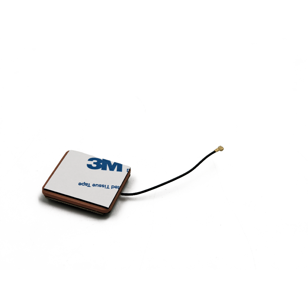
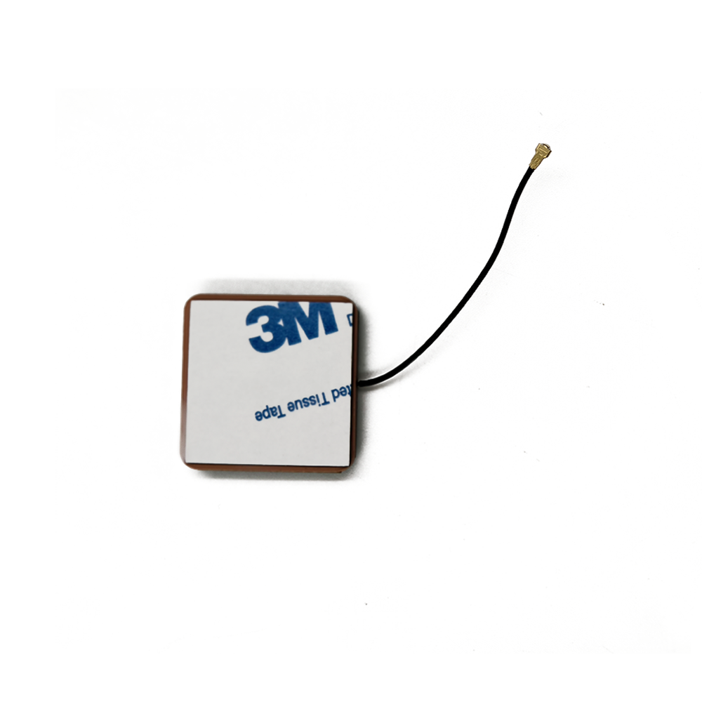
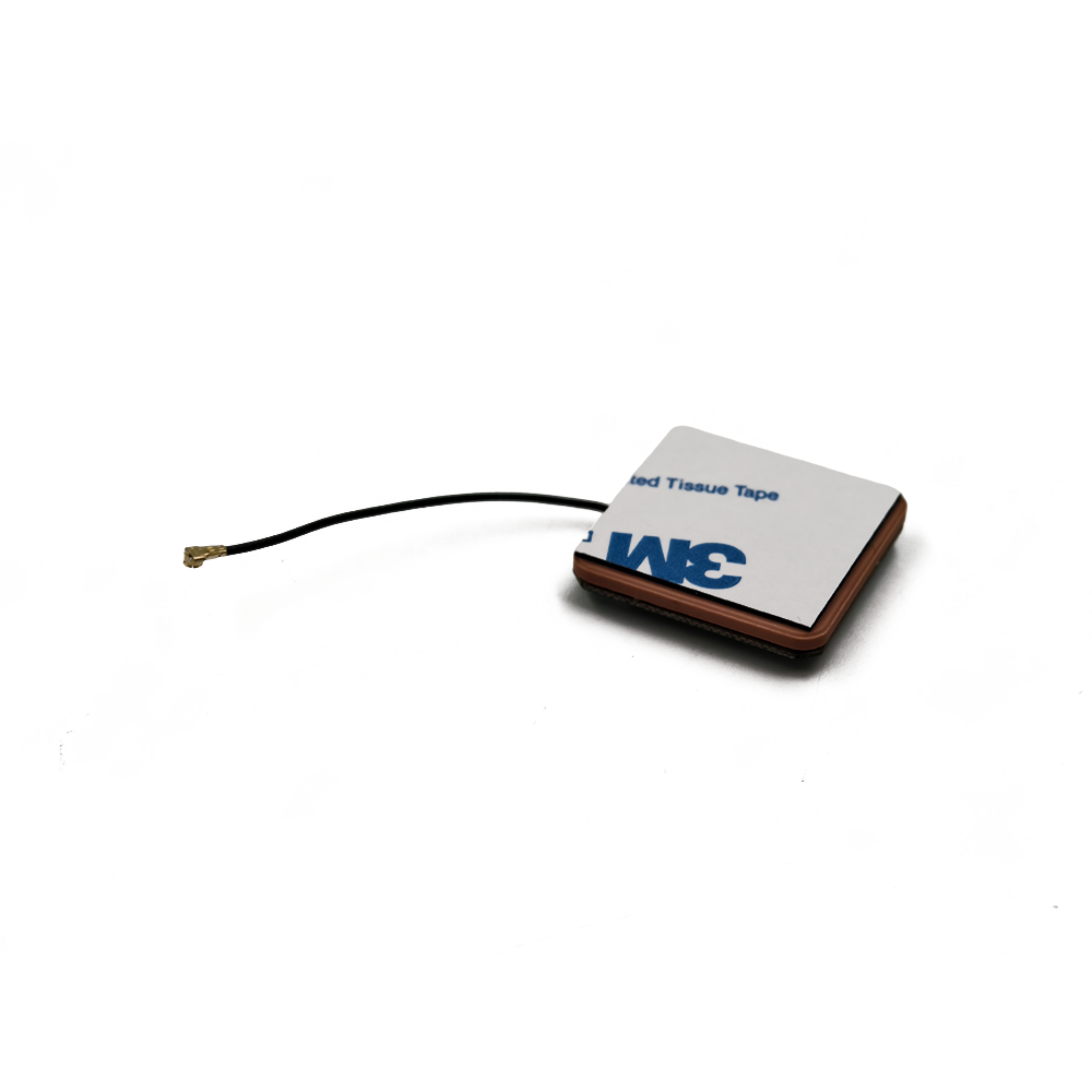
The design and construction of a ceramic patch GPS antenna for drone navigation are a careful balance of electrical engineering and material science, tailored specifically to the unique requirements of UAVs. The fundamental structure of such an antenna typically consists of three main components: the ceramic substrate, the metallic patch, and the ground plane.
The ceramic substrate serves as the foundation of the antenna and is a key factor in determining its performance. It is usually made from a specialized ceramic material with a precisely controlled dielectric constant. The dielectric constant of the ceramic affects the resonant frequency of the antenna, which is tuned to match the frequency of the GPS signals (around 1.575 GHz for the L1 band, commonly used in civilian GPS applications). Manufacturers carefully select and process the ceramic material to ensure consistent electrical properties, as even minor variations in the dielectric constant can significantly impact the antenna's ability to receive and process GPS signals effectively.
On top of the ceramic substrate, a metallic patch is deposited. This patch, often made of copper or gold, is designed to resonate at the GPS frequency. The shape and size of the metallic patch are calculated using electromagnetic field theories to achieve the desired radiation pattern and impedance matching. For drone navigation, the radiation pattern is optimized to provide good coverage in all directions relevant to the drone's flight, typically in a hemispherical pattern above the antenna. This ensures that the drone can receive signals from GPS satellites regardless of its orientation during flight.
The ground plane, located beneath the ceramic substrate, is also made of a conductive material. It acts as a reference for the electrical signals and helps control the radiation pattern of the antenna. By reflecting the electromagnetic waves radiated by the metallic patch, the ground plane enhances the antenna's gain and directivity. In drone - specific designs, the ground plane may be shaped or sized to accommodate the limited space available on the drone's frame while still maintaining optimal performance.
In addition to these basic components, modern ceramic patch GPS antennas for drones may incorporate additional features. For example, some antennas are designed with multiple layers of ceramic substrates and metallic patches to improve impedance matching and increase bandwidth. This allows the antenna to handle a wider range of frequencies, which can be beneficial for future - proofing the drone's navigation system as new GPS frequencies are introduced or when integrating other satellite navigation systems. Integrated filters are also commonly included to reduce interference from other wireless signals, such as those from Wi - Fi or Bluetooth devices that may be present in the vicinity of the drone, ensuring clean and accurate GPS signal reception.
The construction process of these antennas involves advanced manufacturing techniques. Thin - film deposition methods are used to precisely deposit the metallic patches on the ceramic substrates. Photolithography and etching processes are then employed to pattern the metallic layers into the desired shapes with high precision. Quality control is of utmost importance during the manufacturing process, as any defects or variations in the antenna's structure can lead to performance degradation. Stringent testing procedures are carried out to ensure that each antenna meets the required performance specifications for drone navigation, including sensitivity, gain, and radiation pattern.
The working principles of a ceramic patch GPS antenna for drone navigation are based on the interaction between electromagnetic waves and the antenna's physical structure, combined with the principles of satellite - based navigation. When GPS satellites transmit signals in the form of electromagnetic waves, these waves travel through space and reach the antenna on the drone.
The ceramic patch antenna is engineered to resonate at the frequency of the incoming GPS signals. When the electromagnetic waves from the satellites encounter the metallic patch on the antenna, they induce an alternating current (AC) in the patch. This occurs because the changing electric field of the electromagnetic wave causes the electrons in the conductive metallic patch to move, generating an electrical current. The induced current in the metallic patch then creates its own electromagnetic field. The interaction between the incoming electromagnetic wave and the field generated by the patch results in the absorption and re - radiation of energy.
The re - radiated electromagnetic field from the antenna is designed to have a specific radiation pattern that allows it to effectively capture the energy from the GPS satellites. For drone navigation, this radiation pattern is typically configured to have a broad coverage area above the antenna, enabling the drone to receive signals from multiple satellites simultaneously. The more satellites the antenna can receive signals from, the more accurate the drone's position calculation will be.
Impedance matching is a crucial aspect of the antenna's operation. The impedance of the antenna represents the opposition it presents to the flow of electrical current. For maximum power transfer from the antenna to the drone's navigation receiver, the impedance of the antenna must be matched to the impedance of the receiver. The design of the ceramic patch antenna, including the characteristics of the ceramic substrate and the shape and size of the metallic patch, is carefully optimized to achieve good impedance matching at the GPS frequency. This ensures that as much of the received signal power as possible is transferred to the receiver for processing.
Once the antenna has received the GPS signals and transferred them to the navigation receiver, the receiver uses the time - of - arrival (TOA) or time - difference - of - arrival (TDOA) of the signals from multiple satellites to calculate the drone's position. By knowing the precise location of the satellites and the time it takes for their signals to reach the antenna, the receiver can determine the distance between the drone and each satellite. Using the principle of trilateration (or multilateration when more than three satellites are involved), the receiver can then calculate the drone's exact position in three - dimensional space, providing the essential navigation information for the drone's flight control system.
Advantages
One of the most significant advantages of ceramic patch GPS antennas for drone navigation is their compact size and lightweight design. Thanks to the high dielectric constant of ceramic materials, these antennas can be made relatively small, which is highly beneficial for drones. Drones have strict weight and size limitations to optimize flight performance, and the small form factor of ceramic patch antennas allows for easy integration into the drone's structure without adding excessive bulk or weight. This not only helps to maintain the drone's aerodynamic efficiency but also maximizes its payload capacity and flight time.
The durability of ceramic patch GPS antennas is another major advantage. Ceramics are highly resistant to environmental factors that drones commonly encounter during flight, such as temperature fluctuations, moisture, and vibrations. In different weather conditions, from hot summer days to cold winter flights, the antenna can maintain its performance without being affected by thermal expansion or contraction. Similarly, exposure to moisture during light rain or near bodies of water does not cause degradation in the antenna's functionality. The ability to withstand vibrations, which are inevitable during drone flight, ensures that the antenna remains stable and reliable, reducing the risk of signal loss or inaccurate positioning.
In terms of performance, ceramic patch GPS antennas offer high - precision positioning capabilities. Their design allows for effective capture of GPS signals, and with proper impedance matching and radiation pattern optimization, they can provide accurate location information to the drone's navigation system. This precision is essential for tasks such as aerial mapping, where accurate positioning is required to create detailed and reliable maps. For delivery drones, precise navigation ensures that packages are delivered to the correct location, enhancing the efficiency and reliability of the delivery service.
Cost - effectiveness is also a notable advantage. Ceramic materials are relatively inexpensive, and the manufacturing processes for ceramic patch GPS antennas can be scaled up for mass production. This makes these antennas an affordable option for drone manufacturers, enabling them to equip their UAVs with high - quality navigation components without significantly increasing production costs. As the drone market continues to grow, the cost - effectiveness of ceramic patch GPS antennas helps to make advanced navigation technology more accessible to a wider range of users.
Challenges
Despite their many advantages, ceramic patch GPS antennas for drone navigation face several challenges. One of the most significant challenges is interference from other wireless signals. In today's crowded electromagnetic environment, there are numerous wireless devices operating in the same or nearby frequency bands as GPS. Wi - Fi, Bluetooth, and other wireless communication systems can interfere with the GPS signals received by the antenna, leading to signal degradation or loss. For drones, this interference can cause navigation errors, such as incorrect positioning or flight path deviations, which can be dangerous, especially in urban areas or near critical infrastructure.
Another challenge is related to the limited bandwidth of traditional ceramic patch GPS antennas. As GPS technology evolves and new frequencies are introduced, as well as the integration of other global navigation satellite systems (GNSS) such as GLONASS, Galileo, and BeiDou, there is a need for antennas with wider bandwidths. Narrow - bandwidth antennas may struggle to receive and process signals from these new sources effectively, limiting the drone's ability to take advantage of enhanced navigation capabilities and potentially reducing its accuracy and reliability in challenging environments.
Environmental factors, although the antenna is designed to be durable, can still pose problems in extreme conditions. In high - altitude flights, the antenna may be exposed to increased radiation levels, which can gradually degrade its performance over time. In addition, in areas with complex terrain or dense urban canyons, GPS signals can be blocked, reflected, or diffracted, leading to multipath interference. Multipath interference can cause errors in the drone's position calculation, as the navigation system may receive multiple versions of the same signal, each with a slightly different time - of - arrival, resulting in inaccurate positioning.
Manufacturing consistency is also a challenge. Ensuring that each ceramic patch GPS antenna produced has consistent electrical properties and performance characteristics is crucial for reliable drone navigation. Any variations in the ceramic material, the deposition of the metallic patch, or the manufacturing processes can lead to differences in antenna performance. These variations can be particularly problematic when multiple drones are operating in a coordinated manner, such as in a drone swarm, where consistent navigation performance across all drones is essential for successful mission execution.
Applications
Ceramic patch GPS antennas for drone navigation have a wide range of applications across various industries. In the field of aerial photography and videography, drones equipped with these antennas can precisely position themselves to capture stunning images and videos from unique perspectives. The accurate navigation allows photographers and videographers to plan their shots carefully, ensuring that the drone is in the right place at the right time to capture the desired scene. This has revolutionized the photography and videography industry, enabling the creation of high - quality content that was previously difficult or impossible to achieve.
For surveying and mapping, drones with ceramic patch GPS antennas are used to create detailed 3D maps of large areas quickly and efficiently. By flying over the survey area and collecting precise location data, along with other sensor information such as images or LiDAR data, drones can generate accurate maps for a variety of purposes, including land development, urban planning, and environmental monitoring. The use of drones in surveying reduces the time and cost associated with traditional surveying methods while providing more detailed and up - to - date information.
In the delivery industry, drones are increasingly being considered as a means of transporting small packages. Ceramic patch GPS antennas play a vital role in ensuring that these delivery drones can navigate accurately to their destinations, even in complex urban environments. By providing precise positioning, the antennas enable the drones to avoid obstacles, follow the most efficient flight paths, and deliver packages to the correct addresses with a high degree of accuracy. This has the potential to revolutionize the last - mile delivery process, making it faster, more cost - effective, and more sustainable.
Search - and - rescue operations also benefit greatly from the use of drones with ceramic patch GPS antennas. In emergency situations, drones can quickly be deployed to search large areas for missing persons. The accurate navigation provided by the antennas allows the drones to cover the search area systematically, transmitting real - time location data back to the rescue team. This helps the team to locate the missing individuals more quickly, increasing the chances of a successful rescue.
Future Trends
Looking to the future, several trends are emerging for ceramic patch GPS antennas in drone navigation. One of the key trends is the integration of multiple satellite navigation systems. As mentioned earlier, in addition to GPS, there are other GNSS such as GLONASS, Galileo, and BeiDou. Future ceramic patch antennas are likely to be designed to receive signals from multiple GNSS simultaneously, providing more accurate and reliable positioning information. This multi - GNSS capability will enhance the performance of drones in challenging environments, such as urban canyons or areas with limited satellite visibility, where relying on a single navigation system may result in inaccurate positioning.
Another trend is the development of antennas with wider bandwidths. With the evolution of GPS technology and the introduction of new frequencies, as well as the integration of other wireless communication technologies, there is a growing need for antennas that can operate over a broader range of frequencies. Wider - bandwidth antennas will not only be able to handle signals from multiple GNSS but also enable the integration of additional features such as real - time data communication, which is essential for applications like remote - controlled drones or drones used in industrial monitoring.
The miniaturization of ceramic patch GPS antennas is expected to continue. As drone technology advances, there is a constant demand for smaller, lighter, and more efficient components. Manufacturers will strive to reduce the size of these antennas even further while maintaining or improving their performance. This may involve the use of new materials, advanced manufacturing techniques, and innovative antenna designs, such as metamaterials or fractal geometries, which can achieve high performance in a smaller footprint.
There is also a growing interest in integrating ceramic patch GPS antennas with other sensor technologies on drones. For example, combining GPS with inertial measurement units (IMUs), LiDAR sensors, or computer vision systems can create more robust navigation and perception systems for drones. This integration will enable drones to have a better understanding of their environment, improving their ability to navigate autonomously, avoid obstacles, and perform complex tasks with greater precision and reliability.
Conclusion
In conclusion, ceramic patch GPS antennas have become an essential component for drone navigation, enabling UAVs to achieve accurate and reliable positioning in a wide range of applications. Their unique design and properties, such as small size, durability, high - precision performance, and cost - effectiveness, have made them the preferred choice for drone manufacturers.
However, these antennas also face several challenges, including interference from other wireless signals, limited bandwidth, vulnerability to extreme environmental conditions, and manufacturing consistency issues. Overcoming these challenges will be crucial for the continued development and improvement of ceramic patch GPS antennas for drone navigation.
Looking to the future, the applications of these antennas are expected to expand further, driven by emerging trends such as multi - GNSS integration, wider bandwidths, continued miniaturization, and integration with other sensor technologies. As the drone industry continues to grow and evolve, ceramic patch GPS antennas will play an increasingly important role in enabling drones to perform complex tasks with greater accuracy, reliability, and efficiency, opening up new possibilities for various industries and applications.

 86 0755 2819 9597
Lucy Yang | lucy.y@toxutech.com
Nicole Li | nicole@toxutech.com
Dotty Zhao | sales04@toxutech.com
Global Business Director / Sales Team / Global Operations


 En
En Cn
Cn Korean
 Home >


