

-
Products -PCBA Manufacturing RF Connectors RF Cable Assemblys Embedded Antennas External Antennas Positioning Chips and Modules
RF Connectors

RF Cable Assemblys
Embedded Antennas
External Antennas
Positioning Chips and Modules


 Language


Language


In the era of precision agriculture, where every inch of farmland and every drop of resource counts, the role of advanced positioning technology has become indispensable. Among the key components driving this revolution is the waterproof agricultural GNSS (Global Navigation Satellite System) antenna module—a specialized device designed to provide accurate, reliable location data for agricultural machinery, monitoring systems, and precision farming operations, even in the harshest outdoor and wet conditions. To understand its significance, it is first essential to break down its core functions, the context of its use in agriculture, and the unique demands that the agricultural environment places on such technology.
At its most basic level, a GNSS antenna module receives signals from multiple satellite constellations—including GPS (United States), GLONASS (Russia), Galileo (European Union), and BeiDou (China)—to calculate precise geographic coordinates (latitude, longitude, and often altitude). For agriculture, this precision is not a luxury but a necessity: it enables tasks like variable-rate application (VRA) of fertilizers and pesticides, automated guidance for tractors and harvesters, crop yield mapping, and real-time monitoring of soil moisture or crop health. However, unlike GNSS antennas used in urban or indoor settings, agricultural modules face a distinct set of challenges: exposure to rain, irrigation water, dew, mud, extreme temperatures (from freezing winters to scorching summers), and physical debris like dust, crop residues, or soil particles. This is where the "waterproof" feature becomes critical. Waterproofing ensures that the antenna’s internal components—such as the antenna element, signal amplifier, and circuit board—remain protected from moisture intrusion, which could otherwise cause short circuits, signal degradation, or complete device failure.
The adoption of waterproof agricultural GNSS antenna modules has grown in tandem with the rise of precision agriculture. According to industry reports, the global precision agriculture market is projected to reach over $100 billion by 2030, with positioning and navigation technologies accounting for a significant share. Farmers and agricultural enterprises are increasingly investing in these modules because they directly address two major pain points: operational inefficiency and environmental waste. For example, a tractor equipped with a waterproof GNSS antenna can follow pre-planned routes with sub-meter accuracy, reducing overlap in fertilizer application by up to 20%—cutting costs for farmers and minimizing nutrient runoff into waterways.
It is also important to distinguish waterproof agricultural GNSS modules from other types of GNSS devices. While consumer-grade GNSS antennas (used in smartphones or car navigation systems) may offer basic water resistance (e.g., IP65 rating), they lack the durability and signal stability required for agriculture. Agricultural modules typically meet higher protection standards, such as IP67 or IP68, meaning they can withstand complete submersion in water for short periods (IP67) or prolonged periods (IP68). Additionally, agricultural modules often include features like high-gain antenna elements (to capture weak satellite signals in remote rural areas), low-noise amplifiers (LNAs) to reduce signal interference, and rugged enclosures made from materials like UV-resistant plastic or aluminum (to withstand prolonged sun exposure and physical impacts).
Another key aspect of the overview is the regulatory and standardization context. In many regions, agricultural machinery and electronics must comply with industry-specific standards to ensure safety and performance. For example, in the European Union, modules may need to meet CE certification requirements for electromagnetic compatibility (EMC) and environmental protection, while in the United States, they may need FCC approval. These standards help ensure that waterproof agricultural GNSS modules work reliably alongside other agricultural equipment (such as sensors or automated steering systems) and do not interfere with other electronic devices.
In summary, the waterproof agricultural GNSS antenna module is a cornerstone of modern precision agriculture. It combines the core functionality of GNSS positioning with specialized waterproofing and durability features to meet the unique demands of the agricultural environment. Its role in improving efficiency, reducing costs, and promoting sustainable farming practices makes it an essential technology for the future of agriculture. As we move forward, understanding its design, working principles, advantages, challenges, applications, and future trends will be key to leveraging its full potential in transforming agricultural operations worldwide.
The design and construction of a waterproof agricultural GNSS antenna module are a careful balance of three core objectives: maximizing signal reception accuracy, ensuring long-term waterproof durability, and withstanding the harsh physical and environmental conditions of agricultural settings. Every component—from the antenna element to the outer enclosure— is engineered with these goals in mind, and even small design choices can have a significant impact on performance. In this section, we will break down the key design elements, materials, and construction techniques that define these modules, as well as the standards that govern their waterproofing and durability.
2.1 Core Components and Their Design
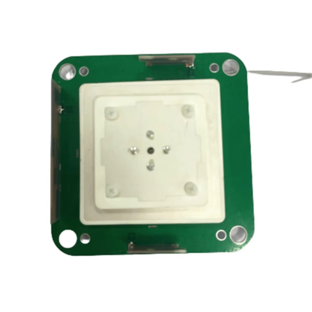
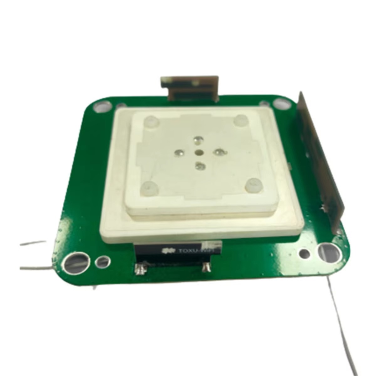
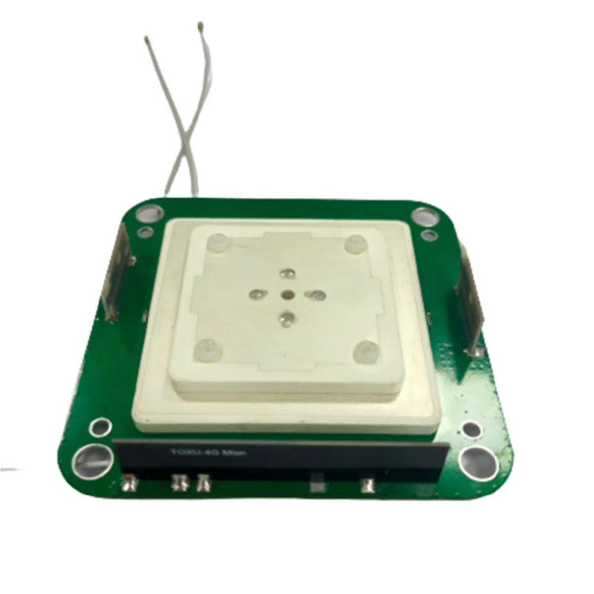
A typical waterproof agricultural GNSS antenna module consists of four main internal components: the antenna element, the low-noise amplifier (LNA), the filter, and the circuit board—all enclosed in a waterproof housing. Each component is designed to address specific challenges of agricultural use.
Antenna Element: The antenna element is responsible for capturing satellite signals, so its design is critical for positioning accuracy. Unlike consumer-grade antennas, which may use small, low-gain elements, agricultural modules often use high-gain patch antennas or helical antennas. Patch antennas are flat, compact, and offer excellent performance for GNSS signals (which operate in L-band frequencies, typically 1.1-1.6 GHz). They are ideal for agricultural use because they can be mounted on machinery (e.g., tractor roofs or harvester hoods) without adding excessive bulk. Helical antennas, on the other hand, provide higher gain and better performance in areas with weak satellite signals (e.g., remote rural regions or areas with dense tree cover), making them suitable for more challenging environments. The antenna element is also designed to be circularly polarized—a key feature because GNSS satellite signals are circularly polarized, ensuring that the antenna can receive signals regardless of the satellite’s position in the sky.
Low-Noise Amplifier (LNA): After the antenna element captures signals, the LNA amplifies them while minimizing additional noise. In agricultural settings, where signals may be weak (due to distance from satellites or interference from terrain), a high-performance LNA is essential. LNAs in agricultural modules typically have a noise figure (NF) of less than 1.5 dB (decibels)—a measure of how much noise the amplifier adds to the signal. A lower noise figure means the amplifier preserves the integrity of the weak satellite signal, which is critical for accurate positioning. The LNA is also designed to be resistant to temperature fluctuations, as agricultural environments can experience extreme heat (up to 60°C) or cold (-30°C), which can degrade amplifier performance.
Filter: The filter’s role is to eliminate unwanted signals (interference) from sources like other electronic devices (e.g., agricultural sensors, radios) or nearby cell towers. In agriculture, interference is a common issue because machinery often carries multiple electronic systems. The filter is typically a band-pass filter that allows only GNSS frequencies (e.g., 1575.42 MHz for GPS L1) to pass through to the circuit board. High-quality filters have a narrow passband and high attenuation of unwanted signals, ensuring that the GNSS receiver gets a clean signal.
Circuit Board: The circuit board connects all components and sends the processed signal to the GNSS receiver (which may be integrated into the module or a separate device, like a tractor’s control system). The circuit board is designed to be waterproof and corrosion-resistant—a critical feature because even small amounts of moisture can cause short circuits. Manufacturers often use techniques like conformal coating (a thin, protective layer applied to the board) or potting (encasing the board in a waterproof resin) to protect it from moisture and dust.
2.2 Waterproof Enclosure Design
The outer enclosure is the first line of defense against moisture, so its design and materials are paramount. The enclosure must meet strict waterproofing standards, with the most common being the IP (Ingress Protection) rating system developed by the International Electrotechnical Commission (IEC). For agricultural modules, the minimum recommended rating is IP67, which means the enclosure is dust-tight (6) and can withstand submersion in 1 meter of water for up to 30 minutes (7). Many high-end modules meet IP68, which allows submersion in deeper water (up to 1.5 meters or more) for longer periods.
To achieve these ratings, enclosures are constructed using two key techniques: sealing and material selection.
Sealing: Seams and openings (e.g., where cables enter the enclosure) are sealed with high-quality gaskets or O-rings made from materials like silicone or nitrile rubber. These materials are resistant to water, oil, and chemicals (e.g., fertilizers, pesticides) that are common in agriculture. For cable entries, manufacturers use gland fittings—threaded connectors that compress a seal around the cable, preventing water from entering through the gap.
Material Selection: Enclosure materials must be durable, lightweight, and resistant to UV radiation (since modules are exposed to sunlight for long periods). The most common materials are:
UV-resistant plastic: Materials like ABS (Acrylonitrile Butadiene Styrene) or PC (Polycarbonate) are lightweight, cost-effective, and offer good impact resistance. They are often treated with UV stabilizers to prevent degradation from sun exposure.
Aluminum: For more rugged applications (e.g., heavy machinery), aluminum enclosures are used. Aluminum is strong, corrosion-resistant (especially when anodized), and provides better heat dissipation (which helps protect internal components from overheating in hot weather).
The shape of the enclosure is also designed for practicality. Most agricultural modules have a low-profile, aerodynamic design to minimize wind resistance when mounted on moving machinery (e.g., tractors, drones). Some modules also include mounting brackets or magnetic bases for easy installation—an important feature for farmers who may need to move the antenna between different pieces of equipment.
2.3 Manufacturing and Quality Control
The manufacturing process of waterproof agricultural GNSS antenna modules involves strict quality control to ensure that every unit meets performance and waterproofing standards. Key steps include:
Component Testing: Before assembly, each component (antenna element, LNA, filter) is tested for performance (e.g., signal gain, noise figure) and durability (e.g., temperature resistance).
Enclosure Leak Testing: After assembly, enclosures are tested using methods like air pressure testing (where the enclosure is pressurized, and leaks are detected by monitoring pressure loss) or submersion testing (where the module is submerged in water and checked for moisture intrusion).
Environmental Testing: Modules are subjected to simulated agricultural conditions, such as extreme temperature cycles (from -30°C to 60°C), vibration testing (to mimic the movement of machinery), and exposure to chemicals (to test resistance to fertilizers and pesticides).
These quality control measures ensure that the modules can withstand the rigors of agricultural use and provide reliable performance for years. In summary, the design and construction of waterproof agricultural GNSS antenna modules are a combination of specialized components, durable materials, and strict manufacturing standards—all tailored to meet the unique demands of precision agriculture.
To understand how a waterproof agricultural GNSS antenna module delivers accurate positioning data in harsh agricultural environments, it is essential to break down its working principles—from signal reception to data output. Unlike consumer-grade GNSS devices, which prioritize simplicity over performance, agricultural modules are engineered to overcome challenges like weak signals, moisture interference, and environmental noise. This section will explain the step-by-step process of how these modules work, as well as the key technologies that enable their reliability and accuracy.
3.1 Step 1: Satellite Signal Reception
The first and most critical step in the module’s operation is capturing signals from GNSS satellites. As mentioned earlier, agricultural modules typically support multiple satellite constellations (GPS, GLONASS, Galileo, BeiDou) because using more constellations increases the number of available satellites, which improves positioning accuracy and reliability—especially in areas with limited sky visibility (e.g., near trees, hills, or tall farm buildings).
The antenna element (usually a patch or helical antenna) is designed to receive circularly polarized L-band signals (the frequency range used by GNSS satellites). Circular polarization is key here because it allows the antenna to capture signals regardless of the satellite’s position or the angle of the signal—unlike linear polarization, which only works if the antenna is aligned with the signal’s direction. For example, a satellite low on the horizon will send a signal at a steep angle, but a circularly polarized antenna can still capture it effectively.
In agricultural settings, signal reception can be challenging due to multipath interference—a phenomenon where satellite signals bounce off surfaces like soil, water, or crop canopies before reaching the antenna. This creates multiple versions of the same signal, which can confuse the GNSS receiver and reduce accuracy. To mitigate this, agricultural modules use anti-multipath designs, such as:
Ground planes: A metal plate (or conductive layer) beneath the antenna element that absorbs reflected signals, preventing them from interfering with the direct signal.
Choke rings: A circular metal structure around the antenna that blocks low-angle reflected signals (which are more likely to cause multipath interference in flat agricultural fields).
These designs ensure that the antenna captures primarily direct satellite signals, laying the foundation for accurate positioning.
3.2 Step 2: Signal Amplification and Filtering
Once the antenna element captures the satellite signals, the next step is to amplify the signals and remove unwanted interference. Satellite signals are extremely weak when they reach the Earth’s surface (typically around -130 dBm, which is equivalent to the power of a light bulb 20,000 miles away), so they need to be amplified before they can be processed.
The low-noise amplifier (LNA) is responsible for this amplification. The LNA’s job is to boost the signal strength while adding as little noise as possible—because any additional noise would obscure the weak satellite signal. Agricultural modules use high-performance LNAs with a noise figure (NF) of less than 1.5 dB, which means the amplifier adds minimal noise. For example, an LNA with a 1.0 dB noise figure will only double the noise level of the incoming signal, while a lower NF (e.g., 0.8 dB) is even better for weak signals.
After amplification, the signal passes through a band-pass filter. The filter’s role is to eliminate interference from sources like:
Other electronic devices: Agricultural machinery often carries sensors, radios, or automated steering systems that emit electromagnetic radiation (EMR) in frequencies close to GNSS bands.
Cell towers or radio transmitters: Rural areas may have cell towers or emergency radio systems that can interfere with GNSS signals.
Atmospheric noise: Natural phenomena like lightning or solar flares can cause temporary signal interference, though this is less common in agricultural settings.
The band-pass filter is tuned to allow only GNSS frequencies (e.g., 1575.42 MHz for GPS L1, 1227.60 MHz for GPS L2) to pass through. This ensures that the signal sent to the next stage (signal processing) is clean and free from interference.
3.3 Step 3: Signal Processing and Position Calculation
After amplification and filtering, the clean signal is sent to the GNSS receiver—which may be integrated into the module (a "module-receiver combo") or a separate device (e.g., a tractor’s on-board computer). The receiver’s job is to process the signal and calculate the module’s exact geographic coordinates.
The processing step relies on a fundamental GNSS principle: time of flight. Each GNSS satellite broadcasts a unique signal that includes a timestamp (the time the signal was sent) and the satellite’s current position (known as its "ephemeris" data). The receiver measures the time it takes for the signal to travel from the satellite to the antenna. Since the speed of light (the speed at which satellite signals travel) is known, the receiver can calculate the distance to the satellite using the formula:
Distance = Speed of Light × Time of Flight
To determine a 3D position (latitude, longitude, altitude), the receiver needs to calculate distances to at least four satellites. This is because each satellite provides one "measurement" (distance), and four measurements are needed to solve for four unknowns (x, y, z coordinates, and a small correction for the receiver’s internal clock, which is less accurate than the satellite’s atomic clock).
In agricultural modules, the receiver uses advanced algorithms to improve accuracy. One common algorithm is Differential GNSS (DGNSS), which uses a reference station (a fixed GNSS receiver with a known position) to correct errors in the module’s measurements. The reference station calculates the difference between its known position and the position it receives from satellites, then sends this correction data to the agricultural module. The module applies the correction, reducing positioning error from several meters (with standard GNSS) to sub-meter or even centimeter levels. For example, Real-Time Kinematic (RTK) GNSS—a type of DGNSS—can provide centimeter-level accuracy, which is essential for tasks like precision seeding or automated tractor steering.
3.4 Step 4: Data Output and Integration with Agricultural Systems
Once the receiver calculates the position, the module outputs the data in a standard format (e.g., NMEA 0183, the most common GNSS data protocol) to other agricultural systems. This data can be sent via wired connections (e.g., RS-232, CAN bus) or wireless connections (e.g., Bluetooth, Wi-Fi, LoRa) depending on the application.
For example:
In an automated tractor, the module sends position data to the tractor’s steering system, which uses the data to keep the tractor on a pre-planned route with sub-meter accuracy.
In a crop yield monitoring system, the module’s position data is paired with data from a yield sensor (mounted on the harvester) to create a yield map—showing which areas of the field produced more or less crop.
In a soil moisture monitoring system, the module’s position data is used to tag moisturedata with specific locations in the field. This allows farmers to create moisture maps, identifying dry areas that need irrigation and wet areas that risk root rot—optimizing water use and crop health.
A critical point here is that the waterproof design does not interfere with data transmission. The enclosure’s materials (e.g., UV-resistant plastic, anodized aluminum) are chosen for their ability to transmit radio signals without significant attenuation. For example, aluminum enclosures are often designed with thin walls or signal-transparent windows to ensure that the module’s output signals (whether wired or wireless) can pass through to connected systems. This balance of waterproofing and signal transparency is a key design achievement in agricultural GNSS modules.
Waterproof agricultural GNSS antenna modules offer transformative benefits to precision agriculture, but they also face unique challenges rooted in the harshness of agricultural environments and the evolving needs of farmers. Understanding both sides is essential for manufacturers, farmers, and policymakers looking to maximize the technology’s value. This section breaks down the key advantages and persistent challenges of these modules.
4.1 Key Advantages
4.1.1 Uninterrupted Performance in Wet and Harsh Conditions
The most obvious yet critical advantage is waterproof durability, which ensures the module operates reliably in the wettest agricultural scenarios. Unlike consumer-grade GNSS devices (which may fail after exposure to heavy rain or irrigation), waterproof modules with IP67/IP68 ratings continue to function even when submerged in water or covered in mud. For example, during a summer storm, a tractor equipped with a waterproof GNSS module can keep planting or spraying without interruptions—saving farmers time and preventing costly delays. In regions with frequent rainfall (e.g., Southeast Asia or the U.S. Pacific Northwest), this uninterrupted performance is a lifeline for meeting planting and harvesting deadlines.
4.1.2 Enhanced Precision for Sustainable Farming
Waterproof agricultural GNSS modules enable sub-meter to centimeter-level positioning accuracy (thanks to features like RTK integration and multi-constellation support), which is a game-changer for sustainable farming. This precision reduces waste by minimizing overlap in resource application:
Fertilizer and pesticide use: By following precise routes, tractors apply chemicals only where needed, cutting usage by 15-25% (per industry studies). This lowers farmers’ input costs and reduces nutrient runoff into rivers and lakes—mitigating water pollution and aligning with global sustainability goals (e.g., the UN’s Sustainable Development Goal 12 on responsible consumption).
Irrigation efficiency: When paired with soil moisture sensors, the module’s position data helps farmers target irrigation to dry patches, reducing water use by up to 30%. This is especially critical in arid regions (e.g., Australia’s wheat belt or the U.S. Southwest) where water scarcity is a major concern.
4.1.3 Cost Savings Over the Long Term
While waterproof agricultural GNSS modules have a higher upfront cost than consumer-grade alternatives (typically \(200-\)1,000 vs. \(50-\)150), they deliver significant long-term cost savings. Their rugged design (UV resistance, corrosion protection, impact durability) means they have a longer lifespan—often 5-7 years, compared to 1-2 years for consumer devices. This reduces the need for frequent replacements. Additionally, the precision they enable cuts ongoing costs for fertilizers, pesticides, and water. A 2022 study by the American Society of Agricultural and Biological Engineers (ASABE) found that farmers using waterproof GNSS modules recovered their initial investment within 12-18 months through reduced input costs and higher crop yields.
4.1.4 Compatibility with Modern Agricultural Ecosystems
Today’s waterproof GNSS modules are designed to integrate seamlessly with other precision agriculture technologies, creating a unified ecosystem. They work with:
Automated machinery: Self-driving tractors and harvesters rely on real-time GNSS data to navigate fields without human intervention.
IoT (Internet of Things) sensors: Modules pair with soil sensors, weather stations, and crop health cameras to provide location-tagged data, enabling farmers to make data-driven decisions (e.g., adjusting planting density based on soil quality maps).
Farm management software: Position data is imported into platforms like John Deere Operations Center or Trimble Ag Software, where farmers can analyze yield trends, plan future planting, and share data with agronomists. This compatibility turns standalone positioning into a holistic tool for farm optimization.
4.2 Persistent Challenges
4.2.1 Signal Interference in Complex Agricultural Landscapes
Despite multi-constellation support and anti-multipath designs, signal interference remains a major challenge in certain agricultural settings. For example:
Dense crop canopies: In fields with tall crops (e.g., corn or sugarcane), leaves block or reflect satellite signals, reducing the number of visible satellites and increasing positioning error. This can degrade accuracy from centimeter-level to meter-level, making tasks like precision weeding difficult.
Terrain obstacles: Farms in hilly or forested areas (e.g., European vineyards or U.S. Appalachian farms) face signal blockages from hills, trees, or barns. In extreme cases, the module may lose signal entirely, forcing farmers to switch to manual operation.
Electromagnetic interference (EMI): Modern farm machinery is equipped with multiple electronic systems (e.g., engine controllers, radios, sprayer pumps) that emit EMI. This interference can disrupt GNSS signals, causing momentary accuracy drops. While filters in the module help mitigate this, EMI from powerful equipment (e.g., large harvesters) can still be problematic.
4.2.2 High Upfront Costs and Accessibility Gaps
The high upfront cost of waterproof agricultural GNSS modules creates an accessibility gap for small-scale farmers. In low- and middle-income countries (LMICs)—where 80% of the world’s farmers are smallholders—many cannot afford the technology. For example, a smallholder farmer in Kenya growing maize may earn only \(500-\)1,000 per year, making a $500 GNSS module unaffordable. Even in high-income countries, small-scale farmers (e.g., U.S. vegetable growers with 5-10 acres) may hesitate to invest in the technology, as the cost savings may not justify the upfront expense for smaller fields. This gap limits the technology’s ability to drive global agricultural sustainability, as smallholders are critical to food security.
4.2.3 Maintenance and Technical Expertise Requirements
Waterproof agricultural GNSS modules require regular maintenance and technical expertise to operate effectively—another barrier for many farmers. For example:
Calibration: Modules need periodic calibration (every 3-6 months) to maintain accuracy. This involves aligning the antenna with reference points in the field or updating firmware to fix software bugs. Farmers without technical training may struggle with this process, leading to reduced accuracy over time.
Repair challenges: If a module fails (e.g., a damaged cable or faulty LNA), repairs often require specialized tools and knowledge. In rural areas with limited access to service centers (e.g., remote parts of Brazil or Canada), farmers may have to wait weeks for repairs—disrupting operations.
Software integration: Using the module with farm management software requires familiarity with digital tools. Older farmers or those with limited digital literacy may find this challenging, reducing their ability to leverage the module’s full potential.
4.2.4 Vulnerability to Extreme Weather Beyond Water
While waterproofing addresses moisture, modules still face risks from other extreme weather conditions common in agriculture:
Extreme temperatures: In desert regions (e.g., Saudi Arabia’s date palm farms), temperatures can exceed 60°C, causing internal components (like LNAs) to overheat and degrade performance. In cold regions (e.g., Canada’s wheat farms), temperatures below -30°C can freeze internal circuits, leading to temporary failure.
Dust and debris: During harvest season, fields are filled with dust, chaff, and crop residues. While IP67/IP68 ratings protect against dust intrusion, accumulated debris can block the antenna’s signal reception if not cleaned regularly. For example, a layer of wheat chaff on the antenna can reduce signal strength by 10-15%, increasing positioning error.
Waterproof agricultural GNSS antenna modules are already transforming a wide range of agricultural tasks, from field preparation to post-harvest analysis. As technology advances, their applications will expand further, driven by innovations in automation, IoT integration, and sustainability. This section explores current key applications and emerging future trends.
5.1 Current Key Applications
5.1.1 Precision Field Preparation and Planting
One of the most common applications is precision field preparation, where modules guide tractors and tillage equipment to create uniform seedbeds. For example, a tractor equipped with a waterproof GNSS module can till rows with sub-meter accuracy, ensuring consistent spacing between plants. During planting, the module integrates with planters to control seed depth and spacing—critical for crops like corn, where even 1-inch variations in depth can affect germination rates. In wet conditions (e.g., after rain), the module’s waterproofing ensures that planting proceeds on schedule, preventing delays that can reduce yield.
5.1.2 Automated Crop Protection (Spraying and Weeding)
Waterproof GNSS modules are essential for automated spraying and weeding, which reduce chemical use and labor costs. Automated sprayers use GNSS data to follow pre-planned routes, avoiding overlap and ensuring that chemicals are applied only to target areas. For example, in a 100-acre soybean field, an automated sprayer with a waterproof GNSS module can complete spraying in 4-6 hours (vs. 8-10 hours for manual operation) and use 20% less herbicide. For organic farms, the modules enable precision weeding—guiding mechanical weeders to remove weeds between crop rows without damaging plants. Even in rainy weather, the module’s waterproofing ensures that weeding or spraying operations continue, keeping crops protected from pests and weeds.
5.1.3 Crop Yield Mapping and Analysis
After harvest, waterproof GNSS modules play a key role in yield mapping—a process that tracks crop yield across a field. Harvesters equipped with yield sensors and GNSS modules record the amount of crop harvested at each location. This data is used to create color-coded yield maps, which show high-yield and low-yield areas. Farmers analyze these maps to identify factors affecting yield (e.g., low-yield areas may have poor soil fertility or drainage) and adjust future management practices. For example, a farmer might apply more fertilizer to a low-yield area in the next growing season. The module’s waterproofing is critical here, as harvests often take place in wet conditions (e.g., autumn rains in Europe or North America), and moisture damage to the module would disrupt yield data collection.
5.1.4 Livestock Tracking and Grazing Management
Beyond crop farming, waterproof GNSS modules are used for livestock tracking—especially in extensive grazing systems (e.g., cattle ranching in Australia or sheep farming in New Zealand). Small, waterproof GNSS collars attached to livestock record their location, allowing farmers to monitor movement, prevent theft, and ensure animals stay within designated grazing areas. For example, a rancher can receive real-time alerts if a cow strays into a neighboring field or a dangerous area (e.g., a river). The modules also help with rotational grazing—a sustainable practice where livestock are moved between pastures to prevent overgrazing. By tracking grazing patterns, farmers can optimize pasture use, improving soil health and reducing the need for supplementary feed.
5.2 Future Trends
5.2.1 Integration with 5G and Edge Computing for Real-Time Decision-Making
The future of waterproof agricultural GNSS modules will see deeper integration with 5G networks and edge computing, enabling faster, more intelligent decision-making. 5G’s high bandwidth and low latency will allow modules to transmit large amounts of location-tagged data (e.g., from sensors, cameras, and machinery) to edge devices (e.g., on-board computers or farm servers) in real time. Edge computing will process this data locally, reducing reliance on cloud servers and enabling instant actions. For example, a tractor equipped with a 5G-connected GNSS module and edge computing could detect a sudden drop in soil moisture (from a paired sensor) and automatically adjust its irrigation system—all within seconds. This integration will turn GNSS modules from "positioning tools" into "decision engines," making farms more responsive to changing conditions.
5.2.2 Miniaturization and Low-Power Designs for IoT Sensors
As IoT sensors become more prevalent in agriculture, waterproof GNSS modules will trend toward miniaturization and low-power designs to integrate with small, battery-powered sensors. Current modules are often too large and power-hungry for tiny sensors (e.g., soil moisture sensors or insect traps). Future modules will be smaller (e.g., the size of a coin) and use ultra-low-power components, allowing them to run on small batteries for years. For example, a miniaturized waterproof GNSS module could be embedded in a soil sensor, tagging moisture data with location and transmitting it wirelessly (via LoRa or NB-IoT) to a farm management system. This will expand the use of GNSS to "micro-level" agricultural tasks, such as monitoring individual plants or small sections of a field.
5.2.3 AI-Powered Signal Optimization to Overcome Interference
To address the challenge of signal interference, future waterproof agricultural GNSS modules will use artificial intelligence (AI) to optimize signal reception. AI algorithms will learn to recognize and filter out interference sources (e.g., crop canopies, terrain, or EMI) in real time. For example, an AI-powered module could detect that a corn canopy is blocking satellite signals and adjust its antenna’s gain or polarization to capture more weak signals. The algorithms could also predict signal disruptions (e.g., from an approaching storm or a passing harvester) and proactively switch to backup constellations (e.g., from GPS to BeiDou) to maintain accuracy. This AI integration will make modules more resilient in complex environments, reducing the need for manual adjustments.
5.2.4 Sustainability-Focused Designs: Recyclable Materials and Energy Harvesting
As global agriculture prioritizes sustainability, future waterproof agricultural GNSS modules will adopt eco-friendly designs, including recyclable materials and energy harvesting. Manufacturers will replace non-recyclable plastics with biodegradable or recyclable materials (e.g., plant-based plastics) for enclosures. They will also integrate energy harvesting technologies (e.g., solar panels, vibration harvesters) to power modules, reducing reliance on disposable batteries. For example, a waterproof GNSS module mounted on a tractor could use a small solar panel to charge its battery, extending its lifespan and reducing waste. These designs will align with farmers’ sustainability goals and regulatory requirements (e.g., EU’s Circular Economy Action Plan), making the technology more environmentally friendly.
5.2.5 Global Standardization to Improve Accessibility for Smallholders
To address the accessibility gap for small-scale farmers, the future will see global standardization of waterproof agricultural GNSS modules. Currently, modules vary widely in design, compatibility, and cost, making it difficult for smallholders to choose and use them. International organizations (e.g., the Food and Agriculture Organization (FAO) or the International Organization for Standardization (ISO)) will develop common standards for performance, compatibility, and affordability. For example, a global standard could mandate that modules support all major GNSS constellations, integrate with open-source farm management software, and have a maximum cost for small-scale farmers. Standardization will also encourage manufacturers to produce low-cost, easy-to-use modules tailored to smallholders’ needs (e.g., modules with simple mobile app interfaces). This will make the technology more accessible, helping smallholders improve productivity and sustainability.
Conclusion
Waterproof agricultural GNSS antenna modules have emerged as a cornerstone of modern precision agriculture, bridging the gap between advanced positioning technology and the harsh, unpredictable conditions of farm life. From their role in enabling sub-meter accuracy for resource-efficient farming to their ability to operate reliably in rain, mud, and extreme temperatures, these modules have transformed how farmers manage fields, machinery, and livestock. As we have explored in this analysis, their value lies not just in waterproofing, but in the seamless integration of durability, precision, and compatibility with the broader agricultural ecosystem.
The journey through their overview, design, working principles, advantages, challenges, and future trends reveals a technology that is both practical and forward-looking. Their advantages—uninterrupted performance, sustainable precision, long-term cost savings, and ecosystem compatibility—address critical pain points for farmers, from reducing input costs to meeting sustainability goals. Yet, challenges remain: signal interference in complex landscapes, high upfront costs for smallholders, and the need for technical expertise. These challenges are not insurmountable, however; emerging trends like AI-powered signal optimization, 5G integration, and global standardization promise to make the technology more resilient, accessible, and sustainable.
Looking ahead, waterproof agricultural GNSS modules will play an even more critical role in addressing global agricultural challenges—from feeding a growing population (projected to reach 9.7 billion by 2050) to mitigating the impacts of climate change. By enabling precision farming practices that reduce waste, conserve resources, and boost yields, these modules will be key to building a more food-secure and sustainable future. For manufacturers, the path forward lies in innovating eco-friendly, low-cost designs that cater to all farmers—large and small. For farmers, it means embracing the technology as a tool to not just survive, but thrive in an era of changing weather patterns and rising input costs. For policymakers, it means supporting standardization and accessibility to ensure that no farmer is left behind.
In the end, waterproof agricultural GNSS antenna modules are more than just pieces of hardware; they are enablers of a smarter, more sustainable agricultural system. As technology continues to evolve, their impact will only grow—helping farmers turn every inch of farmland into a source of productivity, profitability, and environmental stewardship.

 86 0755 2819 9597
Lucy Yang | lucy.y@toxutech.com
Nicole Li | nicole@toxutech.com
Dotty Zhao | sales04@toxutech.com
Global Business Director / Sales Team / Global Operations


 En
En Cn
Cn Korean
 Home >


